Bush Explorers Encyclopaedia
Name:
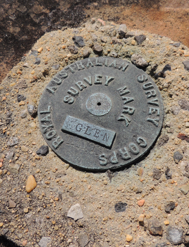
Glen Trig
Description:
Is the highest point on the Wolgan - Capertee Divide, 2.1km due south of Glen Davis Camping Ground. A rocky, smooth outcrop has a round brass survey marker, embedded in concrete, with the inscription,"Royal Australian Survey Corps, Survey Mark, Glen Davis." Elevation 938m.
Maps:
- Mount Morgan
Grid Reference:
- 466 294
Location:
Wollemi National Park
Status:
Protected
Related Names:
Read More In:
Walks:
Photos: