Bush Explorers Encyclopaedia
Name:
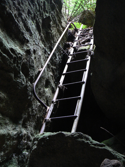
Ladders Defile
Description:
Is a narrow canyon within the upper reaches of Genowlan Creek, between the eastern side of the communications tower and Airly Turret, 1.2km, north, north west of Genowlan Trig Station. Colin (Col) Maxwell Ribaux, former local land owner, set up a number of successive ladders so that the "girls could get down the ravine." It is a delightful experience coming down the top half of the ravine, using the ladders. Named by David Blackwell, one of the three major players in the creation of the Gardens of Stone National Park, c1984. Several gnomes have been placed in discreet locations in the defile.
Maps:
- Glen Alice
Grid Reference:
- 249 329
Location:
Mugii Murum-ban State Conservation Area
Status:
Threatened
Related Names:
Read More In:
Walks:
- GOS1.11: Point Hattera and Ladders Defile
- GOS1.22: The Valley of the Kings
Photos: