Bush Explorers Encyclopaedia
Name:
Last Crusade Point
Description:
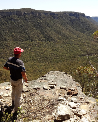
Last Crusade Ravine is a small non perennial creek rising on the northern side of Blackfellows Hand Trail, 900m east of Wolgan Gap. It flows generally north for 1.2km to join the Wolgan River at GR 322 108. Last Crusade Point hasspectacular views down the Wolgan Valley and is located on the eastern side and top of the main cliff line, Also Crusade Rocks,on the eastern side, is an elevated, almost circular depression with outlier pedestal pagodas giving 360 degree views of the area, GR 322 097. All these features were named by Yuri Bolotin on a Bush Club walk, 4th October 2013, in keeping with the named Indiana Jones movie themes for this area.
Maps:
- Cullen Bullen
Grid Reference:
- 320 102
Location:
Newnes State Forest
Status:
Threatened
Related Names:
Read More In:
Walks:
- GOS6.02: Last Crusade Point and Holy Grail Ravine
Photos: