Bush Explorers Encyclopaedia
Name:
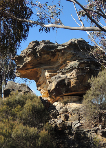
Skittle Row
Description:
Is a line of pagodas set up as a "row of skittles" in the Ben Bullen State Forest,midway between the headwaters of the Coxs River and Ben Bullen Creek. The Cullen Bullen Topo Map shows four of them, GR 286 130, GR 286 132, GR 286 133 and GR 286 134. The northernmost is at GR 286 138. This is a descriptive name proposed by Michael Keats on a bush walk into the area, 22nd August 2008. If careless underground mining continues, it is likely to send the skittles tumbling.
Maps:
- Cullen Bullen
Grid Reference:
- 286 130 to 286 138
Location:
Ben Bullen State Forest
Status:
Threatened
Related Names:
Read More In:
Walks:
- GOS5.06: Subsidence fractures, Ben Bullen State Forest
- GOS5.07: Under Skittle Row
- GOS5.08: Exploring Skittle Row
- GOS5.09: Tyldesley Hill
Photos: