Bush Explorers Encyclopaedia
Name:
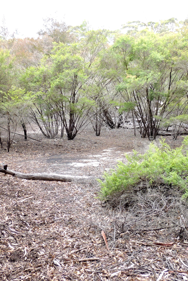
The Pondage
Description:
Is located roughly midway between Point Cameron and Mount Davidson (Wolgan Trig). So named due to the flat sandy area about 40m x 25m formed in a depression. Usually dry, but during the very heavy rains in early 2012 it filled to a depth of hal fa metre. Most likely named by Coast and Mountain Bushwalking Club member Jeff Howard, c1987. He records,"The place always looked like a dried up Pond with its large dead trees (some of which have now collapsed)."This feature has also been recorded as Newnes Pondage and Dead Tree Camp.
Maps:
- Ben Bullen
Grid Reference:
- 311 204
Location:
Gardens of Stone National Park
Status:
Protected
Related Names:
Read More In:
Walks:
- GOS1.07: McLeans Pass and further east
Photos: