Bush Explorers Encyclopaedia
Name:
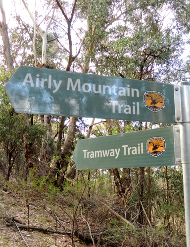
Tramway Trail
Description:
Located at Airly and has been designated by the NPWS, and so chosen as it roughly approximates the horse drawn tramway which linked the North Hartley Mine output to an aerial ropeway in a south westerly direction over the cliff edge to the retorts at Torbane, c1885. The trail sign was erected in 2014. The trail starts at the intersection of the Airly Mountain Trail. No end point is designated. This road ends at GR 218 350, unbelievably at the cliff edge.
Maps:
- Glen Alice
Grid Reference:
- 240 335 start
Location:
Mugii Murum-ban State Conservation Area
Status:
Threatened
Related Names:
Read More In:
Walks:
Photos: