Bush Explorers Encyclopaedia
Name:
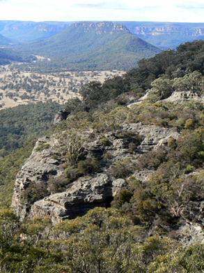
Cape Horn Lookout
Description:
1020m, at Cape Horn. Access is 11.1km from Wolgan Road via Long Swamp Road, The Bicentennial National Trail and Cape Horn Trail. From this cliff based vantage point, a bird's eye view is gained over the Wolgan Valley, having Cape Horn in the foreground and Donkey Mountain in the background. Ref: Shown on the map Proposed Recreation Use, Wolgan SF, Ben Bullen SF, Newnes Plateau. Gardens of Stone Stage 2 Reserve Proposal. The Blue Mountains Conservation Society and Colong Foundation for Wilderness, January 2009.
Maps:
- Ben Bullen
Grid Reference:
- 315 175
Location:
Wolgan State Forest
Status:
Threatened
Related Names:
Read More In:
Walks:
Photos: