Bush Explorers Encyclopaedia
Name:
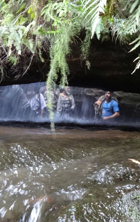
Devils Throat
Description:
So named as the water rushing down Camp Creek enters a circular, 2 to 4m diameter shaft of about 15m in height and pours out at the base via horizontal slot hole in the rock, before cascading down another 15m drop. It is as if the devil's head is upside down and water pours down its throat and out of its mouth. Named by Michael Keats on a Bush Club walk, 22nd March 2007. Devils Throat is also the bottom part of Alcatraz Canyon.
Maps:
- Cullen Bullen
Grid Reference:
- 430 072
Location:
Newnes State Forest
Status:
Threatened
Related Names:
Read More In:
Walks:
- GOS6.27: Carne Creek and Glory Box
- GOS6.28: Silkpod Point and Silkpod Gorge
- GOS6.33: Devils Throuat and the cliffs of East Creek
Photos: