Bush Explorers Encyclopaedia
Name:
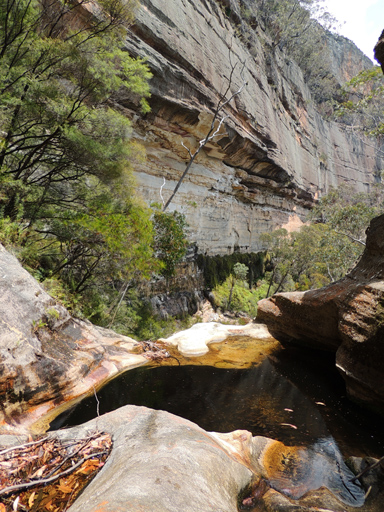
Flat Bottom Creek
Description:
Has its headwaters between Fire Trails No. 7 and 8 off Sunnyside Ridge Road.This creek flows generally north for 7km to its junction with the Wolgan River.Named by Michael Keats on a Bush Club walk, 18th July 2007. A motor bike trail crosses the headwaters of this creek at GR 360 118.
Maps:
- Cullen Bullen
Grid Reference:
- 356 112 headwaters
- 373 172 junction
Location:
Newnes State Forest and Gardens of Stone National Park
Status:
Threatened
Related Names:
Walks:
- GOS6.11: Flat Bottom Creek
Photos: