Bush Explorers Encyclopaedia
Name:
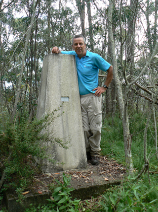
Galah Mountain Trig Station *
Description:
Is now known as Galah Trig Station. Elevation 1042.30m. Located on a small basalt hill, on the southern side of Galah Mountain. Accessed via GlowwormTunnel Road and Galah Mountain Road. Established by the Royal Australian Survey Corps, 1930. Ref: Trig Summary Cards, Department of Lands, Bathurst. Two trig stations in this area are named after the local birdlife; the other one is Cockatoo Hill Trig Station.
Maps:
- Rock Hill
Grid Reference:
- 472 140
Location:
Wollemi National Park
Status:
Protected
Related Names:
Read More In:
Walks:
Photos: