Bush Explorers Encyclopaedia
Name:
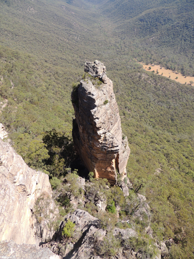
Gindantherie Pinnacle
Description:
Is an imposing isolated sandstone pinnacle, about 70m high. Located on the escarpment 4km due west of Newnes and midway between Point Nicholson and Mount Dawson. Gindantherie Pinnacle was named by Michael Keats and submission sent to the GNB on 9th October 2006. It is highly likely that the name is of Aboriginal origin. Lithgow Council Minutes, 6th August 2007, raised no objections to this name. Other recorded names are Lost Sister (Tom Brennan, October 2010) and the Fourth Sister. The Parish of Gindantherie is a land administrative district within the County of Cook.
Maps:
- Ben Bullen
Grid Reference:
- 378 254
Location:
Gardens of Stone National Park
Status:
Protected
Related Names:
Walks:
- GOS2.27: Mount Dawson via Capertee Creek
Photos: