Bush Explorers Encyclopaedia
Name:
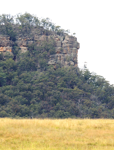
Platform Rock *
Description:
Is a flat rock on the southern side of Gardiners Hill, 4.4km south east of Ben Bullen and 2.5km north of Baal Bone Colliery. This is a descriptive name. Name appears on the 1:63 360 Wallerawang Topo Map,1935. Name assigned by Geographical Names Board, 30th May 1975.
Maps:
- Ben Bullen
Grid Reference:
- 255 173
Location:
Gardens of Stone National Park
Status:
Protected
Related Names:
Read More In:
Walks:
- GOS1.08: Moffitts Trail to Tarpeian Rock via Rowans Hole
- GOS1.14: Rowans Hole West to East
- GOS1.19: Exploring the Pagoda Maze
- GOS1.21: Blackmans Crown and Platform Rock
- GOS4.13: Bungleboori Creek and two tributary creeks
- GOS5.02: Gaudis Walls
- GOS5.03: Sisyphean Ridge
- GOS5.06: Subsidence fractures, Ben Bullen State Forest
- GOS7.05: Clerestory Spurs No. 3 to No. 5
Photos: