Bush Explorers Encyclopaedia
Name:
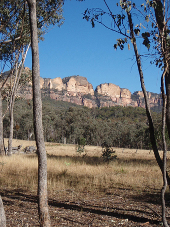
Red Rocks *
Description:
Is the name of the cliff face between Point Anderson and Point Nicholson. The name Red Rocks is shown on Survey Plan dated, 5th February 1856. Original name, The Red Rocks, is a descriptive name of the colour of the rock face in this area.
Maps:
- Ben Bullen
Grid Reference:
- 391 277
Location:
Gardens of Stone National Park
Status:
Protected
Related Names:
Read More In:
Walks:
- GOS1.07: McLeans Pass and further east
- GOS1.09: Passes of East Genowlan Mountain
- GOS1.21: Blackmans Crown and Platform Rock
- GOS2.01: Mount Harvey and Mount Dawson Pass
- GOS2.03: Point Anderson and Canobla Creek
- GOS2.04: Mount Canobla
- GOS2.05: Mount Gundangaroo
- GOS2.06: The Wolgan - Capertee Divide
- GOS2.09: Two of the ridges north of the Newnes Hotel
Photos: