Bush Explorers Encyclopaedia
Name:
Inca Highway
Description:
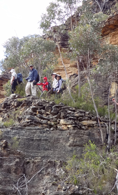
Refers to a cave and constructed pathway, situated on the Wolgan - Capertee Divide, with old internal infrastructure that was seen by a bush walking party led by Barry Higgins on the 3rd October 1977. Barry had likened it to the cliff trails of the South American Inca people and hence named it so. Ref: Track notes from Wilf Hilder's collection held by Stephen Imrie. David Warren Noble was also on this walk.
Maps:
- Mount Morgan
Grid Reference:
- 459 292
Location:
Wollemi National Park
Status:
Protected
Related Names:
Read More In:
Walks:
Photos: