Bush Explorers Encyclopaedia
Name:
Pagoda Maze
Description:
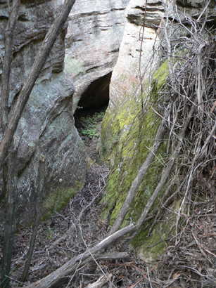
Consists of two parallel arms of pagoda studded ridges surrounding a deep ravine that drops 140m from the highest northern edge down to the southern edge and the Moffitts Trail. The highest concentration of pagodas is in the north east sector. Located 1.6km south east of Rowans Hole. Access via Moffitts Trail. Named by Michael Keats on a Bush Club walk,16th February 2010. Michael records,"Everywhere on this crest the pagodas crowd one another. The slots are convoluted and exciting."
Maps:
- Ben Bullen
Grid Reference:
- 270 191
Location:
Ben Bullen State Forest
Status:
Threatened
Related Names:
Read More In:
Walks:
- GOS1.03: South West end of Airly
- GOS1.08: Moffitts Trail to Tarpeian Rock via Rowans Hole
- GOS1.14: Rowans Hole West to East
- GOS1.16: Rowans Hole and more
- GOS1.19: Exploring the Pagoda Maze
- GOS4.08: Dicksonia Forest Ravine
- GOS4.14: Bungleboori Creek and ravines south of Waratah Ridge
- GOS5.02: Gaudis Walls
- GOS5.03: Sisyphean Ridge
- GOS5.18: Pegasus Rock to Invincible Trig
Photos: