Bush Explorers Encyclopaedia
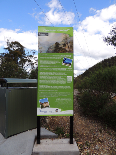
Is one of the finest vantage points to view the southern end of the Capertee Valley. Located on the eastern side of the Castlereagh Highway, 2.5km south east of Capertee and 6.7km north west of Ben Bullen. The panorama (on a clear day) from left to right is Mount Airly, Genowlan Mountain, Cottage Rock, Mount Innes, Mount Iris, Mount Gundangaroo, Mount Canobla, Point Anderson, Red Rocks, Point Nicholson, Mount Dawson, Mount Harvey, Mount Stewart, Mount McLean and Mount Jamison. It is highly likely that this lookout was named after John Westall Pearson. He was listed as Director and Chairman of the Commonwealth Oil Corporation, 1919. He was involved in commercial aspects of the mining at Blackmans Crown (near opposite Pearsons lookout), as well as at Newnes and Glen Davis. Ref: Oil and Petroleum Manual, 1920, p. 54. SMH, 25th December 1912, p. 12.The State Library of NSW holds a photo titled Capertee Valley from Pearsons Lookout, dated December 1937. A directional plaque was erected at this lookout but has long since disappeared. Major road upgrades to this lookout were completed in June 2013.
- Capertee
- 796 262
- GOS1.10: The Cliffs South East of Genowlan Mountain
- GOS1.21: Blackmans Crown and Platform Rock