Bush Explorers Encyclopaedia
Name:
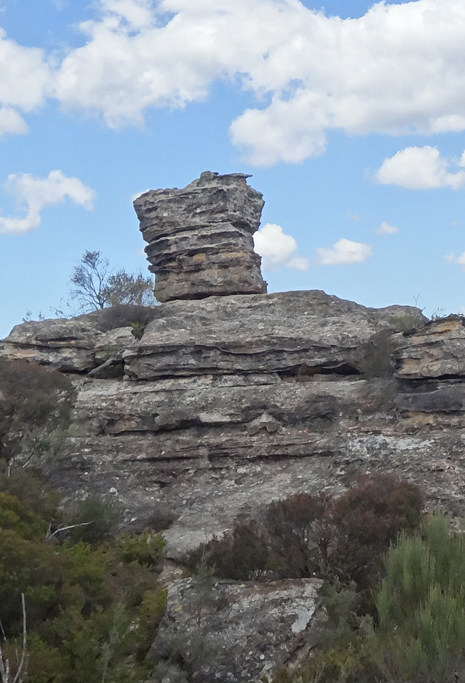
The Altar
Description:
Refers to a rocky square platform, 2m high, located at the end of Fire Trail No. 2 off Glowworm Tunnel Road. This is another location where one can be inspired by the natural beauty of sandstone erosion residuals. Named by Michael Keats on a Bush Club walk, 28th February 2007 due to the shape resembling an Old Testament Biblical altar. See also Lurline Jack Lookout.
Maps:
- Cullen Bullen
Grid Reference:
- 425 072
Location:
Newnes State Forest
Status:
Threatened
Related Names:
Read More In:
Walks:
- GOS3.13: Carne Creek Cliffs, Joseph Creek and Murrays Line
- GOS3.15: Carne Creek Cliffs and Lurline Jack Lookout
Photos: