Bush Explorers Encyclopaedia
Name:
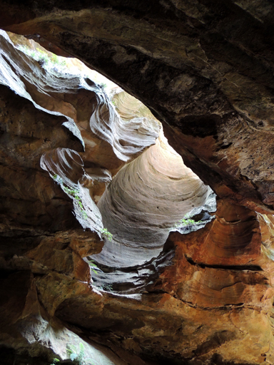
River Caves
Description:
Are located on Budgary Creek, 1.5km south east of Mount Budgary. Access is via Mount Cameron Trail to barrier and walking north west down to the creek. Also known as River Caves Canyon. The River Caves were noted by two brothers, Alan and Russell May, and John Norris in c1948; they called it, The Water Tunnel. They found it by walking down Budgary Creek. Ref: Correspondence with David Warren Noble, 14th October 2009. Oral history with Ken Poppett, 24 February 2012 records,"The May brothers referred to it as RiverTunnels, they did not like the feature referred to as the River Caves," which is the current usage.
Maps:
- Rock Hill
Grid Reference:
- 487 103 to 490 104
Location:
Wollemi National Park
Status:
Protected
Related Names:
Walks:
- GOS3.06: Mt Cameron via Railmotor Ridge, Rock Hill and Nayook Creek
- GOS3.14: Carne Creek Cliffs, Camp Creek, the Dung Cave and more
- GOS4.25: Deep Pass to Natural Bridge
- GOS4.27: Mount Cameron Fire Trail and part of Nayook Creek
Photos: