Bush Explorers Encyclopaedia
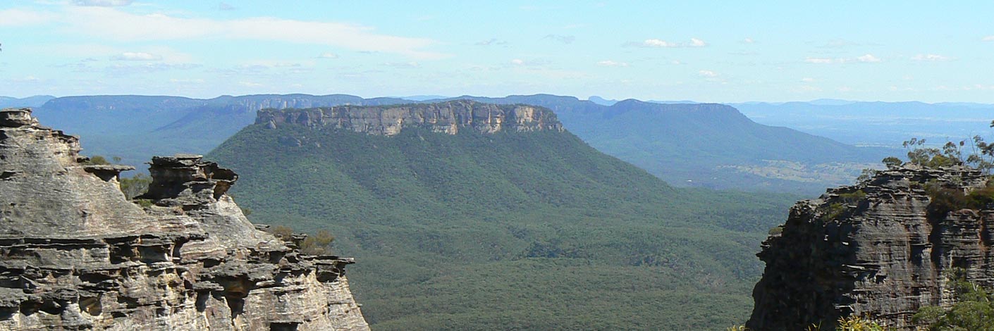
Is a dissected mesa 8km south, south west of Newnes. This large, isolated mountain, 950m in height, is 350m above Wolgan Road. The mesa has at its southern end Mount Wolgan. Extensive views over the greater part of the Wolgan Valley can be seen from the top of this mountain. A note in Surveyor Robert Hoddle's diary, dated 12th November 1825, "Mr Walker J.P. and party in that quarter (Capertee area) A she ass foaled: being the first bred in theColony."Ref: Colville, Berres Hoddle. Robert Hoddle Pioneer Surveyor 1794-1881, 2004, p. 92. Annabella Boswell's Journal, 1839, records, that James Walker (who owned the outstation Wolgan) had quite a few donkeys. The mountain was first shown (but with no name) on the Survey Plan B4.691r, dated 3rd January 1831 Originally spelt on the early parish maps as The Donkey Mountain, for example, Parish of Wolgan, 1884. It was not until the recent parish maps of the early 1960s that the word "The" was dropped. Locals referred to the mesa as Big Donkey and Little Donkey (Little Donkey is Mount Wolgan). Ref: Joe Bird, oral history to Brian Fox, 15th June 2009. Joe also spoke to me about a path cut into the Wolgan Valley, called the Donkey Steps. Joe's great, great grandfather, Edward (Ned) Murray (1791-1862), was one of the earliest farmers in the Wolgan (he worked for the property owner, James Walker from 1824) and he had a donkey that he called Neddy. Thomas Archer records in his diary on the 17th June 1866, "Mule arrived last night from Wolgan." Ref: Morgan, MacLeod. A short history of the Wolgan Valley, 1959. RAHS Journal, Vol. 45, Pt. 2, p. 88. Geoff Fox, a bushwalker with The Bush Club, has explored, mapped and named many of the individual features within Donkey Mountain.
North East Maze section: Grand Entrance, The Freeway, Kents Crevasse, Two Storey Cave, The Green Room, Fairy Cave, Eagle Rock, Eagle Nest, The Grand Hall, Fig Trees Green Room Portal, Jenny Craig, QANTAS Drop, Fire Ramp, Wide Ramp, Scrubby Ramp, Lighthouse, Arrow, Gum Tree Room, Treeway, Cowpasture, Donkey Canyon, High Cave, Low Cave, Mossy Rocks, Long Passage, Too Tight Crevasse, Wolgan Window.
Middle Donkey Mountain section: Window,Titanic Canyon, Fern Gully, Eastern Lookout, Tayan View, Kents Ascent, Sticky Ramp, Port Canyon and Terrace Canyon.
The South West End: Sun Ledge, The Columns, Python Point, Top Slot, Fence, and The Stile.
Note: Donkey Mountain is a very fragile environment. Please help protect it by refraining from camping on the mountain and by only using fuel stoves; no lighting of wood fires.- Ben Bullen
- 381 187
- GOS1.12: Collett Gap and Woolpack Rock
- GOS2.11: Mystery Mountain
- GOS2.17: Constance Point
- GOS2.22: The cliffs and ravines of Western Koopartoo
- GOS2.25: Island Mountain Traverse
- GOS3.01: Donkey Mountain 1
- GOS3.02: Donkey Mountain 2
- GOS3.03: Donkey Mountain 3
- GOS3.07: A natural tribute to Michelangelo
- GOS3.08: Cliffs north of the Glowworm Tunnel - Part 1
- GOS3.09: Cliffs north of the Glowworm Tunnel - Part 2
- GOS3.12: Carne Creek Cliffs Screwdriver pass and the Long Zig Zag Pass
- GOS3.18: Above the Glowworm Tunnel
- GOS5.05: Exploring Cape Horn
- GOS5.12: Wolgan Gap Trig
- GOS5.13: Wolgan Gap cliff line
- GOS6.07: Cape Pinnacle
- GOS6.12: Donkey View Pass
- GOS6.13: Sunnyside Gully
- GOS6.14: Sunnyside Point and Wolgan Pinnacle
- GOS6.16: Endorphin Slot and Gully
- GOS6.22: Zorro Canyon, Rapier and Bullwhip Slots
- GOS6.23: Pyramid Pass to Zorro Pass
- GOS6.26: Birds Rock Creek


