Bush Explorers Encyclopaedia
Name:
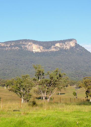
Genowlan Mountain *
Description:
Is located on the northern side of a large mesa between the Capertee River and Coco Creek, 3.5km north east of Airly. Genowlan Mountain and Genowlan Creek are shown on the Parish of Morundurey 1894 Map. Survey Plan R1164.1496, dated 1873, shows it as Genowlan Peak. Genowlan Mountain was also known as Morandurey Range. Ref: Eardley, G H. and Stephens, E M. The Shale Railways of NSW, 1974, p. 88. The name Genowlan has similar syntax with the word Jenolan, which in turn was an Aboriginal name meaning "high place". Ref: Cook, Samuel. The Jenolan Caves,1889, pp. 14-15.
Maps:
- Glen Alice
Grid Reference:
- 268 352
Location:
Mugii Murum-ban State Conservation Area
Status:
Threatened
Related Names:
Read More In:
Walks:
- GOS1.10: The Cliffs South East of Genowlan Mountain
- GOS1.11: Point Hattera and Ladders Defile
- GOS1.14: Rowans Hole West to East
- GOS1.20: Hecates Cauldron
- GOS1.21: Blackmans Crown and Platform Rock
- GOS1.22: The Valley of the Kings
- GOS1.23: The Eastern Extension of Mount Genowlan
- GOS1.24: Genowlan Canyon, Mothers Arms and the Dragons Mouth
- GOS2.01: Mount Harvey and Mount Dawson Pass
- GOS2.04: Mount Canobla
- GOS2.06: The Wolgan - Capertee Divide
- GOS2.24: Traversing Pantoneys Crown
Photos: