Bush Explorers Encyclopaedia
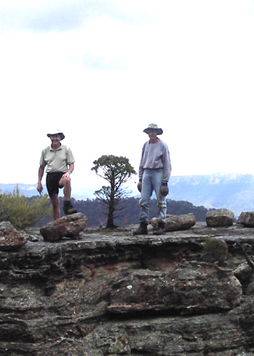
Cleft Point
Is a narrow finger peninsula containing a very deep, narrow cleft. Located approximately half way between Cape Pinnacle and Sunnyside Point. Named by Michael Keats on his Bush Club walk, 18th July 2007. Walking access via Fire Trail No. 8, off Sunnyside Ridge Road.
Cleopatras Needle
Clerestory Spurs
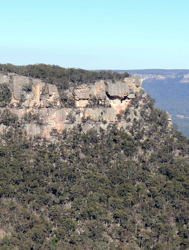
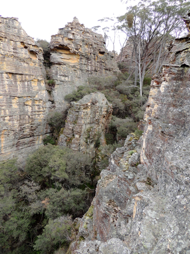
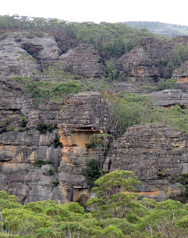
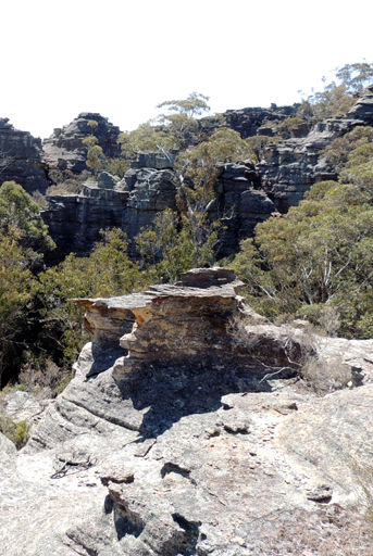
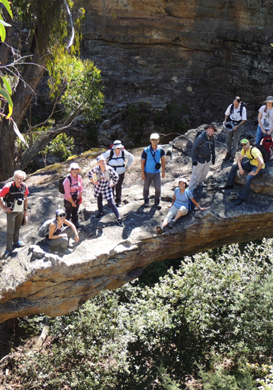
Are twelve, pagoda studded spurs trending approximately north, north east from the main creek system of Sawyers Swamp towards the Beecroft Firetrail. Named by Michael Keats on a Bush Club walk, 14th September 2011. No. 1 GR 308 025; No. 2 GR 312 027; No. 3 GR 313 024; No. 4 GR 317 023; No. 5 GR 319 020; No. 6 GR 322 018; No. 7 GR 324 017, No. 8 GR 326 017; No. 9 GR 327 014; No. 10 GR 331013; No. 11 GR 334 012; No. 12 GR 336 012. A clerestory is the upper part of the nave of a Gothic church or other building with windows above the aisle roofs.The pagodas measure up in every way to such a title, as they include numerous perforations or windows.
Cliffhanger Rock
Clwydd Pass
Is a natural pass giving access from Bungleboori Creek towards Mount Horne, 2.3km due south of Mount Horne. Named by Michael Keats on a Bush Club walk, 24th October 2007, after a local area name, the Parish of Clwydd.
Clwydd Ridge
Is a spur line trending 1.6km in a generally north south direction, having Lithgow High School below on the western side and Hartley Valley Road and the Vale of Clwydd on the eastern side. Lithgow Mercury, 4th June 1915, p. 6, records that James Padley suggested that the ridges at the back of the town be named. “The one at the rear of the Vale of Clwydd he suggested be named Clwydd Ridge.”
Clwydd Trig Station
Is located on a small spur on the eastern side of the Vale of Clwydd above Chifley Road, Lithgow. The steel pillar was placed by the Lands Department on the 13th December 1976. Height 1038.832m. Ref: Lands Department SCIMS Survey Mark Report.
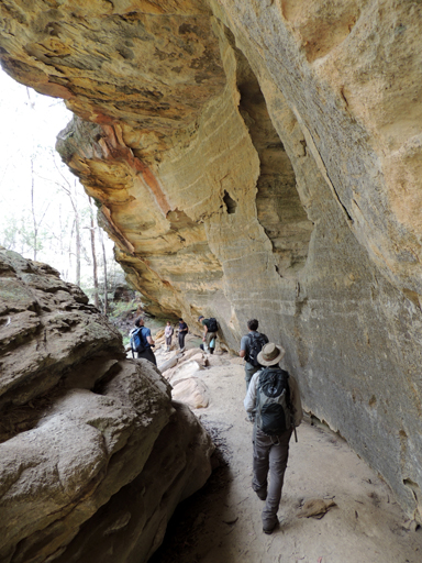
Coach Galleries
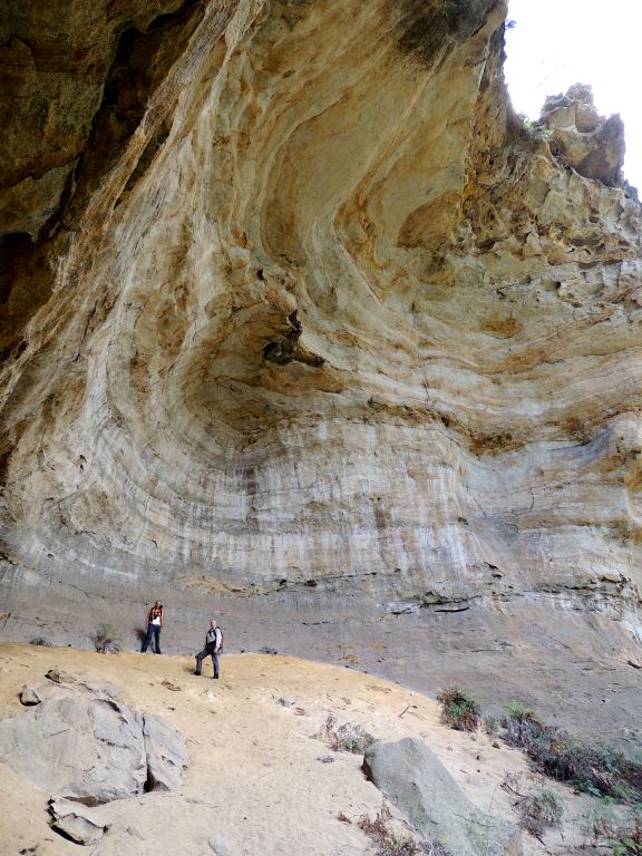
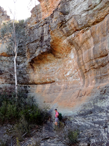
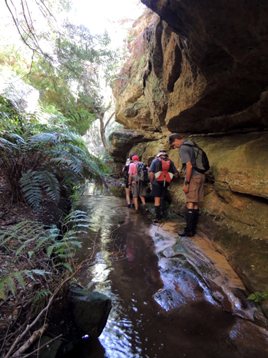
Are located in Sutherland Gully between the Tiger Snake Canyon Track and the Pagoda Track, 1.1km north east of Glowworm Tunnel. The galleries consist of an astonishing series of caves and overhangs. One of the largest is a beautiful chamber of golden sandstone, 40m across by 20m deep by 30m high, with soft sandy floor sloping about 30-35 degrees, except near the drip line, where it is flat. There is no internal vegetation, making the space even more dramatic. Named by Yuri Bolotin and Brian Fox on a bush walk 23 December 2016.
Coach Wood Forest
Was named by Russell, (Russ) Alfred May (1926-2010), c1960s, due to the large number of Coachwood trees (Ceratopetalum apetalum) growing in this side canyon of Rocky Creek. Located 600m south east of Galah Trig Station, accessed via Galah Mountain Road. Sheep Dip Canyon is the next tributary to the west. Within this area is the feature, is the Garden of Eden.
Coccinea Gorge and Pass
Gives access from the western side of Carne Creek to Fire Trail No. 4. 3.1km south south east of Birds Rock Trig. So named by Michael Keats on a Bush Club walk 2nd June 2014 due to the brilliant red fungi,Hygrocybe coccinea located in this gorge. This gorge is 400m in length and varies from 2m to 50m in width.
Cockatoo Hill *
Is located on the southern side of the junction of Glowworm Tunnel Road and Eastern Boundary Road within the Newnes State Forest. This name first appears on the Survey Plan, Tramway from Wolgan to Clarence. Survey Plan M12435. Surveyed by John Haydon Cardew, Licensed Surveyor, 13th December 1905.
Cockatoo Hill TrigStation
Is at 1068.70m above sea level. Established by the Lieutenant Colonel Clews, Royal Australian Survey Corps, 1930. Ref: Trig Summary Cards, Department of Lands, Bathurst and Gough, Noel R. "The Major" Lt. Col. Hugh Powell Gough Clews. Two trig stations in this area are named after the local birdlife; the other one is Galah Trig Station. Note: This trig no longer exists.

Coco Creek *
Is a partly perennial stream rising on the Great Dividing Range about 3km east of Ben Bullen at Rowans Hole. It flows generally north and north east for about 25km into the Capertee River about 5km south south west of Glen Alice. Annabella Boswell's Journal, March 1839 records the name, Coco Creek. The name Coco or Cooks Creek is recorded in the County Land Sales, Sydney Morning Herald, 11th May 1858, p. 3. Early parish maps show the named creek as Cooks or Coco Creek as it was the boundary between the two Parishes, Coco and Cook. Ref: Parish of Coco, 1883. The Sydney Gazette on 25th February 1832 records Cocos Islands as an important trade and resupply stop for sailing vessels and the importance of coco-nuts. The importation of coconut oil in large quantities (over 50 tons) was for the following purpose: "in the making of gas for the purpose of illumination, such gas having been found much superior to the gases commonly in use". Ref: Wentworth, William Charles. A Statistical Account of the British Settlements in Australia, 1824, pp. 428-429. Whether this connection to this named feature is true, is yet to be confirmed. Or maybe the origins of the name Coco and Cook Creeks are linked as they are adjoining Parishes. Certainly, Captain James Cook records in his journal the importance of Coconuts as a lifesaving food source. Ref: Cook's journal, 29th July and 4th August 1770.
Coco Creek Caves
Located on the side of a small rise on one of tributaries of Coco Creek. Note they are on private property, permission must be obtained.
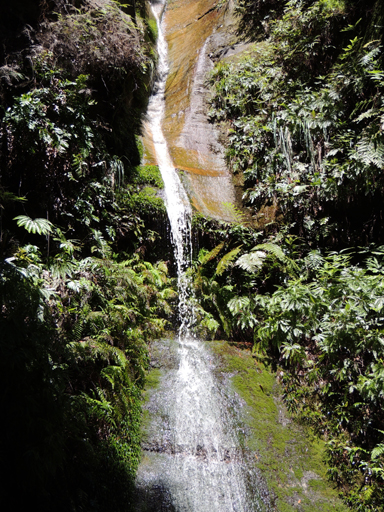
Cohen Falls
Collett Gap *
Is a saddle in a mesa about 4km south west of Mount Dawson and 1km south of Point Cornell. Shown on the map Parish of Wolgan, 1884. This gap divides the tributaries of Red Rock Creek and Barton Creek. Note, Collett Gap is misspelled, so named after Pierce Collitt (1760-1848) and Mary Collitt (1769-1841), who in 1823 were the first to establish an inn on the western side of the Blue Mountains. The Collitt's Inn at the foot of Mount York in the 1820s and 1830s was one of the last comfortable inns before leaving into the wilds of the Capertee and Wolgan area. Ref: Paridaens, Iris. Lithgow and Hartley Valley Sketchbook, 1978, p. 4.
Colosseum
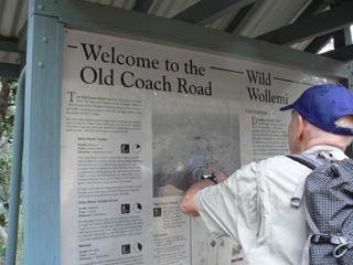
Is a vast natural rocky amphitheatre complete with a natural lectern on the northern side, about halfway up Henry Creek. Located 2.5km north east of the junction of Glowworm Tunnel Road and Old Coach Road. Named by Michael Keats on a Bush Club walk, 17th August 2012.

Comet Mine Incline Railway.
Between the 1880s to c1913, shale oil was mined and refined at Hartley Vale, placed into oil tanks, transported up the mountain incline, then onto a tramline to Hartley Vale Railway siding, from where it was then transferred to Sydney. Comet was the brand name of the kerosene which was produced from the shale. The western extent (top of the incline) was located one kilometre east, north east of Hartley Vale at an elevation of 900m. The eastern extent joined the Darling Causeway near the southern side of the intersection with Hartley Vale Road.
Commandments Rock
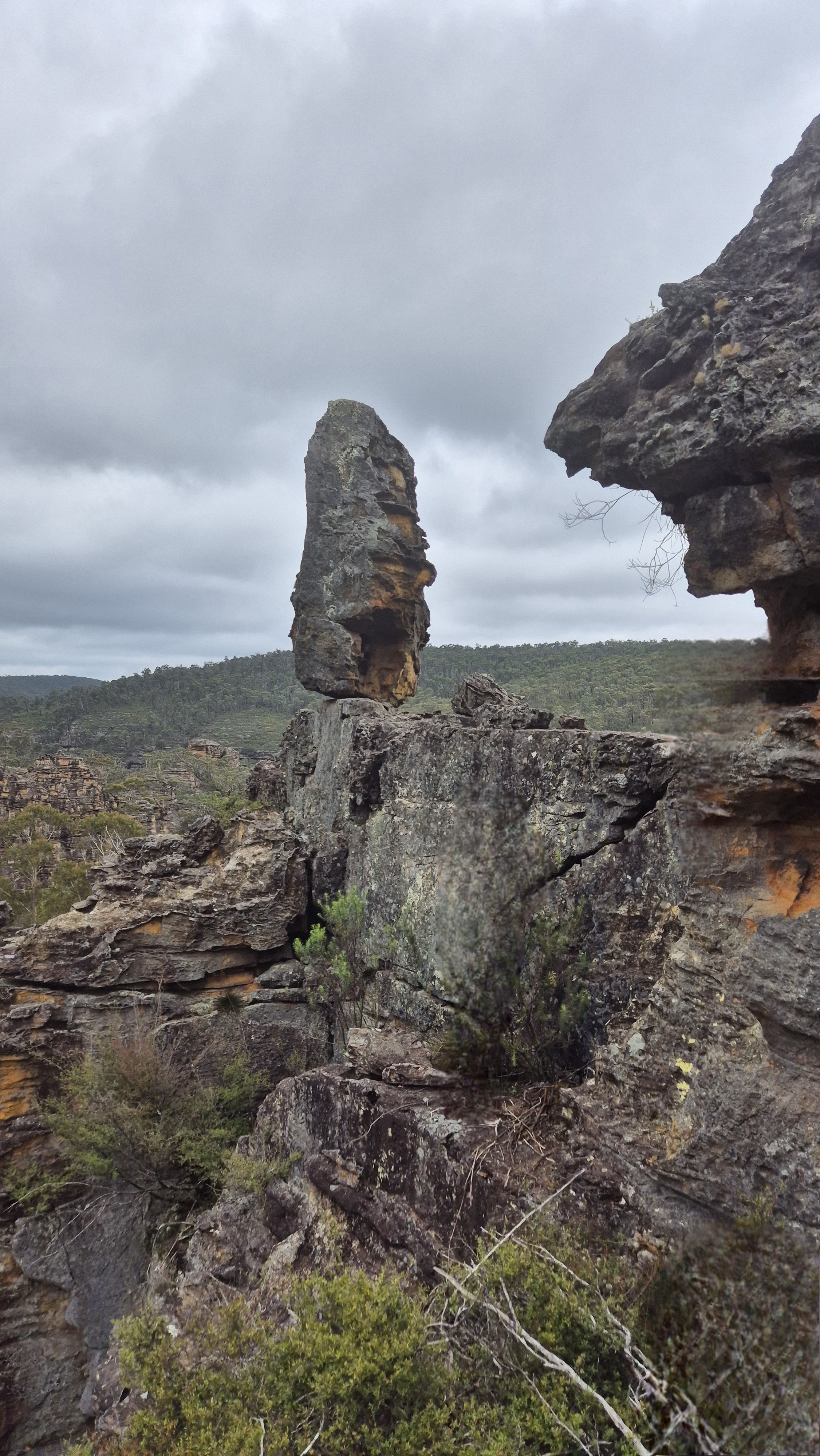
Lies roughly midway between Mount Dawson and Point Nicholson, 200m north east of Gindantherie Pinnacle. Named by Michael Keats on his Bush Clubwalk, 30th August 2006. This rock appears to be suspended in space and on its top, level surface, scattered by nature, are ten small rocks or tablets of stone. Also named as Balancing Boulder. Ref: Tom Brennan's photo gallery, 1 - 2nd June 2013.
Compass Rocks
Is a group of rocks accessed via Wolgan Road and Blackfellows Hand Trail. Located about 700m east, south east of Wolgan Gap. Named by the Woody Pear Walking Group, September 1995. This group started due to an Outdoors TAFE course led by Margaret Baker. Ref: Olive Noble's track notes from Woody Pear Walking Group,17th September 1995. The group were not sure where they were and someone said has any one got a compass, and everyone pulled out a compass.
Constance Falls

Constance Gorge
Refers to the narrow cliff lined ravine that extends from near the saddle at the top of Zobels Gully and down the southern side towards Deanes Creek. A perennial stream runs through it. The Sydney Morning Herald, 10thJanuary 1906, p. 7, Proposed Tramway Route, depicts Constance Gorge as "the scenery is described as magnificent, so that with the construction of the line a new centre of attraction will be opened for the tourist." Carne, J E. Field Book, State Records, 2/663, 11th January 1906, p. 75 records, thin chocolate band (shale) in Constance Gorge and a diagram of bridge across it. Constance Gorge was first shown on the Survey Plan, Tramway from Wolgan to Clarence. M12435. Surveyed by John Haydon Cardew, Licensed Surveyor 13th December 1905.The most likely origin of the name is from Constance Caroline Mary (c1872-1932), who was the wife of Donald Sutherland, Consulting Engineer and General Manager of The Commonwealth Oil Corporation Ltd mine and refinery at Newnes in 1906 at the time when the Wolgan Valley Railway was being constructed. Constance Caroline Mary's name, Constance was also the name given to the Wolgan Valley Railway Shay Locomotive No. 1.
Constance Locomotive Depot
Eardley, G H. and Stephens, E M. in their work, The Shale Railways of NSW, 1974, pp. 139 and 143 record, "Constance, the original locomotive depot sited within the limits set by a reversing triangle." This was located about 200m from the Wolgan River within Zobels Gully.
Constance Pass
Is a means of access from the Wolgan River via Zobels Gully to the top of Constance Point. Constance Point is the northern most point of the spur line in which the Old Coach Road is located. This pass is on the eastern side of the point. Named by Brian Fox on a Bush Club walk 8th January 2016.
Constance Point
Is the most northerly point on a ridge line between Constance Gorge on the east and Wolgan River on the west. Michael Keats has applied this name in his Bush Club track notes, 28th May 2010. Mount Morgan Topo Map, GR 438 229. Constance was also the name given to the Wolgan Valley Railway Shay Locomotive No. 1. Walking access via Zobels Gully and Constance Pass.
Constance-Zobels Trench
Is a unique, natural parallel sided gully with an internal watershed that contains Zobels Gully flowing north and then west to the Wolgan River and Constance Gorge flowing south and then east to Deanes Creek. The trench section is flanked by tall vertical cliffs for the majority of the way.
Convolution Creek
Has its headwaters on the eastern side of Sunnyside Ridge Road 2.5km south of Birds Rock Trig Station. It flows generally south east for 2.6km to its junction with Carne Creek. The topographic map gives only the slightest hint of the sinuous contortions within this creek. Named by Michael Keats on a Bush Club walk, 13th March 2013.
Cooerwull Creek
Sydney Morning Herald, 23rd November 1892, p. 4 records construction of a dam across Farmers or Cooerwull Creek at a place amongst the hills north of Zig Zag Valley. The aboriginal name, Cooerwull was the property name of Thomas Brown. Ref: The Sydney Herald, 18th June 1838, p. 3. The word Cooerwull according to the Australian Town and Country Journal, 23rd March 1878, p. 23, “is an aboriginal name signifying seed or plant.” However most references record it as, “little flowering plant.” The Queenslander, 26th November 1898, p. 1030. “for a small flowering plant” Ref: Lithgow Mercury, 5th April 1917, p. 6. Most likely, it refers to the Bluebell, Wahlenbergia stricta .
Cooerwull Ridge
Has Sheedys Gully on the eastern side and the suburb of Littleton below on the western side with Lithgow Rifle Range in the gully. This ridge has three sets of communication towers along the ridge. On the northern end is Cooerwull Trig Station. Lithgow Mercury, 4th June 1915, p. 6, records that, James Padley suggested that the ridges at the back of the town be named.“The one at the rear of the Extension Estate Cooerwull Ridge”.
Cooerwull Trig Station
Is located above the southern side of the suburb of Cooerwull in Lithgow. Height 1056.1m. The concrete pillar was placed by the Lands Department on the 13th December 1976. Ref: Lands Department SCIMS Survey Mark Report.
Cook s Cave
Is located in Hassans Glen after Gannon Cave and before King Georges Head. Named after Sir Joseph Cook (1860-1947) who settled in Lithgow and worked at the Vale of Clwydd Colliery. In 1891 he became the Local Member for Hartley, and later went on the serve the country as Prime Minister between 1913 and 1914. Re: Lithgow Mercury, 14th May 1915, p. 4.
Cooks Cliffs
Refers to the cliff line behind the old Newnes Hotel overlooking Little Capertee Creek. Name is recorded with map in Taylor, Pete. The Wolgan Valley A Rockclimber's Guide, 1st ed; 1974, p. 17. This map also records the valley below Cooks Cliffs as Cooks Valley. First modern recorded climb was in January 1970, but also climbed from the 1950s by the scouts and other enthusiasts.
Cooks Creek
Is a partly perennial stream rising on the Great Dividing Range about 3km east of Ben Bullen at Rowans Hole. It flows generally north and north east for about 25km into the Capertee River about 5km south, south west of Glen Alice. "Cook's Creek" is shown on Mitchell, Thomas. Map of the Colony of New South Wales, 1834. Now known as Coco Creek.
Coopers Creek
Is a short, 1.2km creek, flowing in a south east direction into the start of the Dumbano Canyon section on the northern side of Dumbano Creek. Peter Fox, a member of the National Parks Association, named this creek in late 1990s after John Alexander Cooper. John is a prominent and active member of The Bush Club.
Coopers Ridge
Extends in a generally north south direction for 4km from Bald Trig Station above the Bungleboori Creek. Peter Fox, a member of the National Parks Association, named this ridge in late 1990s after John Alexander Cooper. John is a prominent and active member of The Bush Club. At the northern end is Bungleboori Lookout.
Corn Paddock
The property known as the Corn Paddock, derives its name from land use on the rich alluvial flats below the confluence of Barton and Carne Creeks on Portion 12, Parish of Wolgan, County of Cook. During the Newnes industrial period most of the vegetables for the townsfolk of Newnes were grown here. Reputedly corn, the dominant crop was grown to feed the working horses. The Corn Paddock homestead and buildings are located on the higher western part of the surveyed portion. SMH 16th May 1932, p. 10 records, road repaired to the spot known as the corn paddocks. Edwin Penrose was the first owner of this portion in 1869. (Survey Plan C387.1507) . Originally known as Penrose's Corn Paddock. Winchester, F, 1982; Wolgan Valley, cited in Lithgow District Historical Society's Occasional Paper. No. 51, p. 3.
Corn Paddock Point
A point of land on the top of the cliff line directly above the property called, Corn Paddock. The Corn Paddock property derives its name from the river flats adjacent to the homestead. The flats were used to raise corn to feed the pit ponies employed by the Newnes Industrial Complex operation from about 1905 to 1920. Ref: Correspondence Doug Coates, owner of the Corn Paddock 29th August 2014. Named by Michael Keats on a Bush Club walk, 29th August 2014.

Cosmic Cave
Is located 2.8km south east of Birds Rock Trig, off Sunnyside Ridge within Newnes State Forest. The plan view is semi circular having a 120 degree arc, the arc being 90m and the diameter 50m.The elevation is more horseshoe in shape and having a height of about 80m. The rocky floor mostly devoid of any vegetation is raked at about 35 degrees. The entrance and a precarious ledge to access this huge overhang is a challenge. To date this is the largest cave documented on the whole of the Newnes Plateau, hence the name, so coined by Yuri Bolotin and Brian Fox on a bush walk, 28th November 2015.
Cosmic Country
Is a name bestowed by rock climbers to an area of cliff line within the eastern tributary of the headwaters of Reedy Creek. It contains a succession of sheer rock faces, where every few metres climbers have painted cryptic alpha numeric inscriptions of identified climbing points. The cliff faces are also embellished with stainless steel bolts and eyelets.
County of Cook *
"So named by me considering that its lofty summits must have been the first land, that meet the eye of that celebrated navigator, on his first approach to the eastern coast."Ref: Mitchell, Major T. L. Three Expeditions into the Interior of Eastern Australia, 1839, Vol. 1; p. 152. Captain James Cook (1728-1779) sailed in the barque rigged ship Endeavour via Cape Horn to Tahiti to observe the transit of Venus. He then circumnavigated New Zealand and sailed west to land at Botany Bay on 29th April 1770. James Cook on the 22nd August at Possession Island took possession of the whole of the eastern coast. Ref: Australian Dictionary of Biography.

Coxs River *
Is a perennial river rising north east of Gardiners Gap about 6km north, north east of Cullen Bullen and flowing generally south and east for about 100km into Lake Burragorang. The river is located on numerous topographical maps; the area of interest for this book is on the Cullen Bullen and Lithgow Topo Maps. Headwaters GR 297 132. Coxs River may have also been known by the local Aborigines as Duiwan. Andy Macqueen's research of Surveyor General Mitchell's assistant, surveyor Peter Grant Ogilvie showed that the monthly report by Ogilvie in March 1829 records the native name of Coxs River as, Duiwan. As late as 1896 Gundungurra elder Billy Lynch was reported as saying that the Gundungurra group who had lived in the Megalong - Kanimba area were the "Therabulat", and that was also their name for the Coxs River. Ref: Heritage. Newsletter of the Blue Mountains Association of Cultural Heritage Organisation Inc. July - August 2015. Issue 39; pp.8-13. Named after William Cox, J P, (1764-1837), by Governor Lachlan Macquarie (1762-1824). Macquarie had commissioned Cox to construct a road over the Blue Mountains, which Cox started on 18th July 1814 and completed in March 1815.
Crack of Doom One
Crack of Doom One and A Half
Crack of Doom Two
Crack of Fools
Crater Pass *
Is an easy pass that leads through the cliff line south of The Crater. Located 300m west of where the Pipeline Track traverses the cliff line above the northern side of the Wolgan River, Newnes. Crater Pass starts as a tumble of easily negotiable broken rock, crosses a small sloping rock face then becomes a series of easy, well graded ramps interspersed with large boulders, all the way up to the top. This pass gives access to the feature known as, The Crater. Named by Yuri Bolotin, Michael Keats and Brian Fox on a Bush Club walk 16th June 2017.
Crisscross Spur
Trends generally south from Waratah Ridge, 300m east of the boundary of Blue Mountains National Park, GR 482 026, to above the Bungleboori Creek. Crisscross Spur is a complex series of parallel, dissected, interstitial ridge like structures that feature canyons and slots. Named by Yuri Bolotin on a Bush Club walk, 15th June 2012.
Crown Creek *
Is a partly perennial stream rising at Baal Bone Gap. It flows generally north, north east for about 15km into Coco Creek.
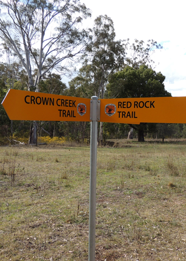
Crown Creek Trail
Crown Creek Trail extends from Baal Bone Gap, GR 280 290. It follows and criss crosses Crown Creek to its junction with Glen Davis Road at Crown Swamp, GR 307 299. The word "crown" referred to ownership by the Crown. Before the area was settled, all land belonged to the Crown / Government. Alternatively the name "crown" may have referred to Pantoneys Crown. Crown Creek Trail and Red Rock Trail have both had new signage erected by NPWS mid 2015.
Crown Flat
Is the northern section of Crown Creek, Crown Flat is shown on Carne, Joseph, Geological Map of the Capertee and Wolgan Valleys, 1901.
Crown Ridge
A very old name, it referred in the 1840s to that part of Glen Davis Road between Coco Creek and the junction of Crown Creek Trail. The name has also been associated with that part of the Great Dividing Range having Crown Ridge Creek on its western side and on its northern extremity, Blackmans Crown. The name Crown Ridge was recorded on the Survey Plan B688.691, dated 25th September 1847.
Crown Swamp *
Is located on Crown Creek about 5km north east of Pantoneys Crown and where Crown Creek Trail crosses Crown Creek. Crown Swamp was recorded on Survey Plan C146.1507, dated 5th February 1856 and County Land Sales within the Sydney Morning Herald, 11th May 1858, p. 3.
Crumble Ledge
Is so named as this 200m ledge consists of crumbling, porous rock which leads around a small bluff. Located 1.1km north east of Invincible Trig Station. Named by Yuri Bolotin on a Bush Club walk, 15th August 2013.
Crusade Rocks
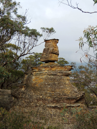
On the eastern side, is an elevated, almost circular depression with outlier pedestal pagodas giving 360 degree views of the area. All these features were named by Yuri Bolotin on a Bush Club walk, 4th October 2013, in keeping with the named Indiana Jones movie themes for this area.

Cullen Bullen *
Is a small village located on the Castlereagh Highway between Lithgow and Capertee. Cullen Bullen Railway Station opened as Carsons Siding on 1st May 1889 and closed on 6th March 1976. School opened in December 1875. Hoddle's diary, 13th February 1825, states,"I have stopt at Messrs. Robt. and Lawrence Dalhunty's from Bath (their grant was called by the natives Cullen Bullen). Living in a cottage made of turf ......are now living romantically, shepherd like." Ref: Colville, Berres Hoddle. Robert Hoddle Pioneer Surveyor 1794-1881, 2004, p. 74. Robert Venour Dulhunty (1802-1853) with his brother Lawrence arrived in Sydney in March 1824. Robert applied for a grant of land on the 23rd March 1824. This grant of 2000ac was selected and called Cullen Bullen. An 1828 census recorded that he had cleared 500ac and owned 75 cattle and 600 sheep. Ref: Dulhunty Papers. The Australian, 5th May 1837 records the marriage of Robert Dulhunty of Cullen Bullen to Eliza Julia Gibbs. Cullen Bullen is shown on Mitchell, Thomas. Map of the Colony of New South Wales, 1834. Both the names Cullen Bullen and Ben Bullen have Aboriginal origins, different suggestions have been put forward for their meanings but as yet there is no substantiation of their exact meanings. Geographical Names Board reference is, "Place where many waters meet or Lyrebird." This aboriginal name according to Helen Riley, Wiradjuri Elder and Sharon Riley, Wiradjuri representative is named after the Lyre Bird. and that the word Bulla refers to, two. Ref: Oral history 3rd May 2016.
Cullen Bullen Trig Station
Elevation 1066m, was established by surveyors from the Forestry Commission of NSW in the 1960s. It is located on Tyldesley Hill within Ben Bullen State Forest, 2km north, north west of Cullen Bullen.
Cullen Creek *
Is a watercourse rising about 3km south east of Cullen Bullen. It flows generally north west for about 6km into Dulhuntys Creek. Named after the village of Cullen Bullen.
Cyclopean Gallery
Is a small valley filled with some huge toppled rocks. It was as though a giant force had taken several dozen, house size cubes of sandstone and scattered them like dice into this small valley. Over time these cubes have softened in outline with some being draped in mosses and lichens, while some developed dry sandy caves and deep pocks with narrow orifices to provide birds and bats with exclusive homes. Short, secret passageways, narrow slots and stunning sculptures are all there. Named by Michael Keats on a Bush Club walk, 22nd November 2013.
Cyclops Pass
Cyclops Watch
Is located 2.6km north east of the barrier at the southern end of the Old Coach Road. Walking access is generally north on the track towards Tiger Snake Canyon. This watch tower is an isolated rocky pinnacle accessed via a twisting corkscrew slot with views south over the Pentafid basin and beyond to Rock Island. Named by Yuri Bolotin and Michael Keats on a Bush Club walk, 1st May 2015.
Dando's Firetrail
Is now known as Angus Place Trail. Prior to the 1930s it was known as Dando's Firetrail. Harry Dando owned what is now part of Angus Place Colliery. The fire trail joined Wolgan Road to Beecroft Firetrail. Ref: Correspondence Danny Whitty local resident and historian, 3rd June 2014. Harry was employed by the Vale mine at Lithgow for more than 30 years, retiring in 1947. Ref: Newcastle Morning Herald and Miner's Advocate 18th September 1947, p. 7.
Daniels Pass
Is located at the northern end of Daniels Ridge. Named by David Warren Noble after Edward (Ted) James Daniels (1930-2008). Ted led many trips in this area on behalf of the National Parks Association and the pass at the end of this ridge was pioneered by him.
Daniels Ridge
Has its southern end at Galah Trig Station and Galah Mountain. This ridge trends in a north, north east direction for 6km to a cliff line above Rocky Creek. It is here that Daniels Pass gives access to Rocky Creek.
Dante Slot
1.3 km south south west of Nobles Canyon car park. The cliff face has fractured and hence created two major parallel slots with a cross fracture, in plan view it looks like a lower case "h". Over 250 m in length and at least 30 m deep. Named by Michael Keats, Brian Fox and Yuri Bolotin on a Bush Club walk, 19th May 2014.
Dargan *
Is a suburb of Lithgow and was assigned as such by the Geographical Names Board on 11th July 1997.
Dargans Arch
Is a natural sandstone arch, it has a length of 14m, a width of 8m and a height of 9.3m. Located 900m north, north east of the intersection of Bells Line of Road and Valley View Road, Dargan. Access is via Sandham Road, Bell.

Dargans Creek *
Is a watercourse about 6.5km long. It rises 3km south west of Bald Trig Station and flows generally east then south into the River Lett. Wollangambe, Lithgow and Hartley Topo Maps,headwaters GR 445 918. Dargans Creek is recorded in the Sydney Morning Herald 15th January 1846, p. 3 in reference to a stock route through to the Mudgee Road at Jews Creek. Also shown on the Survey Plan C346.1507 dated 1866. Thomas Dargin (note various spellings), born in the Hawkesbury area in c1801, married John Howe's step daughter, Eliza Kennedy, in 1821 and later Howe's daughter Mary. He also owned three hotels in Windsor. In1819, Thomas was a member of John Howe's successful expedition to the Hunter region. Ref: Macqueen, Andy. Somewhat Perilous, 2004, p. 111. Dargan was a pioneer drover in the district. Ref: Morgan, MacLeod. A short history of the Wolgan Valley, 1959. RAHS Journal, Vol. 45, Pt. 2, p.90. "Thomas Dargon (sic), John Howe's son-in-law and fellow explorer, who had charge of its herd of cattle." Ref:Rolls, Eric. A Million Wild Acres, 1981, p. 77. This was in 1821. The Map of the Village of Newnes shows one of the unformed roads named Dargan Street. Thomas Dargan purchased 640ac, Portion 1, Parish of Hearne, 1836 and Portion 3, 640ac, 1839. Ref: Survey Plan B.305.691 and B.583.691. Note, one Survey Plan has both the spelling of Dargan and Dargin.
Daves Pass
Is a natural pass linking the top of the cliff line to Newnes, 700m west of the old Newnes Hotel. Described and named by Michael Keats on a Bush Club walk, 9th April 2008."Dave (David) Dash found one that looked possible. It resolved into one of the most beautiful canyon descents I have experienced anywhere. It was richly endowed with Tree Ferns and Epiphytes." Named after David (Dave) Macdonald Dash (1943-2021)
Daves Slot
Dawson Cave
Is located 420m north north east of Mount Dawson on the Capertee / Wolgan divide. It is a more of sheltered location between the rocks as an ideal place to camp. Also known by the name Mount Dawson Caves by bushwalkers from early 2000.
Dead Dog Swamp
Headwaters of Carne Creek, near the junction of Beecroft Firetrail and Sunnyside Ridge Road. Ref: Correspondence with Danny Whitty, 3rd July 2010. Local usage name c1960s.
Dead Sea Scroll
Is an ironstone tube 2m in length and 50cm in diameter. When viewed from the right angle, it appears as a scroll of pastry or paper. In keeping with the heavenly themed features in this area, Michael Keats named this rock sculpture the Dead Sea Scroll on a Bush Club walk, 7th June 2012. Located above the northern side of Bungleboori Creek, 2.9km south, south east of the road intersection of Two Trees Road and Waratah Ridge Road.
Deanes Amphitheatre

Deanes Creek *
Is a perennial stream rising on the north east side of the junction of Glowworm Tunnel Road and Galah Mountain Road. It flows generally north and north east for about 18km into Rocky Creek, about 10km south, south east of Glen Davis. Named after Henry Deane.
Henry Deane (1847-1924), Engineer-in-Chief of NSW Railways, and consulting railway engineer to the Commonwealth Oil Corporation. He was also as a keen photographer and botanist. Eucalypt deanei, located in the Blue Mountains, is named after him, as well as Boronia deanei, which is found on the Newnes Plateau.
Deanes Creek Caverns
Refer to six unique caverns, hollowed deeply into the eastern side of the cliff walls above Deanes Creek. Each has a centrally disposed waterfall which is recessed into the top overhang giving a keyhole or horseshoe effect when viewed from below. Dimensionally five of the caverns are incomplete hollowed out spheres, of the order of 35m to 50m in diameter. Named by Michael Keats and Brian Fox on a Bush Club walk, 13th February 2015.
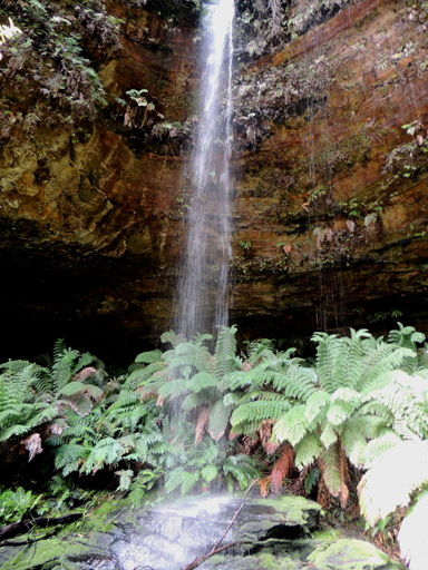
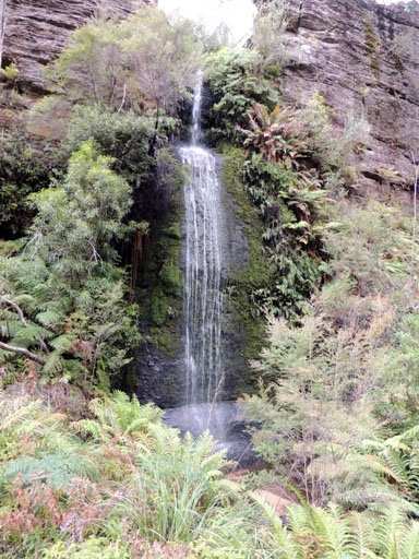
Deanes Creek Falls
Located 1.35km west north west of the locked gate on Deanes Creek Trail via Galah Mountain Road. These falls drop more than 40m through a twisting slot from a deep and complex "C" shaped canyon up on the plateau above. Named by Michael Keats and Brian Fox on a Bush Club walk, 13th February 2015.
Deanes Galleries
Is a series of very large overhangs on the eastern side of Deanes Creek and 500m north east of Rock Island. It also includes an amazing collapsed and tilted rock which has formed a walk through tunnel. It is some 20m long and has a fine, level, washed sandy floor. Named by Brian Fox on a Bush Club walk, 19th December 2013.
Deanes Lookout
Is possibly named by David Warren Noble. David also had heard it called The End of the World by local Lithgow people who had previously taken 4WD vehicles into the area. Ref: Correspondence with David Warren Noble, 14th October 2009. Ref: Yah Hut Log Book, 27th July 1981.
Deanes Plateau
Central to this plateau is Deanes CreekTrail. Murrays Mount is also located on this plateau. The western side is bounded by Deanes Creek and the eastern side by Rocky Creek. The north eastern point is known as Deanes Lookout or The End of the World.

Deanes Siding *
Is now a locality about 4km north of the junction of Glowworm Tunnel Road and Galah Mountain Road. When the Wolgan Valley Railway was operating, Deanes Siding was an important stop for adding additional locomotive power to enable trains to haul products out of Newnes. Deanes Siding was named after Henry Deane, consulting railway engineer to the Commonwealth Oil Corporation, by Donald Alexander Sutherland, Consulting Engineer and General Manager of The Commonwealth Oil Corporation Ltd, in 1906. Ref: Deane, Henry. The Wolgan Valley Railway - Its Construction, 1910, reproduced by the Australian Railway Historical Society, 1979. It was at Deanes Siding that the Wolgan Valley Railway gradient dropped as it neared the Wolgan Valley. Henry Deane (1847-1924), Engineer-in-Chief of NSW Railways, was a keen photographer and botanist. Eucalypt deanei, located in the Blue Mountains, is named after him, as well as Boronia deanei, which is found on the Newnes Plateau.
Death Trap Canyon
Death Trap Canyon is accessed via Galah Mountain Road. Ref: Jamieson, Rick. Canyons Near Sydney, 5th edition, 2012, p. 50.
See Death Trap Cave, Death Trap Rock
Death Trap Cave
Is located about 100m on the eastern side of Rocky Creek and 900m west of Mount Budgary. The cave measures 47m across the mouth, 19.2m deep and 23m high. It has a sloping floor, which does detract from its otherwise impressive dimensions.
Death Trap Falls
Is a double tier waterfall, a simply beautiful, perfectly symmetrical waterdrop. The name Death Trap Rock Falls is consistent with other names as part of Death Trap Canyon but does not reflect the displayed elegance. Accessed via Galah Mountain Road. Ref: Jamieson, Rick. Canyons Near Sydney, 5th edition, 2012, p. 50.
Death Trap Rock
Can be viewed from a ledge at GR 463 109, where this spectacular formation can be photographed. This very large rock within Rocky Creek has cleaved away from the western cliff line, tilted and fractured in the process, but somehow managed to maintain overall integrity.
December Creek
Has its headwaters on the northern side of the road junctions, Chifley Road and Bells Line of Road, Bell. It flows in a north and easterly direction for 6km to join the Wollangambe River at 510 914. Named by Ian Thorpe 17-18th December 2005. .
Deception Canyon
Deception Point
Named after the nearby Deception Canyon. Deception Point is a small but spectacular promontory on the eastern cliff edge of the Wolgan River with commanding views of the Wolgan Valley, Donkey Mountain and the Wolgan - Capertee Divide. Located 900m west of the Glowworm Tunnel car park. Named by Michael Keats and Brian Fox on a Bush Club walk, 15th November 2014.
Deep Pass *
Is a saddle, about 300m west of Mount Norris on the western end of Railmotor Ridge. Access is via Glowworm Tunnel Road, Eastern Boundary Road and Deep Pass Trail. Deep Pass is shown on the map Parish of Rock Hill, 1st edition, 1882. Deep Pass was assigned as a Rural Place by the Geographical Names Board on 11th July 1997.
Deep Pass Camping Area
Road access via Glowworm Tunnel Road, Eastern Boundary Road and Mount Cameron Trail. From the barrier a walking track mostly down hill for 900m leads to the open flat area. NPWS has provided toilet.
Deep Pass Canyon
Is a descriptive name, being "deep" in terms of the surrounding area and also being a narrow gorge dividing two creek systems. Two brothers, Alan and Russell May, and John Norris built a hut at Deep Pass in the late 1940s. The hut has since been destroyed. The chimney foundations can still be identified. The trio may have had some sort of lease in the area. Ref: Correspondence with David Warren Noble, 14th October 2009. See also Mount Norris. Oral history from Ken Poppett, 24th February 2012, as he recalls, "One hut was built / owned by Morris Reginald Hayden (1929-1997), a timber cutter. Later,"bikies"reportedly extended the hut and added a large structure they called a hall. Later again, the whole thing was removed by the NPWS."
Deep Pass Creek
Has its headwaters on the southern side of Deep Pass saddle, between the Blue Mountains National Park barrier and Mount Norris. This small creek of 2.1km flows in a southerly direction to its junction with Dingo Creek. This name is derived from the natural and locality name, Deep Pass.
Deep Pass Trail
Is about 5km in length from its junction with Eastern Boundary Road, to the road barrier. The remaining 250m walk leads down the hill to the level flat camping area, Deep Pass Camping Ground.
Delusional Pass
Refers to the access to below the cliff line above the eastern side of Carne Creek 1.3km east, south east of the Carne Creek and Wolgan River junctions via Delusional Slot. So named by Brian Fox on a Bush Club walk, 19th May 2014.
