Search Results
17 Sisters
Is a string of pagodas stretching from 472 941 to 474 941. Located 1.5km south east of Goochs Crater. Named from a viewing point GR 465 928, when Ian Thorpe was leading a walk for SPAN Outdoors in 2006. The name lampooning the name, The Three Sisters.
84 Foot Lookout
Is located on top of the cliff edge at Hassans Walls Reserve, between Nellies Glen and Pavilion Gully and 90m west of the communication tower. Named by Keith Painter and Brian Fox on an investigative walk 6th September 2016. This unnamed old fenced lookout has 84 feet of meshed fencing. Lithgow Mercury 17th May 1935, p. 4. Records, “ and a start will be made next week on the fencing of 84ft. of a new look-out.”

Acoustic Chamber
Is located within Sunnyside Canyon. Peter Medbury first visited the canyon on 2 November 2008. Peter had contacted Dave Noble at the time and he told me (Peter) the canyon was named Sunnyside Canyon. It had been named Acoustic Canyon when first discovered (late 70s??) but it turned out the name had been used so it was renamed to Sunnyside Canyon. I’d have been surprised if the name hadn’t already been applied to that Chamber (but I could well be wrong). On a later bushwalk by the Bush Club Mike Keats track notes record, The famous hemispherical cave in the lower reaches was visited. Pacing it out, it has a diameter of about 24m, a height of about 15m including a domed ceiling. Droppings on the floor show evidence of an active roost for bats.
Adrenalin Creek
Flows in an approximate north to south direction for 6.5km, from the junction of Birds Rock Trail and Sunnyside Ridge Road to its confluence with Carne Creek. Contained in it's headwaters, is Cathedral Cave. Michael Keats recorded on 25th February 2013, "I have called this area, east of Firetrail No. 6 and the next ridge east, and questionably Firetrail No. 5, the Adrenalin Gorges of Carne Creek. The name is inspired by a complex terrain so stimulating and so beautiful it really gets the adrenalin flowing."
Adrenalin Head
Is the prominent headland located at the end of Firetrail No. 6, south of the Wolgan Pinnacle and between Endorphin Gully and Adrenalin Creek. It is characterised by massive vertical cliffs up to 116m high and partly negotiable benched ledges. The highest point of the headland is at GR 384 137.
Adrenalin Ledge
Is an incredible ledge, halfway below the cliff line overlooking Carne Creek. It extends for 1km. The midpoint is located 1km south east of the Wolgan Pinnacle, access via Sunnyside Ridge Road and Firetrail No. 6. So named by Yuri Bolotin on a Bush Club walk, 6th May 2013, in keeping with the name of the creek system to the east, Adrenalin Creek.
Adrenalin Ledge East
It also dawned on us that the ledge that had we had started walking on in the gully to the east was easily negotiable. Given that it is on the eastern side of Adrenalin Gully we decided to call it Adrenalin Ledge East. Bush Club walk 17th January 2014.
Adrenalin Slot
This slot is special and so it was that we agreed to call it Adrenalin Slot as it faces into, and connects with Adrenalin Creek. Bush Club walk 17th January 2014.
Airly *
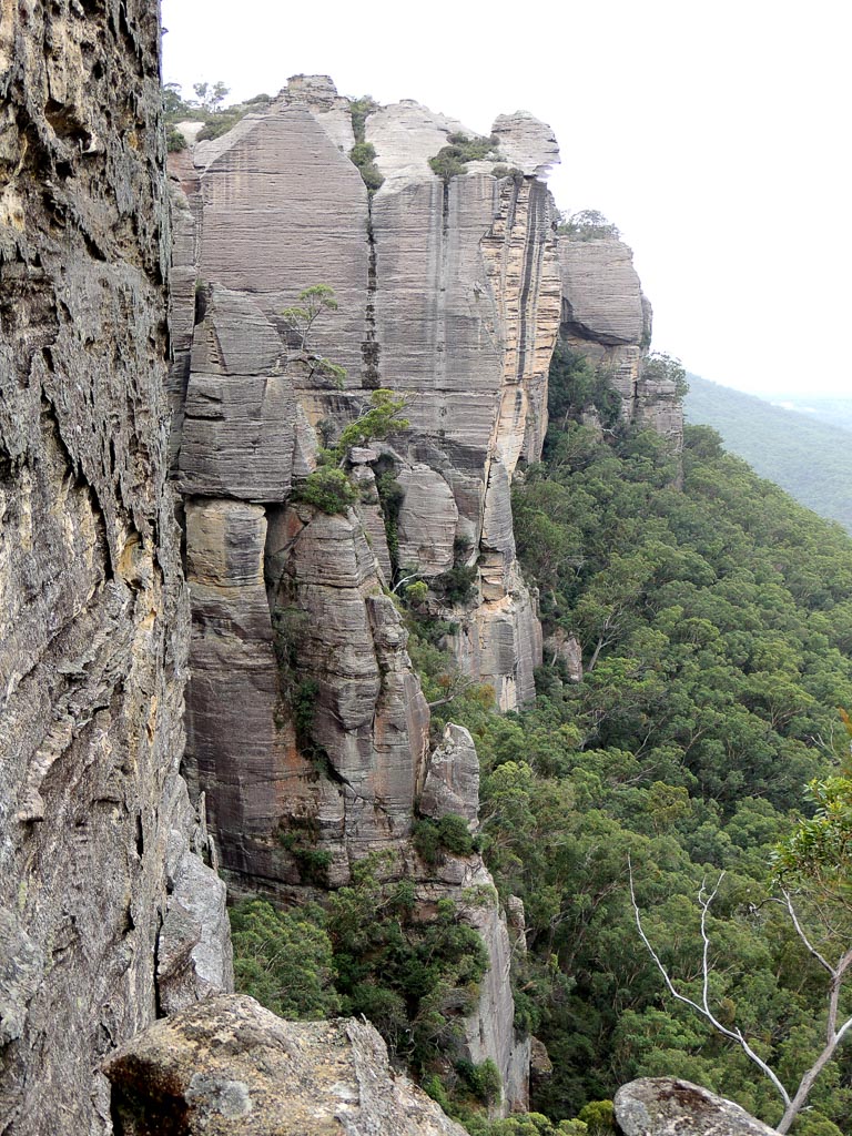
Is the locality name, which encompasses Mount Airly, Airly Turret and what was the Town of Airly. Glen Alice Topo Map, GR 240 332. The earliest reference to this name is recorded in Annabella Boswell's Journal, March 1839. She records the name Elyor, Erly Flat.
James Galagher purchased 40ac in the area in 1852 and used the name Airly. His second house at this location, constructed in 1863, was named Airly House. James" grandson, Rupert, recalls originally the place was called Early Flat.
Airlie is the obsolete dialect form of "early". The word Airly is also the obsolete term for earthly or heavenly and had a mention in Norton's verse in 1652, "which bare up Erth with his Aierly migh."
Ref: Mayne, Dianne. Airly Newsletter 1898. Unpublished, 1980. Galagher,Rodney. The Galaghers of Airly and Port Macquarie, 2010.
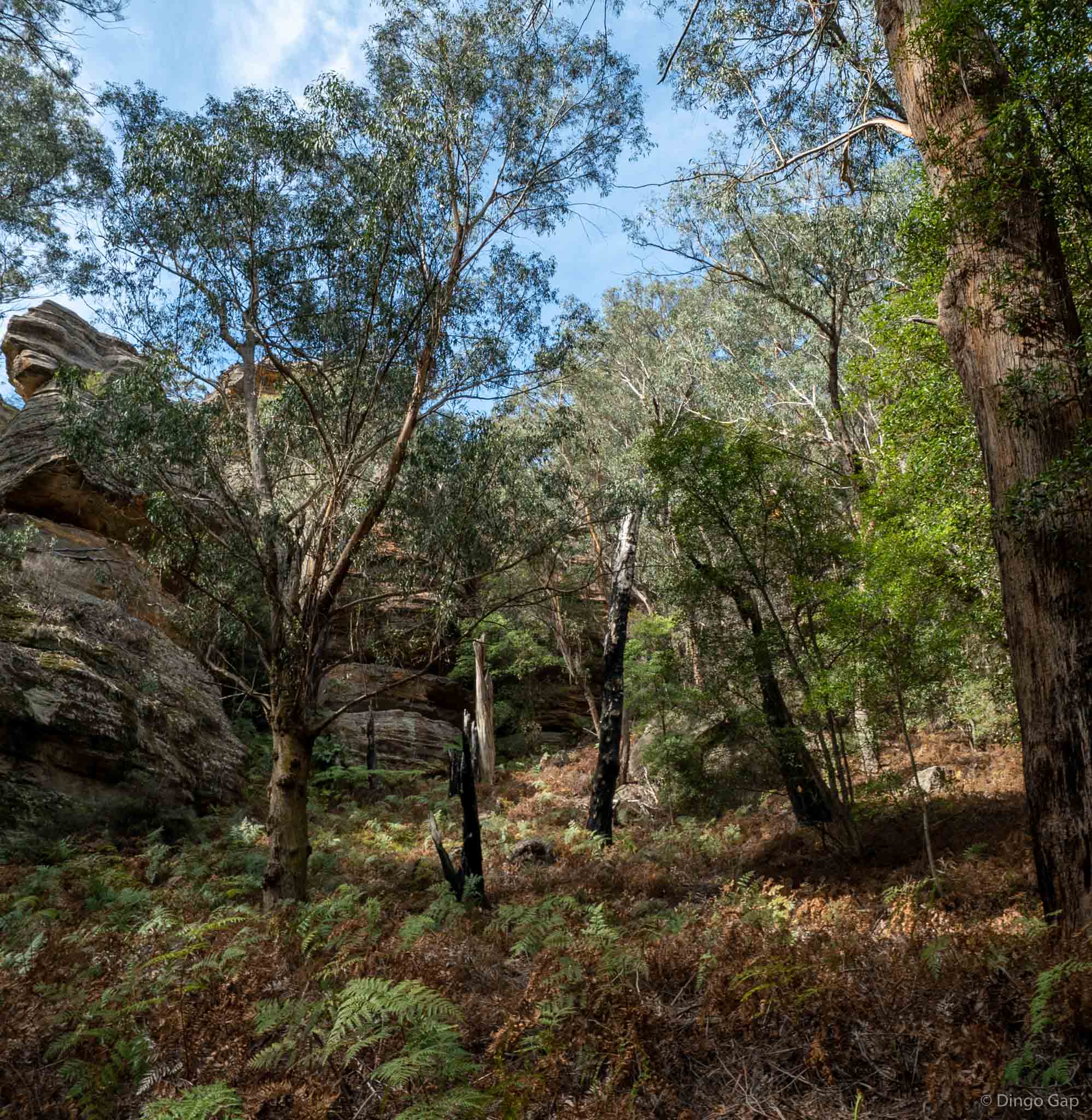
Airly Basin
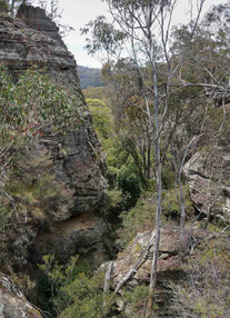
Airly Canyon
Is a short canyon starting on Mount Airly and traversing east to Airly Village. Named by Peter Medbury who records,“The canyon can be traversed in either direction. A tape is required near the top. There are a couple off pools near the top of the canyon. There is an old mine adit under a large rock shelf, a small dam on top and associated water pipes apparently used to supply water to the miners”.
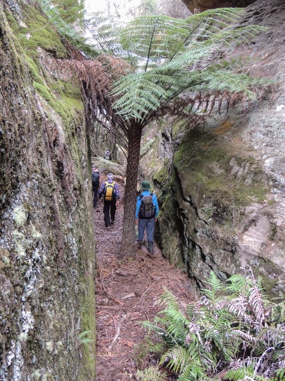
Airly Connector Slot
Is a natural 250m, gentle gradient passage between cliff lines of heights up to 20m. This slot access is an alternate means to using a section of the road from Rock Bottom, Airly Gap towards Mount Airly. The slot has a short tunnel section. Named by Michael Keats, Yuri Bolotin and Brian Fox on a Bush Club walk 23rd June 2017.
Airly Creek *
Is a non perennial stream rising 4.8km north east of Capertee. It flows generally south east for about 12km into Coco Creek. Airly Creek is shown on the map Parish of Bandamora, 1882.
Airly Creek Trail
Is a NPWS signed walking track. It is approximately 5km in length and is based on former property access roads. It commences on Glen Davis Road and follows a ridge south, crosses Airly Creek and terminates at the junction with Murdocks Creek Trail.
Airly Flat
Is located on the Castlereagh Highway just north of the town of Capertee.This old name was used to describe the location of James Galagher's property. Ref: Survey Plan 12.1496, dated 4th November 1852. Bathurst Free Press and Mining Journal, 2nd July 1853, p. 4; col. 1.
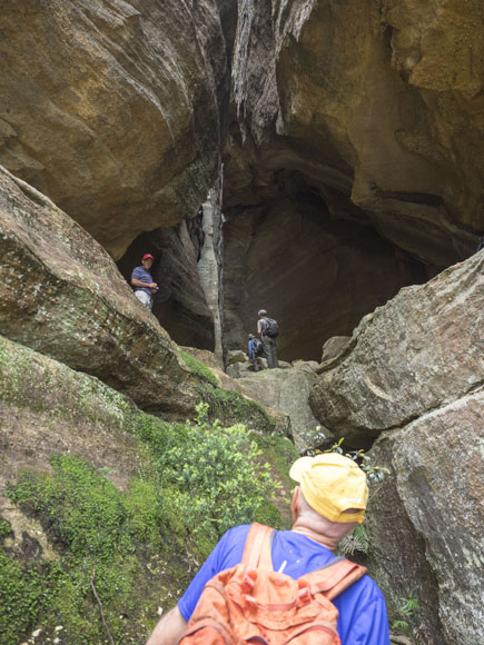
Airly Frustum
Is a hollowed out truncated cone or frustum.This glorious piece of architecture is some 20m in diameter. It is endowed with natural skylights and an internal water supply. At floor level colourful benched decks of red shale extend north and south; internally it is cluttered with fallen rocks like discarded furniture overturned as though someone left in haste. Located 340m due west of the communication tower at Airly. Named by John Fox on a Bush Club walk 16th November 2015.
Airly Gap
Is a saddle separating the catchments of Gap Creek and Malcolms Gully. It was also the original access to the Town of Airly. It is located approximately 1.2km from Glen Davis Road. Also known as Airly Gate.
Airly Mountain Trail
Has been signposted by the NPWS (erected 2014). This trail starts at the intersection of the TramwayTrail, near the property Rock Bottom, GR 240 335. The trail winds its way up Mount Airly and along the top of the plateau and then in a north east direction to approximately 235 342.
Airly Turret *
Is a rocky peak about 2km south east of Mount Airly. Airly Turret is shown on the map Parish of Airly, 1st edition, 1884.
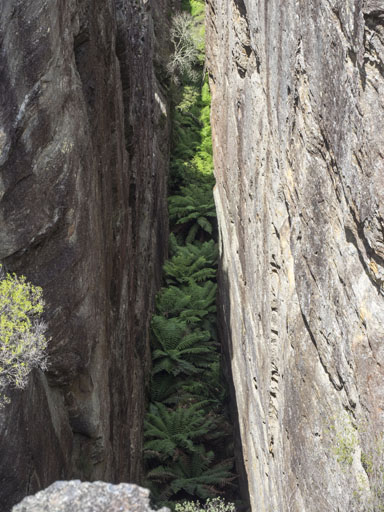
Airly Turret Slot
Located 240m due west of the communication tower at Airly is a major feature being some 3-5m wide, 45m deep and 100m in length, however traceable over a distance of more than 400m from Airly Turret in the south to a non negotiable 30m north point on the cliff line. The floor of this slot is full of the Soft Tree Ferns, Dicksonia antarctica. Named by Yuri Bolotin and Michael Keats on a Bush Club walk 16th November 2015.
Alcatraz
Is a descriptive name based on the notorious prison in the USA. This prominent isolated impregnable monolith above 1000m is located south west of Woolpack Rock, and the southern extremity, between Hughes Defile and Woolpack Gap. The name was created by the original three who proposed the Gardens of Stone National Park, Rodney Falconer, David Blackwell and Dr Haydn Washington, in November 1984.
On 28th February 2017 Haydn clarified the naming of Alcatraz, “...with Alcatraz we were looking along the divide and saw past Woolpack Rock and that creek what seemed a virtually impregnable fortress of cliffs, so called it Alcatraz, and I recall it was interesting getting onto it. So it was the whole pagoda cluster that led me to give it that name.”
Alcibiades Rift
A 20m slot near the western end of Zeus Minor formed by a section of cliff line having broken off and fallen away to now give access from the western to eastern side of Zeus Minor. Alcibiades was an Athenian politician and general in the Peloponnesian War.After the death of his father in 447, he was brought up by Pericles and Pericles's brother Ariphron. He was notable for changing sides. Named on a Bush Club walk, 25th July 2011 by Michael Keats.
Alloway
Was named after the Alloway in Ayrshire, Scotland. Captain John Piper was born in Maybole, Ayrshire. Ref: Eldershaw, M. Bernard, The Life and Times of Captain John Piper, 1973, p. 126.
Alloway Creek *
Is shown on the Parish of Coco map, 1883. It is a non perennial stream rising on the south west side of Mount Alloway. It flows generally south east and north, north east for about 6km into Airly Creek. The name Alloway Bank was the property name of Captain John Piper (1773-1851), whose main residence was in Bathurst. He also held grazing rights in this area of Alloway Creek. Fry, Ken. Beyond the Barrier, 1993, p. 118, records Captain John Piper "excelled in hospitality and social graces. His door was always open to guests and visitors of his class." John Piper was an early Magistrate and hence held in high honour and esteem.
Alois Creek
Has its headwaters on the Great Dividing Range 4km south east of Cullen Bullen. It flows south, then east for 3.6km into the Coxs River. Named by Michael Keats on a Bush Club walk on 19th October 2012. Named after Alois Joseph Neubeck (1821-1904). When he and his wife Clara emigrated from Germany to Australia in 1855, they moved to Wallerawang and Alois was employed by James Walker. In 1862, the family moved to Blackmans Flat (near the present day Mount Piper Power Station), where he set up a business as a blacksmith, and also provided a staging area for Cobb and Co.
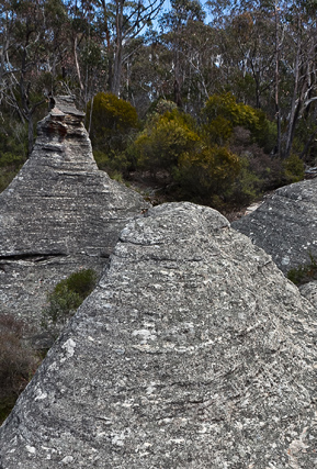
Alois Spur
Is located to the east of Hermits Spur and is conjoined to it at its northern extremity, GR 272 083. Named by Michael Keats on a Bush Club walk, 19th October 2012. Named after Alois Joseph Neubeck (1821-1904).This spur extends south for about 1.8km.
Altar Room
Yuri Bolotin devised the name, the Altar Room, after his emotional experience of visiting the place on 10th September 2011 on a walk led by Tom Brennan. He did not share his thoughts with others in the party at that time but returned to that place a few months after.The Altar Room is a pass about 250m in overall length joining Little Capertee Creek to the crest dividing it from the Canobla Creek. The ascent from bottom to top is about 350m. Altar Room, previous name by Dave Noble 2002, Suspira Canyon, The Three Mothers by E.Varelli.
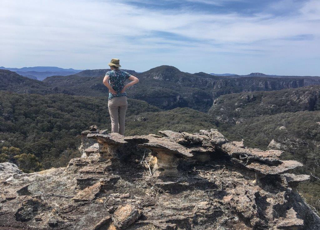
Altar Room Panorama
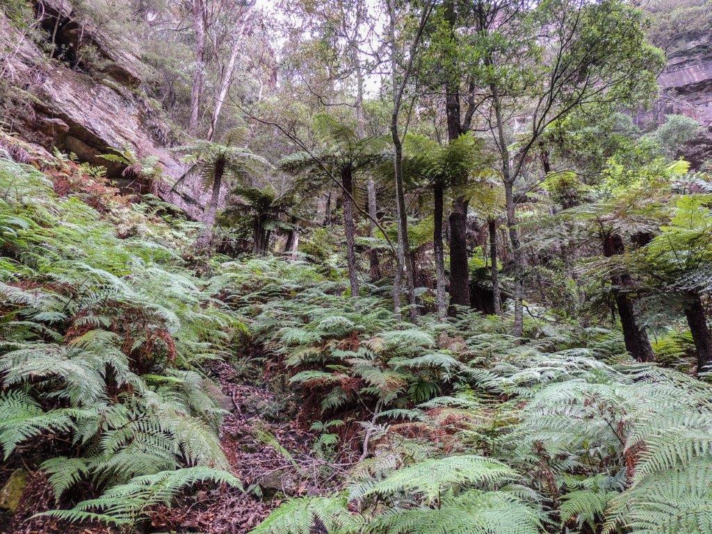
Amphitheatres Pass
Is a pass which breaches the cliff line between Woolpack Gap and Collett Gap giving access to the Wolgan Capertee Divide. Through not as easy as the other passes in this area, a narrow steep slot at the top on the western side of the amphitheatre gives final access to the divide. The amphitheatres is a descriptive name adopted for the shape of this tree fern laden area. Named by Yuri Bolotin and Brian Fox on a Bush Club walk 16th March 2018.
Angels Rest
Is a 360 degree view atop a pagoda with extensive views into the incised convolutions of the Bungleboori Creek, where each twist and turn is embellished with pagodas, cliffs, caves and decorated walls, while deep dark patches indicate the presence of hidden canyon sections. Located 2.8km north east of Bald Trig Station and accessed via the firetrail towards Dumbano Creek. This name was coined by Michael Keats on a bush walk, 30th April 2012, to coincide with the named feature to the east, Holts Heaven.
Angels Rest Falls
Is located on a southern tributary of Bungleboori Creek, 2.9km north east of Bald Trig. This perennial waterfall has a drop of about 30m. After heavy rain it is spectacular, flowing into a ravine of tree ferns. Named by Michael Keats on a Bush Club walk 12th January 2015 as it is in close proximity to the pagoda known as Angels Rest.
Angels Window
Was named along with the heavenly theme of other features in this area. This single pagoda on the northern side of Bungleboori Creek gives impressive 180 degree views of a pagoda studded landscape, particularly south east towards Holts Heaven. Named by Brian Fox,Yuri Bolotin and Michael Keats on a Bush Club walk, 21st May 2012.
Angry Man Lookout
Is a lookout point from where a giant caricature of a face was spotted high on the cliff face (looking east down Capertee Creek) by Marion Davies. Viewed from a rocky pinnacle above Capertee Creek along Newnes Balcony East. Named by Yuri Bolotin and Brian Fox on a Bush Club walk, 1st November 2013.
Angus Place *
Is a locality about 4km south of Wolgan Gap and 4km north, north east of Lidsdale. Angus is another Scottish name within this region. Airlie in Scotland is located within the County of Angus. Ref: Gazetteer of British Place Names. James Walker was one of the original land owners holding a number of portions of land in this vicinity. He emigrated from Perth, Scotland in 1823. Angus is a locality in close proximity to Perth, Scotland. The Survey Plan of Portions 71-73, dated 28th August 1930, showing one acre blocks, has the pencilled text, Angus Place. Ref: Survey Plan C2803.1507.
Angus Place Trail
Is a NPWS signed walking track. It is approximately 5km in length, commencing on the Wolgan Road at Angus Place, GR 299 056, and terminating at a junction with the Beecroft Firetrail, GR 321 030. Also see Dando's Firetrail
Annie Rowan Creek *
Is a perennial stream rising about 2km south east of Mount Cameron. It flows generally north for about 9km into the Wolgan River about 1.5km south west of Mount Morgan. It first appeared on the map Parish of Barton, 1884. At the junction of the Wolgan River and Annie Rowan Creek is the feature known as (see) Binnings Hole. It is most likely Annie Rowan was the sister of Walter Rowan who died on 3rd November 1858, aged 40. Rowans Hole was named after Walter Rowan. Ref: NSW BDM Rego No. 5413/1858 and Old Catholic Cemetery, North Street, Nowra records.
Ant Hill
Is located midway along Ant Hill Ridge at 1025m. Named by Peter Fox, National Parks Association bushwalker, 1995-1998.
Ant Hill Ridge
Generally trends north south off Girdwood Ridge. On the eastern side is the feature known as Holts Heaven. The northern end of the fire trail on this ridge leads to the headwaters of Dumbano Creek.
Anzac Ridge
Refers to the spur line 300m in length extending south of King Georges Head towards the Great Western Highway, within Hassans Walls Reserve, Lithgow. The Democrat, 1st October 1915, p. 6, records the progress association, entry,“new track….to King George’s Head Rock, and thence to a small ridge overlooking the Bathurst-road, which was recently named Anzac Ridge." So named after the Australian and New Zealand troops landing at Anzac Cove, Gallipoli, 25th April 1915.
Apex Lookout
Is located in the vicinity of Bracey Trig Station. Access via the southern end of Bridge Street, Lithgow. The Apex Club of Lithgow developed the area in 1952-53. The Lithgow Mercury, 6th July 1953, p. 2, records, “ During the week-end, under the supervision of Mr. Glen Edgar, a working bee formed a track, from the Apex Lookout, the furthest point which could be previously reached by vehicles, to Bracey's Lookout so that material could be taken to the proposed site of the lookout shelter shed."
Apex Point
Is the point of land in the vicinity of Bracey Trig Station. Access via the southern end of Bridge Street, Lithgow. The Lithgow Mercury, 28th October 1952, p. 2 and 7th July 1954, p. 3, records,“A preliminary survey, conducted by a team of five members of Lithgow Apex, on Saturday pegged out portion of a proposed easy access route from the junction of Bridge and Esk streets, around Apex Point, to Bracey Lookout and Hassans Walls Lookout."
Apple Tree Point
Is the end of the ridge line above Annie Rowan Creek, 3.4km north, north east of Mount Cameron. Local usage name prior to 1980s. Ref: correspondence with Danny Whitty, 3rd July 2010.
Aragorn Slot
Is a beautiful slot crowned with stunning pagoda formations on the top. Aragorn is the main protagonist of Lord of the Rings who was instrumental in the quest against the forces of evil. Named by Yuri Bolotin on a Bush Club walk on 15th August 2013, in keeping with his Lord of the Rings themed names in this area. Located 1.2km north east of InvincibleTrig Station.
Ariadne Needles
Are two slots within the Koopartoo Mesa complex. Located 1.9km west of the Wolgan River and Zobels Gully junction. Named by Yuri Bolotin on a bushwalk 22 August 2017 who recorded,“two thin parallel slots, close to one another, about 130m and 80m long, both negotiable. You can take one to go up for incredible views from the top, and another one to come down. I will call them Ariadne Needles.”The name is in keeping with the mythology theme names related to the Minotaur, Ariadne Thread, etc.
Ariadne Thread
Is an amazing slot that allows walking access from the northern section of Koopartoo Mesa down into the eastern end of Minotaur Lair. Located 1.5km near due west of the Wolgan River / Zobels Gully junction. This cliff lined slot drops 80m and has an overall length of 200m. It would rank as one of the most spectacular descents in the Wollemi National Park. A tape is recommended in at least two locations for extra caution when traversing this slot. Jointly named by Yuri Bolotin, Michael Keats and Brian Fox on a Bush Club walk on 10th October 2016. The Greek myth of the Labyrinth and the Minotaur, where Ariadne gave Theseus a ball of red thread to follow out of the Minotaur Lair, provided us with an ancient insight on how to find our way through the slot. A 10 m high stone statue of Ariadne stands at the bottom part of the slot.
Arwens Pathway
Is located on the Ben Bullen Range, 2.7km east, south east of Cullen Bullen. This is a beautiful long overhang, decorated with ornate weathering and multi coloured layers. The overhang connects the Hall of Celebrian to the cliff line that rises to the Hall of Elrond. Hall of Arwen is located at GR 268 104 at the start of Arwens Pathway. Named by Yuri Bolotin on a Bush Club walk, 28th June 2012. Arwen is the daughter of Elrond and Celebrian and the future wife of Aragorn, the main hero of Lord of the Rings. Yuri has named several features in this area based on the fictional characters created by J. R. R Tolkien.
Ascension Point
Is the end of a small spur. In keeping with the heavenly themed features in this area, Yuri Bolotin named it on a Bush Club walk on 7th June 2012. Located above the northern side of Bungleboori Creek, 3.3km south, south east of the Two Trees Road and Waratah Ridge Road intersection. Other features in this area include Holts Heaven, Angels Window and Angels Rest.
Axehead Cave
Located above the upper reaches of Bungleboori Creek has a width below the drip line of about 17m. The depth is about 13m as is the height at the front. The most visible sign that it is a significant Aboriginal site is the solitary quite large red ochre hand and forearm stencil on the left hand side wall of the cave. The assessment of the stone which gives the cave its name, was that it looks like a basalt stone core that has been well worked judging by what appears to be numerous flake scars on its surface, but it could have once been an axe, given its form.
Baal Bone
Is a locality name. The first land grant of Cullen Bullen, (2000ac), was taken up by Robert Venour Dulhunty. His brother Lawrence Vance Dulhunty also took a large grant of land nearby. Robert Dulhunty was at one stage Commissioner of Disputed Land Claims in Queensland. Robert's son, Lawrence Joseph Edward Dulhunty, moved to Queensland, where he held extensive properties and was a well-respected and influential person. Dulhunty Plains and Dulhunty River were named after his family. The Dulhuntys took an interest in Aboriginal names of the Tambo area. An Aboriginal name for water and drink in the Norman River area was "baal". Locally, Baal Bone Gap is the only easy accessible means through the cliff line to the headwaters of the Baal Bone Creek and further south to the headwaters of the Coxs River. The coining of the word, "bone" as in "pointing the bone" adds direction via this gap. Ref: Indigenous word lists compiled by Smyth and Curr. Dulhunty Papers.The Brisbane Courier, 26th March 1881, p. 7. This aboriginal place according to Helen Riley, Wiradjuri Elder and Sharon Riley, Wiradjuri representative is for, Mens Business, and they would go no where near it. Ref: Oral history 3rd May 2016.
Baal Bone Creek *
Is a non perennial stream rising at Baal Bone Gap. It flows generally west, southwest for about 4km into Jews Creek.
Baal Bone Creek Trail
Is a NPWS signed trail named on the Ben Bullen topographic map with extensions to the south west being shown but not named on the Cullen Bullen topographic map. Taken at its greatest extension, it stretches from the Wolgan Road near Lambs Creek, GR 302 082,crossing through Gardiners Gap, passing east of the Baal Bone Colliery and terminating where it joins The Bicentennial National Trail about 1km south of Baal Bone Gap at GR 290 179.
Baal Bone Gap *
Was first shown on the map Parish of Ben Bullen, 1885. Baal Bone Gap is a saddle 1km west of Mount McLean. The Bicentennial National Trail crosses this gap.
Baal Bone Point *
Was also first shown on the same map as Baal Bone Gap. Baal Bone Point is the terminal point of land at northern end of the escarpment 2.5km south west of Pantoneys Crown.
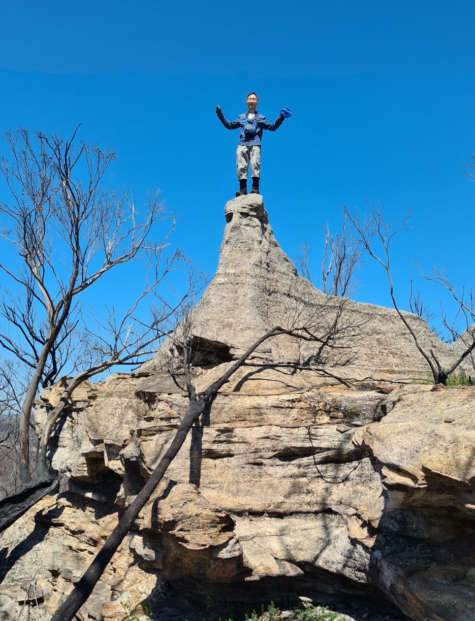
Baal Sphinx Rock
It is an interesting rock that looks like a Sphinx. Located 2.25 km north north west of Baal Bone Gap; exactly halfway between Mercurys Boot and Baal Bone Point. If you walk along the ridge from Baal Bone Gap to Baal Bone Point, you won't miss this rock. Named on a bushwalk led by Paul Ma on 15 October 2020, with Harold Thompson, Freda Moxom and Nick Collins.
Bald Hill
is a descriptive name for the hill on which Bald Trig Station is positioned. One of the most extensive views in this region is seen from this vantage point. Bald Hill. The name was described in the Lithgow Mercury 12th March 1908, ….Bald Hills greet the sight. These hills are well named, for they are indeed bald. The name is shown on the map Mount Victoria to the Western County, 1914. The previous name for Bald Hill was Panoramic Hill. Named by Surveyor Robert Hoddle, 20th October 1823. Ref: Colville, Berres Hoddle. Robert Hoddle Pioneer Surveyor 1794-1881, 2004, p. 43. The former Wolgan Valley Railway skirted Bald Hill on the eastern side.
Bald Ridge
Was an older name for where the present Bald Hill and Bald Trig is located. Ref: The Lithgow Mercury 21st November 1902.
Bald Trig Station *
Is a trig station, at the elevation of 1180.70m, located on the ridge between the Bungleboori Creek to the north and north east and the Wollangambe River to the south and south east. The supporting stepped concrete base for this trig is over 2m high. The trig station was constructed in 1878-1879. Ref: Trig Summary Cards, Department of Lands, Bathurst.
Bandamora, Parish of *
A lands administrative division within the County of Roxburgh. It appears that the current spelling of the parish is incorrect as the earlier references show it spelt as Bandanora. The Sydney Gazette, 5th January 1832, p. 1 records land sale, 640 acres at Bandanora, about fifteen miles from Cullen Bullen. The property, Bandanora, is shown on the map NSW, The Surveys of the Australian Agricultural Company, 1833. A written history by William Corlis who lived at the property Bandanora from 1851 recalls the station was always called Bandanora, but he did not know the origin or meaning of the word. Ref: Jefferys, Bruce. The Story of Capertee, 1982, pp. 16-17.
Banksia Slot
Was so named by Brian Fox on a Bush Club walk 29th April 2016 as it contained four very fine healthy examples ofBanksia serrata. Located above the cliff line overlooking Canobla Creek and would be a pass through the cliffs to Canobla Gap Trail. Access via Newnes, Little Capertee Creek Camping Ground, Cathedral Canyon and the end of the northern spur.
Banner Drop Lookout
Is located on the western end of a short spur line off Gardiners Gap Trail within Ben Bullen State Forest 1.3km north, north west of Invincible Trig. So named after a protest in 2011 to stop open cut coal mining in this area. Name shown on Karen McLaughlin’s 2nd edition The Gardens of Stone Stage 2 Reserve Proposal Map, August 2016.
Barcoo Swamp
Is an old, disused name. Barcoo is an Aboriginal name meaning, "Ice on Water". Barcoo Swamp forms the headwaters of Deanes Creek. Barcoo Swamp is located on the north east side of the Glowworm Tunnel Road and Galah Mountain Road intersection. Cullen Bullen Topo Map, GR 438 111. Ref: Barcoo Swamp shown on Tramway from Wolgan to Clarence. Survey Plan M12435. Surveyed by John Haydon Cardew, Licensed Surveyor, 13th December1905. Stephens, Eric. Wolgan Railway Notebook, 1934-1937. Records, "Track to Barcoo Hut". The first land grant of Cullen Bullen (2000ac) was taken up by Robert Venour Dulhunty. His brother Lawrence Vance Dulhunty also took a large grant of land nearby. He was at one stage Commissioner of Disputed Land Claims in the Tambo, Barcoo district in Queensland. Robert's son Lawrence Joseph Edward Dulhunty, moved to Tambo, Queensland and it was here that some of his children were born. The Barcoo River runs past Tambo. Ref: Dulhunty Papers, The Brisbane Courier, 26th March 1881, p. 7. Carne, J E. Field Book, State Records, 2/663, 11th January 1906, records, "Barcoo Hut".
Baroque Spur
Is located on the western side of Deep Pass 1.3km south, south west of Deep Pass.Cliff lined on two sides, it contains the most intricate delicate erosion sculptures, incuding a window. So named by Michael Keats on a Bush Club walk, 24th August 2012. Michael chose the name, Baroque Spur, as the rocky features reminded him of the lavish architectural and artistic style of the baroque period.
Barton Creek *
Is a non perennial stream rising at McLeans Pass and Mount Jamison. It flows generally east by north for about 10km into the Wolgan River.
Barton Glen
Barton Pass
Is a natural inclined ramp that gives access from the base of the first cliff line to the top of the southern point, Chimera Point, and plateau which overlooks the Wolgan Valley, Donkey Mountain and the property, Penrose below. Named by Brian Fox on a Bush Club walk, 24th March 2016.
Barton Slot
Is located above the cliff line 1.5km north west of the Wolgan Road and Emirates intersection. This slot the about 200m long. In places it is 70m deep and varies in width from 50cm to 2m. Having a general gradient of 30 degrees except where a drop of 6m would entail a rope descent. Named on a Bush Club walk 28th August 2015 by Brian Fox, Yuri Bolotin and Michael Keats as it is located on one of the tributary creeks of Barton Creek.
Beagle Head
Is located 400m south east from the locked gate off Wolgan River Trail at Newnes. But with an elevation difference of 280m. This huge undercut part of the top cliff face jutting out over the Wolgan when viewed from the north east resembled the head of a Beagle dog. Named by Brian Fox on a bush walk 28th July 2014.
Beecroft Firetrail
Is a NPWS signed track about 8km long. It commences in Masons Lane north of Lidsdale at GR 296 045 and tracks generally east to join the Blackfellows Hand Trail close to the headwaters of the Wolgan River, GR 358 026. Beecroft Firetrail was from 1876 a shortcut for drovers moving their cattle and sheep from Bell to Ben Bullen via Gardiners Gap. Ref: Brown, Jim. Bent Backs, 1989, pp. 275-276. Henry Beecroft (1852-1935) first held a Conditional Purchase, 29th January 1876, then in 20th February 1881, 69ac. Later purchased Portion 100, Parish of Lidsdale, 40ac in1903; Portion 101, 84ac in 1908. Ref: Survey Plan 936.1507 and Certificate of Title Vol. 1560, Fol. 154. The land was passed down jointly to his son, Norman Edley Searl Beecroft (1894-1982), and in 1937 to another son Joseph GeorgeBeecroft (1878-1953) and his wife Annie May Beecroft (1876-1962) who held it until 1954. Joseph George Beecroft also held two Conditional Purchases at Mount Cameron from 1903-1947. Ref: Survey Plan C2098 and 2099.1507.
Beecroft Trig Station *
Was constructed by the Royal Australian Survey Corps in 1930. Ref: Lands Department Bathurst Trig Summary Cards. It is located at the elevation of 1025m on the southern side of Beecroft Firetrail, 2.5km north north east of Lidsdale.
Bell *
Is the locality on the north west extremity of the Grose Valley where the Darling Causeway joins Bells Line of Road. The railway station was originally named as Mount Wilson in May 1875 as it was here that travellers got off the train to continue their journey by horse and buggy to Mount Wilson. The name was changed to Bell Railway Station on the 1st May 1889, so named after Archibald Bell. The locality also taking on this name by default.There was a surveyed but unformed street in Newnes named Bell Street as well as seven families with the surname, Bell, appearing on the electoral roll as living in Newnes between 1906 -1922.
Bells Grotto
A beautiful Tree Fern filled grotto, is part of Tunnel Creek and is located on the southern side of the Glowworm Tunnel. This grotto by passes the tunnel. It was also referred to as Penrose Gorge. Eardley, G H. and Stephens, E M. The Shale Railways of NSW, 1974, p. 136, record, "The more hardy adventurous passengers left the train during the watering operation and walked the narrow footpath through the beautiful Bells Grotto." Ref: Deane, Henry. The Wolgan Valley Railway - Its Construction, 1910, reproduced by the Australian Railway Historical Society, 1979, p. 13, shows a map with Bells Grotto.
Bells Line of Road
Archibald Bell made a successful attempt of finding a passage from the Hawkesbury River to the Coxs River in September 1823. Surveyor Robert Hoddle was dispatched by Surveyor General John Oxley to survey this line just one month later, in October 1823. The name was referred to as Bell's Road, Ref: Government Notice, The Sydney Gazette and New South Wales Advertiser, 4th June 1829, p. 3. However, later the name was known as Bells Line of Road, Ref: Land sale advertisement in The Sydney Monitor, 18th June 1838, p. 3. The Lithgow Topo Map shows two sections of the Old Bells Line of Road. From Clarence to the junction of Glowworm Tunnel Road, and a small section of named road from Bungleboori Camping Ground in what is now known as Blackfellows Hand Trail. This was so named as it was part of Robert Hoddle's survey of Bell's Line, even though Archibald Bell did not traverse this area.
Ben Bullen *
Is a village located about 9km north of Cullen Bullen and 21km north by west of Wallerawang. Its boundaries are within the Lithgow Council administrative area. On John Lang's second visit across the Blue Mountains in 1834, he recorded stopping at the property,Ben Bullen, owned by Thomas Cadell, J. P., who with his family had arrived from Sydney in 1832. Ref: Lang, John Dunmore. An Historical and Statistical Account of New South Wales, 1875, pp. 218-221. The Sydney Gazette, 3rd August 1844, p. 3, records a boiling down establishment for the production of tallow from sheep at Ben Bullen. The NSW Geographical Names Board records Ben Bullen as an Aboriginal derived word. Two meanings have been given: high, quiet place and Lyrebird. Endacott, Sydney J. Australian Aboriginal Words and Place Names, 1961, p. 11.
Ben Bullen Creek *
Is a watercourse rising about 3km west of Wolgan Gap Trig Station. It flows generally north north west for about 6.5km into Jews Creek.
Ben Bullen Pillars
Are two very special prominent pagodas which can be seen from the Wolgan Road when passing through Angus Place. Both are subject to underground coal mining and one has a massive 45 degree split through it. Name given to them by Michael Keats and Brian Fox on a Bush Club walk, 21st December 2011.
Ben Bullen Railway Station *
Opened on 15th May 1882 and closed on 1st June 1974. The Ben Bullen public school opened in January 1878 and closed in December 1949. Ben Bullen Post Office opened 1st November 1889, closed 6th March 1965.
Ben Bullen Range *
Extends from the Great Dividing Range, 2.6km south west of Gardiners Gap. It trends generally north west for about 5km and finishes about 1km south east of Kirbys Hill. It was first shown on the Survey Plan 58.14996, dated 5th October 1853.
Ben Bullen State Forest *
Is located in the Bathurst Forestry District. It has an area of approximately 19,220 acres (7,778ha). Ben Bullen State Forest was dedicated on 20th May 1938.
Benbys Pinch *
Is a steep section of the old road way on the south side of the Wolgan River about 1km east of the Village of Newnes. Earliest map reference, Surveyor Edgar Harris on his survey of Wolgan River, October 1890. Ref: Survey Plan Misc. 111. Oe. R. One possible origin of the name is in recognition of William Benby. He arrived in Sydney from Brisbane on the steam ship Governor Blackall on 2nd June 1882. Another plausible suggestion is that the name was originally spelt incorrectly and that instead of Benbys it should have been Bendys Pinch as this pinch of land (tight constriction) is located where the Wolgan River takes a right hand turn from generally flowing south to north to west to east. This common descriptive name also fits with the common generic name of the named pinch further downstream, Devils Pinch.
Big Bell
Is a large bell shaped pagoda near the end of Point Cameron. Named by Dr Haydn Washington. Ref: Correspondence with Haydn Washington, 30th May 2010.
Big Foot Canyon
Was discovered by Ted Hartley on a Kameruka Bushwalking Club trip in 1977. It is located on the southern side of Island Mountain and accessed via Zobels Gully and Telephone Pass. It is a moderate grade three canyon with deep wades but no swims. It discharges into Deanes Creek.
Bindu
Is an overhang on the upper reaches of Kangaroo Corner Creek on the property Glastonbell. It is an old camping/ picnic site with old billies and mugs. GR withheld due to it being on private property.
Binnings Gap
Described by Surveyor, Joseph Carne, c. 1901, “as a well worn track that leads to a pass through the lower cliff line at a break to the right of the main gully.” Andy Macqueen, Wayfaring in Wollemi. pp 33-34 plus map reports, “The pass is steep and exposed. Above the pass the track appears to sidle for 140m until it intersects with the creek. It continues up the left hand side for 300m. The section from the creek to the small gully, although overgrown, was once laboriously benched and cleared of boulders and rocks.”
Binnings Hole
Is to be found at the junction of Annie Rowan Creek and the Wolgan River. It is first shown on Carne, Joseph. Geological Map of the Capertee and Wolgan Valleys, 1901. Carne, Joseph. Geology and Mineral Resources of the Western Coalfield,1908, p. 95. Alexander Binning (c1810-1863), a stonemason by trade, was a sub-inspector in charge of convicts working on Victoria Pass in the 1830s; he constructed Glasgow Arms Inn at Bowenfels and designed St Bernard's Church, Hartley, c1843. Ref: Cuneo, William Rev. Hunters of God, 1979, p. 26. Morgan, MacLeod. A short history of the Wolgan Valley, 1959. Jenkins, Yvonne. Bowenfels, 2008, p. 28. Survey Plan 491.691. Plan of 2 Portions applied for to purchase (Bowenfels), dated 1838. Alexander Binning also constructed Eskbank House, Bennett Street, Lithgow, in 1842, for Thomas Brown. This building is now a museum. It is most likely that Binnings Hole was named by Thomas Brown who had a selection of 80 to 90 acres there prior to 1899. Ref: Bathurst Free Press and Mining Journal, 28th April 1899, p. 3. Also see Rowans Hole, for geological description of the term 'Hole'.
Binnings Hole Neck
Is a 230m high basalt hill named by Joseph Carne, 27 October 1904, In his ‘Geology and Mineral Resources of the Western Coalfield, 1908,’ Carne writes “on south bank of Wolgan River, within the channel gorge. Apex at foot of southern escarpment of Hawkesbury Sandstone cliffs, extending thence to the river bank as a narrow, steeply falling ridge. Contacts well developed. Small channel down western slope exposing excellent sections of tuffs and agglomerates, GR 539 237. Ridge formed of olivine basalt. Patch of Coal Measure shales caught up in centre”.
Birds Cave No. 2
See Birds Caves
Refer to 3 caves along Birds Rock Creek. GR 402 083. The first and most significant is approximately 18m wide, 12m deep and 6m high with flat foor. The other two caves are located at GR 409 086, dimensions 25m wide, 10m deep and 10m high and at GR 410 086 a cave that is about 30m long and is effectively a two storey cave. It is proposed to name these caves Birds Caves after brothers James and Richard Bird. It is their names which was given to Bird Rock Trig. Station. Named by Yuri Bolotin and Michael Keats on a Bush Club walk 27th December 2013.
Birds Caves
Birds Caves No. 3
See Birds Caves
Refers to 3 caves along Birds Rock Creek. GR 402 083. The first and most significant is approximately 18m wide, 12m deep and 6m high with flat foor. The other two caves are located at GR 409 086, dimensions 25m wide, 10m deep and 10m high and at GR 410 086 a cave that is about 30m long and is effectively a two storey cave. It is proposed to name these caves Birds Caves after brothers James and Richard Bird. It is their names which was given to Bird Rock Trig. Station. Named by Yuri Bolotin and Michael Keats on a Bush Club walk 27th December 2013.
Birds Rock Creek
Is located within Birds Rock Flora Reserve. Having its headwaters off the eastern side of Birds Rock Trig Station, it flows generally east for 4.5km into CarneCreek. James (Jim) Lancelot Bird (1895-1978) and his brother Richard Edward (Bert) Bertrum Bird (1891-1961) during the 1920s used horse teams to log the area on top of Newnes Plateau. Jim also worked for the surveyor Lieutenant Colonel Clews when Birds Rock Trig Station was constructed in 1930 by the Royal Australian Survey Corps. Ref: Joe Bird (son of Jim) oral history to Brian Fox,15th June 2009. Lands Department Bathurst Trig Summary Cards. Survey Plan 2811 and 2812.1507 records James Lancelot Bird having a special lease of 339ac (137ha) between the years 1934 and 1961 within the Wolgan Valley.
Birds Rock Flora Reserve *
Is roughly elliptical in shape and lies to the east of Birds Rock Trig Station within Newnes State Forest. About 16km north, north east of Lithgow. Access is via Sunnyside Ridge Road and Birds Rock Trail. Birds Rock Flora Reserve has a total area of 415ha. Originally accepted for preservation in 1966 but not gazetted until 23rd September 1988. A number of Eucalyptus species are in this reserve, including the Blue Mountains Ash,Eucalyptus oreades. Ref: Birds Rock Flora Reserve No. 126; Newnes State Forest No. 748, Working Plan.
Birds Rock Lookout
Is a dramatic cliff edge lookout where the eastern end of Birds Rock Trail terminates less than 10m from a 150m drop into Carne Creek. Named by Brian Fox on a Bush Club walk, 10th October 2013. Access via Sunnyside Ridge Road.
Birds Rock Trig Station *
At the elevation of 1181m, is located about 6km south west of Deanes Siding and about 600m north, north east of the intersection of Sunnyside Ridge Road and Birds Rock Trail. T. S. No. 6278. Previously known as Sunnyside.
Birth Canal
Is a 180 degree bend below a spherical cavern within Kangaroo Corner Creek, 1.4km west of Bell. So named by a previous owner ofGlastonbell in the early 1990s.
Blackfellows Hand Rock *
Also known as Mayinygu Marragu also spelt as Maiyingu Marragu, is a spectacular rock wall and overhang located about 1km south, south east of Wolgan Gap. It is a significant Aboriginal stencil art site. The State Government Gazette, 18th July 2008, p. 7252 describes the land County Cook, Parish Cox, about 491 hectares, being Crown Reserve R 42350 for public Recreation. Notified 15th January 1908, excluding that part of Ben Bullen State Forest dedicated over the Crown Reserve and the Council Public road within the Crown Reserve. NPWS/07/12315. Blackfellows Hand Shelter and Complex was declared an Aboriginal Place, 8th November 2008. This grants it additional protection under the NPWS Act and assures the Wiradjuri people an ongoing link with their cultural heritage. Ref: Connections. The Wiradjuri name for the site is Mayinygu Marragu, various spellings, source Mingann Aboriginal Corp, Lithgow. Correspondence, 3rd February 2012: Helen Riley, widow of the late Mugii Murum-ban. Later reference 25th July 2016, Mingann confirmed the spelling as Maiyingu. An article in The Lithgow Mercury, 1907, records, in the vicinity of Wolgan Gap, “is a commodious arched rock shelter, which is liberally endowed with quaint designs of Aboriginal skill in the way of hands, feet and boomerangs that appear in the rock faces.” The Survey Plan C2323-1507, dated 13th February 1914, shows, ‘Cave with Aboriginal Markings.’ A detailed notice board was erected March 2016 on the approach road Blackfellows Hand Trail.
Ref: Lithgow Mercury 13 December 1907, p. 3 "Local residents, particularly Mr. R. H. Bulkelry, are agitating that a Government reserve, to include the Gap and rock shelters, be made."
Ref: Lithgow Mercury 14th June 1918.
Blackfellows Hand Trail
Joins Wolgan Road at GR 309 090, 800m south of Wolgan Gap, and extends to Beecroft Firetrail, GR 358 026. Note: from the junction of Beecroft Firetrail and Blackfellows Hand Trail to the Glowworm Tunnel Road at Bungleboori, it is signposted as Blackfellows Hand Trail, but in fact it is Old Bells Line of Road. Cullen Bullen and Lithgow Topo Maps. Note: A high clearance 4WD is required for the western section between Blackfellows Hand Rock and Fire Trail No. 5.
Blackmans Creek *
Rises from a number of tributaries between the southern side of Browns Gap and the western side of Mount Clarence. A partly perennial stream, it flows generally south, south east for about 4.8km into River Lett. John Blackman owned at one stage 687 acres of land surrounding this creek system. Ref: Parish of Lett, 2nd edition, 1890.
Blackmans Crown *
Is a hill rising about 240 metres from Turon Creek with a height of 1015m. It is about 3km south, south east of Capertee and 1km south of Pearsons Lookout. Located on the Great Dividing Range, this part of the ridge is locally known as Crown Ridge.The NSW Government Gazette, 1835, p. 24, records the name Blackmans Crown. Lang, John Dunmore. An Historical and Statistical Account of New South Wales, 1875, p. 220, records,"the singularly formed summit of which is called Blackman's Crown, in honour of one of the earliest settlers at Mudgee, whose hat or head piece it was to resemble."
Blackmans Flat *
Is a suburb 7.5km south, south east of Cullen Bullen and 3km north, north west of Lidsdale. Boundaries are within the Lithgow Council area. The Castlereagh Highway passes through it. The name Blackmans Flat is shown on Survey Plan 13.1507, dated 1853. Blackmans Flat was the site of Diggers Arms Inn, and the road in this area had a government toll gate. James Blackman (c1792-1868) married Mary John in 1815. He was the principal overseer of Government Stock. Ref: The Sydney Gazette, 30th April 1814, p. 2. This same newspaper on 5th July 1822, p. 1, recorded the Governor appointing him as Constable in the Town of Parramatta. Between the years 1819 and 1821, he was the Superintendent of Convicts at Bathurst. In c1821, he marked out a road from Bathurst to Wallerawang. Together with William Lawson and an Aboriginal named Aaron, in 1822, they explored a route from Bathurst to within the Rylstone area. Ref: Gresser, P J. The Aborigines of the Bathurst District from AIATSIS Library MS21/3/b, pp. 4-5. Australian Dictionary of Biography. Blackmans Crown shown on the Survey Plan by Robert Dixon, September 1830. Surveyor General select list of Maps and Plans, 2517.
Blacks Corner *
Is a local name recorded by Eardley and Stephens, "The ramparts of Airly Mountain are located on the western portion of the Morandurey (or Genowlan) Range and its rugged escarpments and out-jutting spurs, in plan view, resemble a three-leafed shamrock bending towards the east, a narrow-necked western extension, curling around northwards provided the shamrock shape with a figurative stalk which terminates in a headland known as Black's Corner." Ref: Eardley, G H. and Stephens, E M. The Shale Railways of NSW, 1974, p. 88. Within the chapter, The Genowlan Shale Company, Airly. The headland is located at approximately GR 230 360 with a height of just over 1020m.
Blacksmiths Cave
Is located 600m south west of the intersection of Petra Avenue and Donald Road, Clarence. This sandstone overhang is 7m long by 4m wide and has a small, oval shaped opening at the back of the cave. Named Blacksmiths Cave, as at one time blacksmithing tools were located within it. This cave would have been in use during the period 1908-1910, when construction of the 10 tunnel deviations for the Main Western Line was being done. It was very likely named at this time.
Blue Mountains Range *
Is a range of mountains, plateau and escarpments extending off the Great Dividing Range about 4.8km north west of Wolgan Gap ina generally south east direction for about 96km and terminating at Emu Plains.For about two thirds of its length it is traversed by the Great Western Highway and the Main Western Railway. Several established towns are situated on its heights, including Katoomba, Blackheath, Mount Victoria, and Springwood. It forms the watershed between Coxs River to the south and the Grose and Wolgan Rivers to the north. The range is bounded on the north by the Wolgan and Colo Rivers, on the west and south by Coxs River and Lake Burragorang, and on the east by the Nepean-Hawkesbury River. Blue Mountains Range is shown on the Map of Colony of NSW by Robert Dixon, 20th July 1837. The range was crossed by Blaxland, Wentworth and Lawson in 1813. Surveyor George Evans was instructed by Governor Macquarie to survey the road over the Blue Mountains, which he started in November 1813. William Cox was then commissioned to build the road. Work started on 18th July 1814 and was completed in March 1815.
Blue Rock
Also called Blue Rocks, is a massive Devonian Limestone outcrop located on Crown Creek, midway between Pantoneys Crown and Mount Stewart in the Capertee Valley.
Blue Rock Creek
Flows from Blue Rock Gap between Mount Stewart and Point Cameron in a north, north westerly direction for 2.5km into Crown Creek. Where Crown Creek Trail crosses this creek, NPWS signage indicates Blue Rock Creek.
Blue Rock Gap *
Is a saddle dividing the watersheds of Crown Creek on the north west and Barton Creek on the south east. Located between Mount Davidson and Hughes Defile. GNB records, 27th August 1970 suggests that name is believed to depict the colour of the rock obtainable from Crown Creek. The name is recorded as Blue Cap Rock on the 2nd, 3rd and 4th editions of Parish of Goollooinboin maps, 1903-1930.
Blue Rocks
Consist of a massive outcrop of greyish - blue limestone, with a vertical face about 300 feet in height, which has been caused by the undermining and solvent action of the water of Crown Swamp Creek along a joint plane. The water disappears at this point, and is not seen above ground for about 3 miles, where it trickles over bars of travertine." Ref: Carne, Joseph Edmund. Mineral Resources of the Western Coalfield,1908, p. 245. The limestone outcrop supports a unique and distinctive vegetation, that includes the White Box Eucalypt, the Grass Tree, Xanthorrhoea glauca and the easternmost example of desert Spinifex Grass, Triodia. It also supports an extensive and unique native land snail fauna.
Braceys Lookout
Overlooks Lithgow and is accessed by foot up the Eskbank Track or via Hassans Walls Road and Norm Henry Drive. The Lithgow Mercury, 28th October 1952, p. 2, records, " Bracey's Lookout, as a tribute to the late Mr. H. E. S. Bracey, whose works as a pioneer of Lithgow should carry a mark of perpetual remembrance." Braceys Lookout was redeveloped by Lithgow City Council in 2012 and rededicated in September with several members of the Bracey family in attendance. The solid concrete shelter shed from the 1950s is gone, but the name from it has been preserved on a nearby boulder.
Braceys Lookout
This old lookout not to be confused with the current Braceys Lookout overlooking Lithgow, was located on the top of a large singular rock just down from the top of Hassans Glen and on the eastern side, near the road junction of Hassans Walls Road and the road to Padleys Pedestal. The Lithgow Mercury, 14th May 1915, p. 4, records, “This fine attraction has been named Bracey's Lookout, in recognition of the services to the town of Major Bracey, who has been identified prominently with local public matters for several years. " Horace Bracey (1852-1928), served as Mayor of Lithgow in 1895-96, 1903, 1906, 1910. Below this rock is Sandford Cave and Pillans Lookout and on the top of the rock is the feature known as the Natural Throne.
Bracey Trig Station
Is located 300m north west of near Braceys Lookout, Lithgow. Elevation of 1021m. The steel pillar was placed by the Lands Department on 13th December 1976. Named after Horace Edward Seymour Bracey (1852-1928), Hassans Walls Trustee 1892-98. Ref: Lands Department SCIMS Survey Mark Report.
Breakaway Point
Refers to a 7m x 2.5m rock platform having a 50m drop on three sides and a half metre gap on the fourth side to access this incredible view point. Located above the main bifurcation of Capertee Creek, and 3.1km south west of the old Newnes Hotel. Views of the surrounding cliff lines and downwards to the green pastures of the western end of the property known as Red Cliffs. Named by Brian Fox and Yuri Bolotin on a bushwalk of 23rd September 2016.
Brighties Falls
Are located 3km north, north west of Mount Cameron. Below the falls, the unnamed creek flows into Annie Rowan Creek. Access is via Mount Cameron Trail. Ref: Correspondence with Danny Whitty, 3rd July 2010. Danny recalls his mother calling the falls, Bridal Falls when she was a child due to the 25ft (7.62m) thin mist (as a bridal veil). Local usage name c1920s.
Broad Swamp
Is the headwaters of East Creek, Newnes Plateau. Located between North Ridge Road and Camp Road, 3.5km north east of Bungleboori Camping Ground. Descriptive name was applied to this 150m wide, 20ha swamp in February 1985.Boronia deanei is one of the main native shrubs in this area.
Broken Barrier Range
Was described as, "This convoluted range divides the Wolgan Valley from Capertee Valley."Ref: Morgan, MacLeod. A short history of the Wolgan Valley, 1959. RAHS Journal, Vol. 45, Pt. 2, p. 94. This name is no longer in use. This range is part of the Great Dividing Range.
Browns Gap
Also known simply as, The Gap, is the access between Lithgow and Hartley, via Browns Gap Road. The Sun, 16th April 1913, p. 5, records the Aboriginal name as,Gnallwarra. Named after Thomas Brown (1811-1889), who lived atEskbank House . Thomas Brown was police magistrate and land commissioner for the district of Hartley and used to ride down a bridle track in the vicinity of the present road over the Gap on his way to and from the courthouse at Hartley. Ref: Lithgow Mercury 9th June 1916, p. 6. The Empire, 20th April 1865, p. 7, records the name Browns Gap.
Browns Gap Track
At Hassans Walls Reserve is recorded in the Democrat, 9th October 1915, p. 13,"Early in the year we also made a six feet track from the Centenary Pavilion, a distance of about one and a half mile, connecting with Brown's Gap and Wilton's Ridge, another return track from Lithgow……This track named the Brown's Gap track. ” Named after Thomas Brown (1811-1889). This is now part of Hassans Walls Road. Original stone work can be seen at the top of Hassans Glen and start of the Undercliff Track.
Browns Swamp *
Is a swamp about 800m north east of Clarence Railway Station and on the northern side of Bells Line of Road. Shown on the map Parish of Marangaroo, 1889 and the Parish of Lett. Named after Valentine Harding Brown who owned 280 acres of land on the western side of Browns Swamp. He also held the lease for a sawmill at Medlow (Medlow Bath) from 1 January 1881, for 5 years.
Bubyong Pass
Is a natural pass that gives access from the southern side of the Wolgan River up to the top of a plateau. Located 1.3km south, south east from Rocky Creek and Wolgan River junction. Named by Michael Keats on his Bush Club walk, 2nd October 2007. Michael's choice was derived from an Aboriginal Gundungurra word for 'head'.
Buddha Cave
Is a small niche, eroded into the base of a sandstone wall, the shape and white grains of sand give it the appearance of being a Buddha retreat. Named by Michael Keats on a Bush Club walk, 15th August 2013. Located 1.6km north east of Invincible Trig Station.
Budgary Creek *
Is a watercourse, about 9km long. It rises at Cockatoo Hill Trig Station and flows generally north east by north into Rocky Creek.
Bulla Nadgyung
Is an Aboriginal Gundungurra word for 'two waters'. It refers to two, opposing waterfalls about 15m in height within Minyaba Canyon, 900m south east of Mount Norris. Named by Michael Keats on his Bush Club walk, 31st October 2007.
Bulls Camp
Is located1.5km due west of Birds Rock Trig. Access was via Sunnyside Ridge Road. Ref: Correspondence with Danny Whitty, 3rd July 2010. Local usage name prior to 1980s. Stockyards were constructed in this area.
Bullwhip Slot
Yuri Bolotin named it on a Bush Club walk 20th January 2014. The bull whip being Zorro's second weapon of choice. Located 60m west of Rapier Slot and 100m west of Zorro Canyon.
Bungleboori Arch
Is located 1.3km, 10 degrees west of south from Mount Horne. It is oriented north west to south east. Bungleboori Creek flows around the Arch to the north west, not through it. The dimensions of the actual Arch are thickness 3m, reasonably uniform, width 12m at the base and height 9m.
Bungleboori Camping Ground
And picnic area are on the eastern side of the intersection of Glowworm Tunnel Road and Old Bells Line of Road. Access is via State Mine Gully Road or via Clarence. This camping ground is not currently being maintained by the Lithgow Council and therefore cannot be recommended. This site originally contained two Forestry Commission cottages, subsequently one moved to the Afforestation Camp and one was moved to a private property on Mckanes Falls Road, Lithgow. Later the Forestry Commission installed toilets, now removed. Ref: Eric Lane, former forestry foreman, 20th November 2012.
Bungleboori Creek *
Is a watercourse, about 36km long. It rises on the eastern side of Glowworm Tunnel Road at Bungleboori Camping Ground and flows into the Wollangambe River. Forthe majority of its length, it generally flows in an easterly direction. GNB names register records the previous name for the southern tributary, which rises about 3km south west of Mount Horne, as Nine Mile Branch. The Lithgow Council, investigating the region for a suitable water supply for the town when it was experiencing a drought in the early 1940s, named the area as "Lithgow Water Supply Bungleboori Augmentation Scheme Catchment District". Ref: Lithgow Council Minutes, 12th January 1942. Originally, the two main creek sections of the western end of Bungleboori Creek were called North Branch Bungleboori Creek and the southern branch, Nine Mile Creek. The north branch is now called Dingo Creek.
Bungleboori Lookout
A local name, is located 2.6km northeast of Bald Trig Station. Access is via 4WD firetrails to a mine airshaft GR 444 975 and walking north east to the end of the ridge line. Bungleboori Lookout is highlighted in Karen McLaughlin's pamphlet, short walks on the Newnes Plateau. Compiled for the Blue Mountains Conservation Society, June 2009. There are spectacular views from a narrow ridge line towards north and east of Bungleboori Creek and surrounding area. The three Aboriginal named creeks, Bungleboori, Dumbano and Yarramun, are shown on the Wallerawang one inch to the mile Army Topo Map, March 1933, most likely named by Lt. Col. Hugh Powell Gough 'Major' Clews when he compiled this map sheet.
Bushrangers Creek
Has its headwaters in a 900m ravine between the western side of Sunnyside cliffs and the eastern side of Cape Pinnacle cliffs. This creek flows generally north and north east for about 5.5km to its junction with the Wolgan River. Named by Hugh Speirs in 2011 after his bushwalking group, called the Bushrangers.
Camp Cave
Refers to the large series of overhangs and the cave at Point Cameron. Ref: Correspondence with Rodney Falconer, 3rd May 2010. Rodney also remembers this as the Point Cameron Hotel. Named c1984.
Camp Cave
Is a large overhang on the southern side of the upper reaches of Genowlan Creek, 1.1km north of Genowlan Trig Station. Named by Colin (Col) Maxwell Ribaux, former property owner of Airly Mountain. Camp Cave has a number of options for water, depending on recent rains. Ref: Correspondence with David Blackwell, 28th April 2010 and Haydn Washington, 30th May 2010.
Camp Creek
Has its headwaters on Waratah Ridge and flows generally south for 5km, passing through Murrays Swamp. It then generally winds in a westerly direction between Firetrails No. 1 and 2 until it joins Carne Creek. Named after the road, Camp Road, which in turn was named after the old Newnes Afforestation Camp. Descriptive name coined by Michael Keats on his Bush Club walk, 7th March 2007.
Campground Defile
Above Campground Point on Old Baldy which is the cliff line above and north of Capertee Camping Ground at Newnes is a defile raising in a north west direction in a steep narrow gully, 400m in length, variable depth of 80m and width 10-20m. Named by Yuri Bolotin on a Bush Club walk 2nd October 2015, when he led a walk along Skywalker Traverse on Old Baldy.
Campground Point
Was named by Yuri Bolotin on a Bush Club walk on 2nd October 2015, when he led a walk along Skywalker Traverse on Old Baldy above Newnes. This point had a protruding rock platform giving views of the valley and Little Capertee Creek Camping Ground below. Above Campground Point raising in a north west direction is a steep narrow defile, 400m in length, variable depth of 80m and width 10-20m. Yuri so named as Campground Defile.
Canobla Creek *
Is a non perennial stream rising east of Point Nicholson. It flows generally north east for about 9km into the Capertee River.
Canobla Gap *
Is a saddle between Mount Canobla and Point Anderson. Canobla Gap Trail passes through Canobla Gap from the Glen Davis Road, GR 356 318 to The Gullies Road, GR 321 315.
Canobla Gap Trail
Passes through Canobla Gap (where the pressure reducing station is located) from the Glen Davis Road, to The Gullies Road.
Canobla Point
Is located 1.4km due east of Point Anderson and 2.8km south east of Mount Canobla. Named by Michael Keats, Yuri Bolotin and Brian Fox on a Bush Club walk 16 May 2014, when our group reached a location on Canobla point, at 408 282. Michael records,“Here we stood on the cliff edge with 200m drop. The view is totally glorious, ranging from the western end with skyline profile of Point Anderson, to the twin peak of Mount Canobla, then the irregular profile of Mount Gundangaroo, with Tayan Pic behind, the brilliant green sward of Canobla Creek valley”. Also located on this point is an old (over 120 years) Mineral Lease survey mark.
Canobla View
At GR 408 282 is a most breathtaking view above a 200m drop. The view is totally glorious, ranging from the western end with skyline profile of Point Anderson, to the twin peak of Mount Canobla, then the irregular profile of Mount Gundangaroo, with Tayan Pic behind, the brilliant green sward of Canobla Creek. Jointly named by Brian Fox and Yuri Bolotin on a Bush Club walk 16 May 2014.
Cape Horn *
Is the eastern most bluff of the cliffs of the Great Dividing Range between the Wolgan Gap and McLeans Pass. It has the tributaries of Barton Creek on the north and the tributaries of Wolgan River on the south. Shown on both Cullen Bullen and Ben Bullen Topo Maps at easting 325. Cape Horn was possibly named in connection with John Dunmore Lang, the Scottish minister who encouraged 140 Scottish tradespeople and families to immigrate to NSW. Many ended up in the CaperteeValley. Lang, who had arrived in Sydney in 1823, made two trips back to England via Cape Horn. On one occasion he recorded icebergs as triangular in shape, 300ft high and "magnificent a phenomenon". No doubt, the rocky sandstone pagodas reminded him of the icebergs at Cape Horn. He also named his youngest son John Cape Horn Lang. Ref: The Maitland Mercury, 3rd October 1849, p. 3, death of John Cape Horn Lang, and Lang, John. An Historical and Statistical Account of New South Wales, 1833.
Cape Horn Lookout
1020m, at Cape Horn. Access is 11.1km from Wolgan Road via Long Swamp Road, The Bicentennial National Trail and Cape Horn Trail. From this cliff based vantage point, a bird's eye view is gained over the Wolgan Valley, having Cape Horn in the foreground and Donkey Mountain in the background. Ref: Shown on the map Proposed Recreation Use, Wolgan SF, Ben Bullen SF, Newnes Plateau. Gardens of Stone Stage 2 Reserve Proposal. The Blue Mountains Conservation Society and Colong Foundation for Wilderness, January 2009.
Cape Pinnacle *
Is a pinnacle about 3km south east of Cape Horn and about 5km north east of Wolgan Gap Trig Station. The word'cape' is associated with the name as in Cape Horn, in this instance being a projecting cliff line stretching north and overlooking the Wolgan River. The column of rock or pinnacle is located near the end of this cliff line.
Capertee *
Is a small village, located on the crest of the Great Dividing Range about 800m above sea level, 200km from Sydney. The Castlereagh Highway links the village to Lithgow in the south and Mudgee to the north. Capertee was proclaimed a village on 4th October 1890. Ref: Government Gazette. Previously the locality was known as Capertee Camp. Ref: Application for the Establishment of a Public School, 1881 at Capertee Camp. The Capertee Railway Station was opened on 15th May 1882. Regular services ceased on 1st September 1993. Capertee Public School was opened in April 1882. The name Capertee was recorded as part of the description of the County of Roxburgh in The Sydney Gazette, 17th October 1829, p. 1 as "Head of the Capertee Rivulet". Capita River (named by William Lee, later Sir John Jamison's property) is shown on Peter Ogilvie's survey of Capita and Umbiella Creek, 31st January 1830. Ref: State Records, Surveyor Generals Maps, 2509. This aboriginal name according to Helen Riley, Wiradjuri Elder and Sharon Riley, Wiradjuri representative is a people clan name, and was originally, Capita. Ref: Oral history 3rd May 2016.
Capertee Creek *
Is a non perennial stream rising east of Mount Dawson. It flows generally south east and north east for about 6km into the Wolgan River at Newnes. Capertee Creek is shown as Capertee Gully on the map, Parish of Gindantherie,1892.
Capertee Creek Cliffs
Refers to the cliff line on the northern side of Capertee Creek. Name recorded in Taylor, Pete andPenney, Andrew. The Wolgan Guide, 1984, p. 173 and shown on a hand drawn map The Newnes Area, 2005, compiled by Thomas Ebersoll, owner of the old Newnes Hotel. But note: the older name and current local usage name is (see) Red Cliffs.
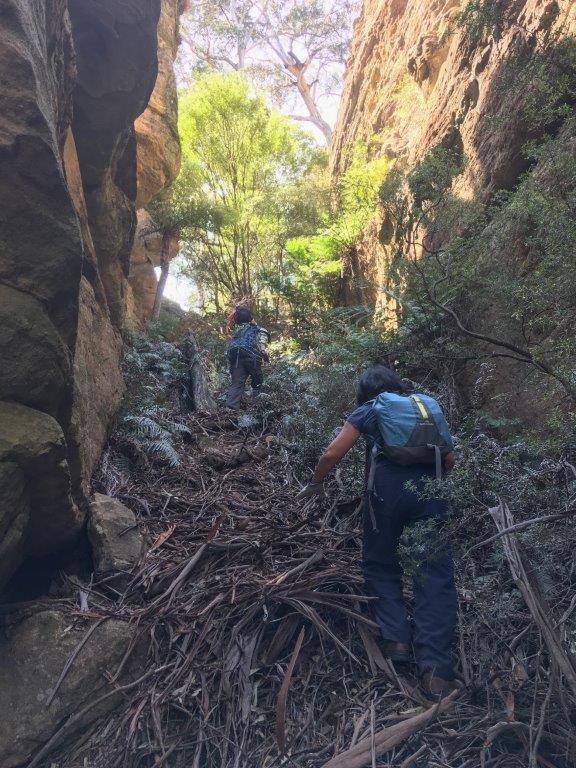
Capertee Creek Defile
Is located 1.8km north east of Mount Dawson in the high cliffs above the northern side of Capertee Creek. The slot slowly tapers from about 15m to less than 5m wide, is 200m in length and a vertical displacement of 55m. Named by Yuri Bolotin and Brian Fox and on a bushwalk of 27 September 2019.
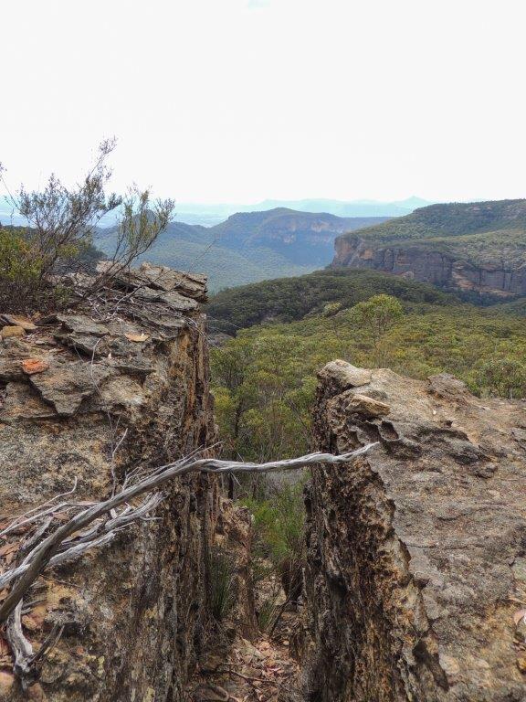
Capertee Panorama
Capertee River *
Is a perennial river rising on the Great Dividing Range south of Mount Gangang. It receives its identity at the confluence of Tea Tree and Brymair Creeks. It flows in a meandering course generally south, east and south east for about 92km to its confluence with Wolgan River to form the Colo River. It passes Glen Alice and Glen Davis. Bogee. Capertee River is shown on the map published on 1st September 1833 for The Australian Agriculture Company. Surveyor Frederick Robert D'Arcy surveyed the Capertee River in mid 1831 from below Mount Gundangaroo about 5km west of Glen Davis downstream for about 46km. Ref: Andrews, Alan E J. Major Mitchell's Map,1834 and Macqueen, Andy. Frederick Robert D'Arcy, colonial surveyor explorer and artist, c1809-1875, 2010.
Capstan Spur and The Capstan
Is a very narrow spur 400m in length at the southern end of The Barnacles and is capped at its northern end by a generally squat circular pagoda. In keeping with the nautical theme commenced by Ian Thorpe in 2010, this feature was named by Michael Keats on a bushwalk 14th September 2015. The Capstan is located at, GR 490 910. Capstan Spur contains an old cairn and upright stick in the centre, GR 490 909. Capstan Spur terminates above Bell Creek.
Cardews Line
Refers to the surveyed trial line for the Wolgan Valley Railway from Newnes Junction to Newnes via Island Mountain by John Haydon Cardew (1852-1941). The surveyed line appeared on a map prepared by geologist Joseph Edmund Carne in 1906. Cardew’s line involved the construction of a massive bridge across Constance Gorge and an incline ropeway some 1200 feet high to connect from the high level terminus to the mine entrance in Newnes. This option was abandoned by Engineer Henry Deane in favour of a route that took the railway into Newnes via tunnels and steep grades. Cardews Line was used to construct a telephone service as it was the most direct route. See Gardens of Stone National Park and beyond. Book 7, pp 84- 88 and pp 180-189.
Carne Creek *
Is a watercourse about 19.5km long. It rises 2.5km north, north west of the Bungleboori Camping Ground and flows generally north into the Wolgan River. Carne Creek and the Wolgan River join at the northern edge of the Cullen Bullen Topo Map. Previously these two major drainage patterns were known as the Eastern and Western Branches of the Wolgan River. The Eastern Branch was officially renamed Carne Creek, 1970. Ref: GNB notes, 5th March 1970. It was first named Carne Creek in 1965 by Myles Dunphy. Joseph Edmund Carne (1855-1922), geologist. His major works are The Kerosene Shale Deposits of New South Wales, 1903, Geology and Mineral Resources of the Western Coal Field, 1908 and, with L. J. Jones, the classic Limestone Deposits of New South Wales, 1919. In all Carne's writings and maps, he combined clarity with meticulous scholarship. Carne carried out careful investigation of the Wolgan Valley and its environs, including the Newnes oil shale field. Carne Creek runs roughly parallel to the old Wolgan Valley Railway line constructed to the shale oil field.
Carne Creek Lookout
Is located above the cliff line on the northern end of a firetrail opposite Lurline Jack Lookout and above Carne and Camp Creek junction. From this view point, the cliff lined walls of Carne Creek are viewed downstream. Named by Karen McLaughlin and shown on her map The Gardens of Stone Stage 2 Proposal State Conservation Areas and National Park Extensions. Compiled by Karen McLaughlin for Blue Mountains Conservation Society and Colong Foundation for Wilderness, December 2010.
Carne View Lookout
Is located 1km west of Glowworm Tunnel Road and 2.4km east of Wolgan Pinnacle. From this vantage point on top of the cliff line, one has views directly up the cliff lined Carne Creek. Named by Michael Keats on his Bush Club walk, 10th October 2007.
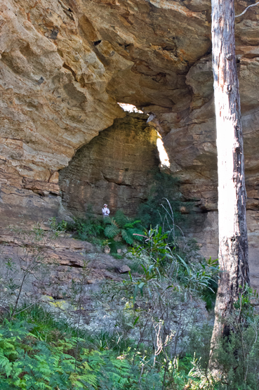
Cathedral Arch
An imposing natural overhang with an arched window at the top, is on the south eastern side of Goochs Crater. Named by Brian Graetz on bushwalk, 23rd May 2012.
Cathedral Canyon
Is a canyon within a non-perennial gully which rises above the north western side of Little Capertee Creek Camping Ground, 1.7km due north of the old Newnes Hotel. Cathedral Canyon was named by Thomas Ebersoll in 2005 due to the cathedral of fern trees within the central section of this canyon. This canyon and / or pass also gives access to Old Baldy, the cliff face overlooking the camping ground at Newnes. Near the base of this canyon is a small waterhole known by Thomas Ebersoll, owner of Newnes Hotel as The Bathtub, GR 424 265. Ben Bullen Topo Map, Top of pass, 421 274, base 424 266.
Cathedral Canyon Gully
Is a non-perennial gully which rises above the north western side of Little Capertee Creek Camping Ground, 1.7km due north of the old Newnes Hotel. It flows in a south and south easterly direction for 1.1km into the Wolgan River. Named after Cathedral Canyon which is located within the top section of this gully. This gully and canyon and / or pass also gives access to Old Baldy, the cliff face overlooking the camping ground at Newnes.
Cathedral Cave
Is located 1.7km north, north west of Birds Rock Trig. It is 50 metres wide, 50 metres high and 30 metres deep. The back wall has an outline of a near perfect cupola and a large fallen rock is centrally disposed and elevated. The floor has a rake of about 30 degrees, is sandy and has areas of duricrust, a secondary product of weathering. Named by Yuri Bolotin on a Bush Club walk, 26th November 2012.
Cathedral Pass / Canyon
Is the access between Little Capertee Creek Camping Ground to the top of the cliff line at Mount Tricky. A rock climbers name as this pass also gives access to Old Baldy, the cliff face overlooking the camping ground at Newnes. Near the base of this pass is a small waterhole known by Thomas Ebersoll, owner of Newnes Hotel as, The Bathtub GR 425 264.
Cathedral Point
Cave Swamp Creek
Celestial Chamber
Is one of the largest semi enclosed overhangs in the Greater Blue Mountains. It is more than 80m across, at least 30m high and 20m deep. Located in HenryCreek, 1.9km north east of the junction of Glowworm Tunnel Road and Old Coach Road. The area had a number of overhangs which Michael Keats on a Bush Clubwalk on 23rd July 2012 named Cave Galleries and Yuri Bolotin named the main cave Celestial Chamber.
Centaur Rocks
Are located on top of the cliff line 1.5km north north east of the property, Penrose. The pagodas have reached an advanced stage of erosion with the contorted ironstone forming fantastical shapes. One such shape is of a large horse shoe. It was named by Yuri Bolotin on a Bush Club walk 24th March 2016 in keeping with the mythical creatures denominated in this area. Centaur is the mythical Greek half horse half man.
Centaur Slot
Is a very deep incised weathered Y shaped slot directly below Centaur Rocks. It is located high up on the cliff line above the north north eastern side ofPenrose.This slot is non negotiable without abseiling gear. Named by Yuri Bolotin on a Bush Club walk, 24th March 2016.
Central Gorge
Located 1km north of Wolgan River and midway between the Pipeline Track and Petries Gully. Named by Yuri Bolotin on a bushwalk 17 July 2017. Yuri recorded,“The first objective was to descend into the headwaters of a prominent ravine to the west, which begins at the watershed we were currently standing on and continues all the way down into Petries Gully. It is the most significant gully within the Petries Slots area, and is located roughly in the middle of it, at about the same distance from The Crater to the south and Petries Slots Pass to the north. I called this feature Central Gorge.”
Centre of the Universe
Is the name given to a group of prominent pagodas 3.2km south east of Goochs Crater. Marked on the topo map as spot height 994. Known by this name by bushwalkers prior to 1990s. Graham Conden records the name in 1999 as Submarine Rocks, because when walking in from the Bells Line of Road, he felt as though you were on the conning tower of a submarine in the middle of the ocean.
Cerberus Creek
Has its headwaters on the south east side of Two Trees Road and Waratah Ridge Road, GR 452 019. It flows generally north east for 5.3km into Dingo Creek, GR 483 046. A lower section of this creek forms a canyon that includes six 's' bends as it wends its way through towering cliffs and extends for more than one sinuous kilometre. Named by Michael Keats on a Bush Club walk,7th May 2010. Michael recorded,"at the foot of these cliffs the dry sandy floor was covered in hundreds of dog foot prints. Is that why the main creek is called Dingo Creek? This creek needed a name with dog connotations and so Cerberus Creek was named, Cerberus was the gigantic three headed hound that guarded the gates of Hades. He was posted there to prevent ghosts of the dead from leaving the underworld. He is described as a three headed dog with a serpent's tail, a mane of snakes, and a lion's claws."
Cerberus Falls
Is a 5m waterfall which flows into a large, 20m, sandy bottom, round pool. Named by Brian Fox on a Bush Club walk, 26th March 2012.
Cerberus Heads
The three Cerberus heads include: one, the high promontory between Dingo Creek and Cerberus Creek, two, the narrow high promontory between Cerberus Creek and Little Cerberus Creeks and three, the extended rugged promontory between Little Cerberus Creek and Dingo Creek. Cerberus Heads were named on 24th January 2011 by Michael Keats.
Ceremonial Room.
A part of the Moffitts Pagodas complex. Located 2.75km north of Gardiners Hill and 1km west of Rowans Hole. Named after the Moffitts (see Moffitts Trail). When entering Moffitts Pagodas, you walk through a level encircled rock walled area. It was named the Ceremonial Room by Michael Keats on a Bush Club walk, 14th July 2010, due to the feeling that Aboriginal initiations could have taken place here.
Cesspit Creek
Has its multi stemmed headwaters on the northern side of Girdwood Ridge. The western side is in the Newnes State Forest and the eastern side is in the Blue Mountains National Park. It flows in a generally north east direction, the last 1.5km being known as Cesspit Canyon. Joins Dumbano Creek. This name was derived from the name Cesspit Canyon as recorded in Jamieson, Rick. Canyons Near Sydney, 1993, p. 39.
Chaos Ridge
Trends south, south east from Bungleboori Creek for 2.5km towards Dumbano Creek. Named by Frank Leyden, Sydney Bushwalkers on 11th November 1967 due to "the many minarets, creeks and cliffs on top of it." Ref: The Sydney Bushwalker, December 1967, pp. 12-14.
Chimera Passage
Is located above the main cliff line 1.5km north north east of the property Penrose. A number of small slots radiate off the main passageway, which is about 5m wide and extends on a flat floor for about 80m. Named by Yuri Bolotin on a Bush Club walk, 24th March 2016.
Chimera Point
Refers to the southern point of the cliff line above the property, Penrose,which is directly below. Access is via Barton Pass. Named by Michael Keats on a Bush Club walk 24th March 2016.
Chimera Slots
There are three of them in very close proximity to each other. One of which give access to the plateau above. They each are narrow and contain doglegs and a small room. Located above the main cliff line 1.5km north north east of the property Penrose. Named by Yuri Bolotin on a Bush Club walk, 24th March 2016. Chimera in Greek mythology is monstrous fire-breathing hybrid creature composed of the parts of more than one animal. So named in keeping with the Greek theme of the Minotaur Lair to the east of this plateau.
Choir Cave and Choir Loft
Located 900m south east of Beecroft Trig and accessed via Beecroft Firetrail and part of Clerestory Spurs No. 1. Being 40m around the curved perimeter it contained some old graffiti and glass fragments. Directly above was the Choir Loft Cave, 30m around the perimeter which contained an old hearth. Named by John Fox on a Bush Club walk 13th June 2014 in keeping with the church architecture terms of this area such as Clerestory Spurs.
Chrysler Building
Is part of Minotaur Watch complex. Located 900m south west of the Wolgan River / Zobels Gully junction. Named by Yuri Bolotin on a Bush Club walk, 10th September 2016. Yuri recorded,“One part of the split pinnacle has become a separate monolith that ends up with a giant pyramid shaped top. That structure is strangely reminiscent of the famous Chrysler Building in New York.”
Chrysler Lane
Is a narrow 50m slot and part of Minotaur Watch complex on the southern side of the pyramid shaped rock formation known as the Chrysler Building, hence this name. Located 900m south west of the Wolgan River / Zobels Gully junction. The top of this slot has views back down over the Chrysler Building. Named by Michael Keats and Yuri Bolotin on a Bush Club walk, 7th October 2016.
Citadel Pass North
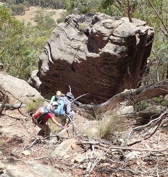
Gives walking access between Glen Davis Road and Citadel Spur on the western side and southern end of Genowlan Mountain. 500m further south along this cliff line is Citadel Pass South. Named by Yuri Bolotin, Michael Keats and Brian Fox, 20th February 2017-2 February 2018.
Citadel Pass South
Gives walking access between Glen Davis Road and Citadel Spur on the western side and southern end of Genowlan Mountain. 500m further north along this cliff line is Citadel Pass North. Named by Yuri Bolotin, Michael Keats and Brian Fox 20th February 2017-2 February 2018.
Citadel Point
Citadel Spur
Is a prominent spur above the Glen Davis Road, Capertee. Extending from Genowlan Trig in a generally southern direction to the highest point, The Citadel and the southern point, Citadel Point. Named by Michael Keats on a Bush Club walk, 2nd March 2015.
City in the Sky
Is located 900m north, north east of Genowlan Trig Station, Named by Dr Haydn Washington who had named it in reference to Ball, Duncan. Emily Eyefinger and the City in the Sky, 2006. Ref: Correspondence with David Blackwell, 27th April 2010 and Haydn’s map.
Clarence *
Is a locality about 7km east of the City of Lithgow. Boundaries are within the Lithgow Council area. GR 417 922. Clarence would have taken its name from Mount Clarence, which is located 2.5km south west of the railway station. Governor Macquarie in his trip across the Blue Mountains to Bathurst in 1815 named Clarences Hilly Range in honour of H.R.H. the Duke of Clarence. Ref: Macquarie's journal. Mount Clarence would have been derived from this name.
Clarence Arch
Is located 450m south west of the intersection of Donald Road and Ray Crescent, Clarence. This arch is about 15m high, 14m long and 1.5m wide. It is easy to walk on and off at the northern end but the southern end involves a pagoda climb. The southern end also is undercut with a very pleasant, ochre coloured, curved semi cave. This arch and the area below it came into prominence during the construction of the Main Western Line in the early 1900s.
Clarence Firetrail
Extends generally in a west east direction along Girdwood Ridge from Bald Trig Station to the Blue Mountains National Park barrier. This trail gives access to Goochs Crater, Holts Heaven and the Dumbano Creek system.
Clarence Railway Station *
Opened in 1874 and closed in 1910. Reopened as part of the Zig Zag tourist attraction. On 18th October 1975, the tourist railway carried its first passengers between Top and Bottom Points. The extension of the tourist railway to Clarence was opened on 29th October 1988. The Zig Zag and Clarence Railway Station closed in 2012 after failure to complywith WHS requirements. A reopening date has been put back due to the 2013 bush fires that destroyed some of the track and rolling stock.
Cleft Point
Is a narrow finger peninsula containing a very deep, narrow cleft. Located approximately half way between Cape Pinnacle and Sunnyside Point. Named by Michael Keats on his Bush Club walk, 18th July 2007. Walking access via Fire Trail No. 8, off Sunnyside Ridge Road.
Cleopatras Needle
Clerestory Spurs
Are twelve, pagoda studded spurs trending approximately north, north east from the main creek system of Sawyers Swamp towards the Beecroft Firetrail. Named by Michael Keats on a Bush Club walk, 14th September 2011. No. 1 GR 308 025; No. 2 GR 312 027; No. 3 GR 313 024; No. 4 GR 317 023; No. 5 GR 319 020; No. 6 GR 322 018; No. 7 GR 324 017, No. 8 GR 326 017; No. 9 GR 327 014; No. 10 GR 331013; No. 11 GR 334 012; No. 12 GR 336 012. A clerestory is the upper part of the nave of a Gothic church or other building with windows above the aisle roofs.The pagodas measure up in every way to such a title, as they include numerous perforations or windows.
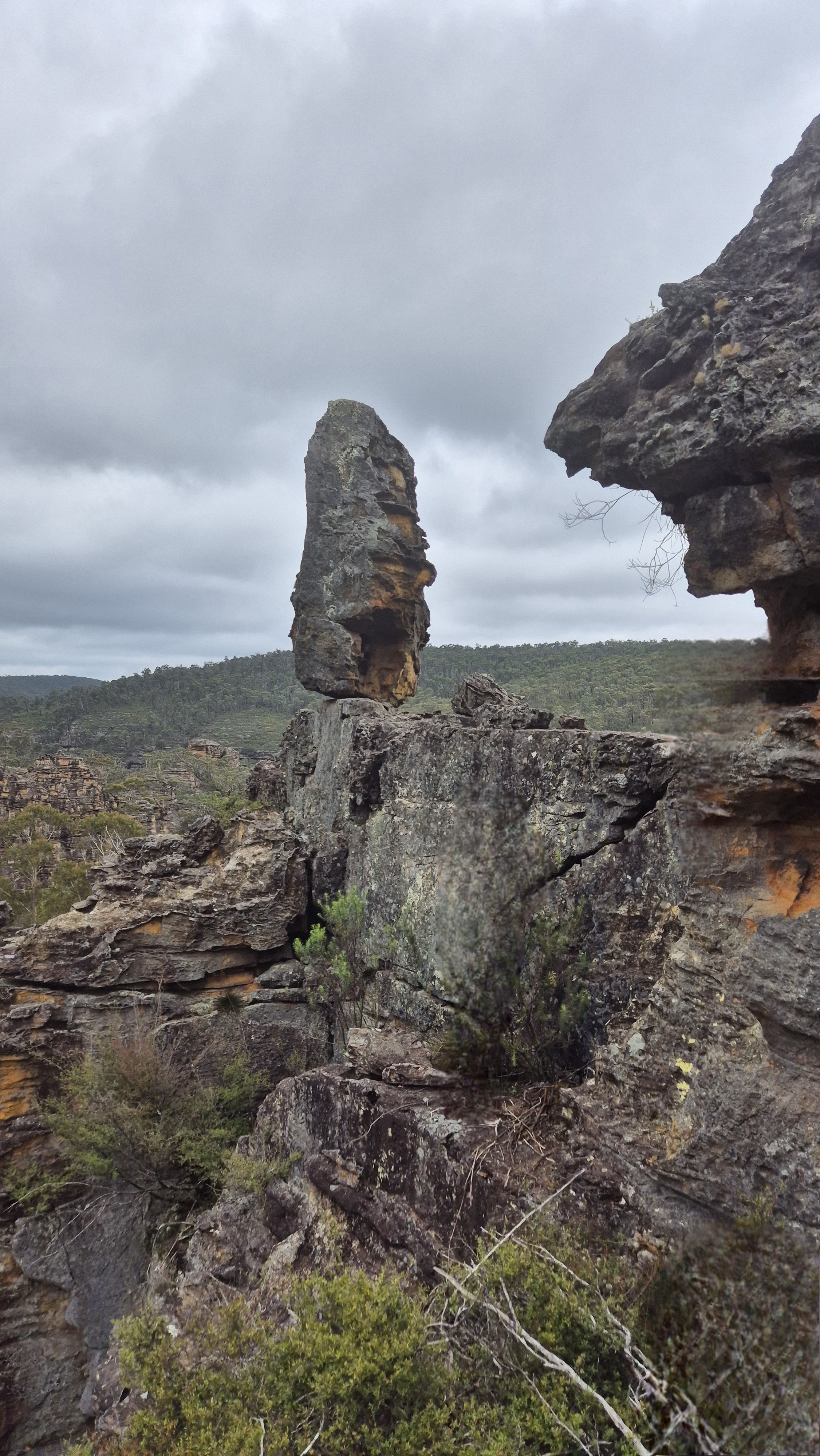
Cliffhanger Rock
Clwydd Pass
Is a natural pass giving access from Bungleboori Creek towards Mount Horne, 2.3km due south of Mount Horne. Named by Michael Keats on a Bush Club walk, 24th October 2007, after a local area name, the Parish of Clwydd.
Clwydd Ridge
Is a spur line trending 1.6km in a generally north south direction, having Lithgow High School below on the western side and Hartley Valley Road and the Vale of Clwydd on the eastern side. Lithgow Mercury, 4th June 1915, p. 6, records that James Padley suggested that the ridges at the back of the town be named. “The one at the rear of the Vale of Clwydd he suggested be named Clwydd Ridge.”
Clwydd Trig Station
Is located on a small spur on the eastern side of the Vale of Clwydd above Chifley Road, Lithgow. The steel pillar was placed by the Lands Department on the 13th December 1976. Height 1038.832m. Ref: Lands Department SCIMS Survey Mark Report.
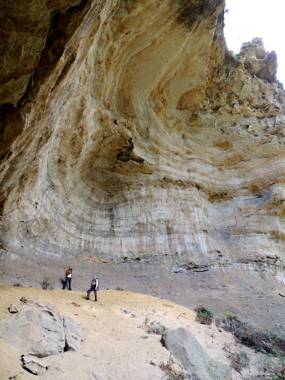
Coach Galleries
Are located in Sutherland Gully between the Tiger Snake Canyon Track and the Pagoda Track, 1.1km north east of Glowworm Tunnel. The galleries consist of an astonishing series of caves and overhangs. One of the largest is a beautiful chamber of golden sandstone, 40m across by 20m deep by 30m high, with soft sandy floor sloping about 30-35 degrees, except near the drip line, where it is flat. There is no internal vegetation, making the space even more dramatic. Named by Yuri Bolotin and Brian Fox on a bush walk 23 December 2016.
Coach Wood Forest
Was named by Russell, (Russ) Alfred May (1926-2010), c1960s, due to the large number of Coachwood trees (Ceratopetalum apetalum) growing in this side canyon of Rocky Creek. Located 600m south east of Galah Trig Station, accessed via Galah Mountain Road. Sheep Dip Canyon is the next tributary to the west. Within this area is the feature, is the Garden of Eden.
Coccinea Gorge and Pass
Gives access from the western side of Carne Creek to Fire Trail No. 4. 3.1km south south east of Birds Rock Trig. So named by Michael Keats on a Bush Club walk 2nd June 2014 due to the brilliant red fungi,Hygrocybe coccinea located in this gorge. This gorge is 400m in length and varies from 2m to 50m in width.
Cockatoo Hill *
Is located on the southern side of the junction of Glowworm Tunnel Road and Eastern Boundary Road within the Newnes State Forest. This name first appears on the Survey Plan, Tramway from Wolgan to Clarence. Survey Plan M12435. Surveyed by John Haydon Cardew, Licensed Surveyor, 13th December 1905.
Cockatoo Hill TrigStation
Is at 1068.70m above sea level. Established by the Lieutenant Colonel Clews, Royal Australian Survey Corps, 1930. Ref: Trig Summary Cards, Department of Lands, Bathurst and Gough, Noel R. "The Major" Lt. Col. Hugh Powell Gough Clews. Two trig stations in this area are named after the local birdlife; the other one is Galah Trig Station. Note: This trig no longer exists.
Coco Creek *
Is a partly perennial stream rising on the Great Dividing Range about 3km east of Ben Bullen at Rowans Hole. It flows generally north and north east for about 25km into the Capertee River about 5km south south west of Glen Alice. Annabella Boswell's Journal, March 1839 records the name, Coco Creek. The name Coco or Cooks Creek is recorded in the County Land Sales, Sydney Morning Herald, 11th May 1858, p. 3. Early parish maps show the named creek as Cooks or Coco Creek as it was the boundary between the two Parishes, Coco and Cook. Ref: Parish of Coco, 1883. The Sydney Gazette on 25th February 1832 records Cocos Islands as an important trade and resupply stop for sailing vessels and the importance of coco-nuts. The importation of coconut oil in large quantities (over 50 tons) was for the following purpose: "in the making of gas for the purpose of illumination, such gas having been found much superior to the gases commonly in use". Ref: Wentworth, William Charles. A Statistical Account of the British Settlements in Australia, 1824, pp. 428-429. Whether this connection to this named feature is true, is yet to be confirmed. Or maybe the origins of the name Coco and Cook Creeks are linked as they are adjoining Parishes. Certainly, Captain James Cook records in his journal the importance of Coconuts as a lifesaving food source. Ref: Cook's journal, 29th July and 4th August 1770.
Coco Creek Caves
Located on the side of a small rise on one of tributaries of Coco Creek. Note they are on private property, permission must be obtained.
Cohen Falls
Collett Gap *
Is a saddle in a mesa about 4km south west of Mount Dawson and 1km south of Point Cornell. Shown on the map Parish of Wolgan, 1884. This gap divides the tributaries of Red Rock Creek and Barton Creek. Note, Collett Gap is misspelled, so named after Pierce Collitt (1760-1848) and Mary Collitt (1769-1841), who in 1823 were the first to establish an inn on the western side of the Blue Mountains. The Collitt's Inn at the foot of Mount York in the 1820s and 1830s was one of the last comfortable inns before leaving into the wilds of the Capertee and Wolgan area. Ref: Paridaens, Iris. Lithgow and Hartley Valley Sketchbook, 1978, p. 4.
Colosseum
Is a vast natural rocky amphitheatre complete with a natural lectern on the northern side, about halfway up Henry Creek. Located 2.5km north east of the junction of Glowworm Tunnel Road and Old Coach Road. Named by Michael Keats on a Bush Club walk, 17th August 2012.
Comet Mine Incline Railway.
Between the 1880s to c1913, shale oil was mined and refined at Hartley Vale, placed into oil tanks, transported up the mountain incline, then onto a tramline to Hartley Vale Railway siding, from where it was then transferred to Sydney. Comet was the brand name of the kerosene which was produced from the shale. The western extent (top of the incline) was located one kilometre east, north east of Hartley Vale at an elevation of 900m. The eastern extent joined the Darling Causeway near the southern side of the intersection with Hartley Vale Road.
Commandments Rock
Lies roughly midway between Mount Dawson and Point Nicholson, 200m north east of Gindantherie Pinnacle. Named by Michael Keats on his Bush Clubwalk, 30th August 2006. This rock appears to be suspended in space and on its top, level surface, scattered by nature, are ten small rocks or tablets of stone. Also named as Balancing Boulder. Ref: Tom Brennan's photo gallery, 1 - 2nd June 2013.
Compass Rocks
Is a group of rocks accessed via Wolgan Road and Blackfellows Hand Trail. Located about 700m east, south east of Wolgan Gap. Named by the Woody Pear Walking Group, September 1995. This group started due to an Outdoors TAFE course led by Margaret Baker. Ref: Olive Noble's track notes from Woody Pear Walking Group,17th September 1995. The group were not sure where they were and someone said has any one got a compass, and everyone pulled out a compass.
Constance Falls
Constance Gorge
Refers to the narrow cliff lined ravine that extends from near the saddle at the top of Zobels Gully and down the southern side towards Deanes Creek. A perennial stream runs through it. The Sydney Morning Herald, 10thJanuary 1906, p. 7, Proposed Tramway Route, depicts Constance Gorge as "the scenery is described as magnificent, so that with the construction of the line a new centre of attraction will be opened for the tourist." Carne, J E. Field Book, State Records, 2/663, 11th January 1906, p. 75 records, thin chocolate band (shale) in Constance Gorge and a diagram of bridge across it. Constance Gorge was first shown on the Survey Plan, Tramway from Wolgan to Clarence. M12435. Surveyed by John Haydon Cardew, Licensed Surveyor 13th December 1905.The most likely origin of the name is from Constance Caroline Mary (c1872-1932), who was the wife of Donald Sutherland, Consulting Engineer and General Manager of The Commonwealth Oil Corporation Ltd mine and refinery at Newnes in 1906 at the time when the Wolgan Valley Railway was being constructed. Constance Caroline Mary's name, Constance was also the name given to the Wolgan Valley Railway Shay Locomotive No. 1.
Constance Locomotive Depot
Eardley, G H. and Stephens, E M. in their work, The Shale Railways of NSW, 1974, pp. 139 and 143 record, "Constance, the original locomotive depot sited within the limits set by a reversing triangle." This was located about 200m from the Wolgan River within Zobels Gully.
Constance Pass
Is a means of access from the Wolgan River via Zobels Gully to the top of Constance Point. Constance Point is the northern most point of the spur line in which the Old Coach Road is located. This pass is on the eastern side of the point. Named by Brian Fox on a Bush Club walk 8th January 2016.
Constance Point
Is the most northerly point on a ridge line between Constance Gorge on the east and Wolgan River on the west. Michael Keats has applied this name in his Bush Club track notes, 28th May 2010. Mount Morgan Topo Map, GR 438 229. Constance was also the name given to the Wolgan Valley Railway Shay Locomotive No. 1. Walking access via Zobels Gully and Constance Pass.
Constance-Zobels Trench
Is a unique, natural parallel sided gully with an internal watershed that contains Zobels Gully flowing north and then west to the Wolgan River and Constance Gorge flowing south and then east to Deanes Creek. The trench section is flanked by tall vertical cliffs for the majority of the way.
Convolution Creek
Has its headwaters on the eastern side of Sunnyside Ridge Road 2.5km south of Birds Rock Trig Station. It flows generally south east for 2.6km to its junction with Carne Creek. The topographic map gives only the slightest hint of the sinuous contortions within this creek. Named by Michael Keats on a Bush Club walk, 13th March 2013.
Cooerwull Creek
Sydney Morning Herald, 23rd November 1892, p. 4 records construction of a dam across Farmers or Cooerwull Creek at a place amongst the hills north of Zig Zag Valley. The aboriginal name, Cooerwull was the property name of Thomas Brown. Ref: The Sydney Herald, 18th June 1838, p. 3. The word Cooerwull according to the Australian Town and Country Journal, 23rd March 1878, p. 23, “is an aboriginal name signifying seed or plant.” However most references record it as, “little flowering plant.” The Queenslander, 26th November 1898, p. 1030. “for a small flowering plant” Ref: Lithgow Mercury, 5th April 1917, p. 6. Most likely, it refers to the Bluebell, Wahlenbergia stricta .
Cooerwull Ridge
Has Sheedys Gully on the eastern side and the suburb of Littleton below on the western side with Lithgow Rifle Range in the gully. This ridge has three sets of communication towers along the ridge. On the northern end is Cooerwull Trig Station. Lithgow Mercury, 4th June 1915, p. 6, records that, James Padley suggested that the ridges at the back of the town be named.“The one at the rear of the Extension Estate Cooerwull Ridge”.
Cooerwull Trig Station
Is located above the southern side of the suburb of Cooerwull in Lithgow. Height 1056.1m. The concrete pillar was placed by the Lands Department on the 13th December 1976. Ref: Lands Department SCIMS Survey Mark Report.
Cook s Cave
Is located in Hassans Glen after Gannon Cave and before King Georges Head. Named after Sir Joseph Cook (1860-1947) who settled in Lithgow and worked at the Vale of Clwydd Colliery. In 1891 he became the Local Member for Hartley, and later went on the serve the country as Prime Minister between 1913 and 1914. Re: Lithgow Mercury, 14th May 1915, p. 4.
Cooks Cliffs
Refers to the cliff line behind the old Newnes Hotel overlooking Little Capertee Creek. Name is recorded with map in Taylor, Pete. The Wolgan Valley A Rockclimber's Guide, 1st ed; 1974, p. 17. This map also records the valley below Cooks Cliffs as Cooks Valley. First modern recorded climb was in January 1970, but also climbed from the 1950s by the scouts and other enthusiasts.
Cooks Creek
Is a partly perennial stream rising on the Great Dividing Range about 3km east of Ben Bullen at Rowans Hole. It flows generally north and north east for about 25km into the Capertee River about 5km south, south west of Glen Alice. "Cook's Creek" is shown on Mitchell, Thomas. Map of the Colony of New South Wales, 1834. Now known as Coco Creek.
Coopers Creek
Is a short, 1.2km creek, flowing in a south east direction into the start of the Dumbano Canyon section on the northern side of Dumbano Creek. Peter Fox, a member of the National Parks Association, named this creek in late 1990s after John Alexander Cooper. John is a prominent and active member of The Bush Club.
Coopers Ridge
Extends in a generally north south direction for 4km from Bald Trig Station above the Bungleboori Creek. Peter Fox, a member of the National Parks Association, named this ridge in late 1990s after John Alexander Cooper. John is a prominent and active member of The Bush Club. At the northern end is Bungleboori Lookout.
Corn Paddock
The property known as the Corn Paddock, derives its name from land use on the rich alluvial flats below the confluence of Barton and Carne Creeks on Portion 12, Parish of Wolgan, County of Cook. During the Newnes industrial period most of the vegetables for the townsfolk of Newnes were grown here. Reputedly corn, the dominant crop was grown to feed the working horses. The Corn Paddock homestead and buildings are located on the higher western part of the surveyed portion. SMH 16th May 1932, p. 10 records, road repaired to the spot known as the corn paddocks. Edwin Penrose was the first owner of this portion in 1869. (Survey Plan C387.1507) . Originally known as Penrose's Corn Paddock. Winchester, F, 1982; Wolgan Valley, cited in Lithgow District Historical Society's Occasional Paper. No. 51, p. 3.
Corn Paddock Point
A point of land on the top of the cliff line directly above the property called, Corn Paddock. The Corn Paddock property derives its name from the river flats adjacent to the homestead. The flats were used to raise corn to feed the pit ponies employed by the Newnes Industrial Complex operation from about 1905 to 1920. Ref: Correspondence Doug Coates, owner of the Corn Paddock 29th August 2014. Named by Michael Keats on a Bush Club walk, 29th August 2014.
Cosmic Cave
Is located 2.8km south east of Birds Rock Trig, off Sunnyside Ridge within Newnes State Forest. The plan view is semi circular having a 120 degree arc, the arc being 90m and the diameter 50m.The elevation is more horseshoe in shape and having a height of about 80m. The rocky floor mostly devoid of any vegetation is raked at about 35 degrees. The entrance and a precarious ledge to access this huge overhang is a challenge. To date this is the largest cave documented on the whole of the Newnes Plateau, hence the name, so coined by Yuri Bolotin and Brian Fox on a bush walk, 28th November 2015.
Cosmic Country
Is a name bestowed by rock climbers to an area of cliff line within the eastern tributary of the headwaters of Reedy Creek. It contains a succession of sheer rock faces, where every few metres climbers have painted cryptic alpha numeric inscriptions of identified climbing points. The cliff faces are also embellished with stainless steel bolts and eyelets.
County of Cook *
"So named by me considering that its lofty summits must have been the first land, that meet the eye of that celebrated navigator, on his first approach to the eastern coast."Ref: Mitchell, Major T. L. Three Expeditions into the Interior of Eastern Australia, 1839, Vol. 1; p. 152. Captain James Cook (1728-1779) sailed in the barque rigged ship Endeavour via Cape Horn to Tahiti to observe the transit of Venus. He then circumnavigated New Zealand and sailed west to land at Botany Bay on 29th April 1770. James Cook on the 22nd August at Possession Island took possession of the whole of the eastern coast. Ref: Australian Dictionary of Biography.
Coxs River *
Is a perennial river rising north east of Gardiners Gap about 6km north, north east of Cullen Bullen and flowing generally south and east for about 100km into Lake Burragorang. The river is located on numerous topographical maps; the area of interest for this book is on the Cullen Bullen and Lithgow Topo Maps. Headwaters GR 297 132. Coxs River may have also been known by the local Aborigines as Duiwan. Andy Macqueen's research of Surveyor General Mitchell's assistant, surveyor Peter Grant Ogilvie showed that the monthly report by Ogilvie in March 1829 records the native name of Coxs River as, Duiwan. As late as 1896 Gundungurra elder Billy Lynch was reported as saying that the Gundungurra group who had lived in the Megalong - Kanimba area were the "Therabulat", and that was also their name for the Coxs River. Ref: Heritage. Newsletter of the Blue Mountains Association of Cultural Heritage Organisation Inc. July - August 2015. Issue 39; pp.8-13. Named after William Cox, J P, (1764-1837), by Governor Lachlan Macquarie (1762-1824). Macquarie had commissioned Cox to construct a road over the Blue Mountains, which Cox started on 18th July 1814 and completed in March 1815.
Crack of Doom One
Crack of Doom One and A Half
Crack of Doom Two
Crack of Fools
Crater Pass *
Is an easy pass that leads through the cliff line south of The Crater. Located 300m west of where the Pipeline Track traverses the cliff line above the northern side of the Wolgan River, Newnes. Crater Pass starts as a tumble of easily negotiable broken rock, crosses a small sloping rock face then becomes a series of easy, well graded ramps interspersed with large boulders, all the way up to the top. This pass gives access to the feature known as, The Crater. Named by Yuri Bolotin, Michael Keats and Brian Fox on a Bush Club walk 16th June 2017.
Crisscross Spur
Trends generally south from Waratah Ridge, 300m east of the boundary of Blue Mountains National Park, GR 482 026, to above the Bungleboori Creek. Crisscross Spur is a complex series of parallel, dissected, interstitial ridge like structures that feature canyons and slots. Named by Yuri Bolotin on a Bush Club walk, 15th June 2012.
Crown Creek *
Is a partly perennial stream rising at Baal Bone Gap. It flows generally north, north east for about 15km into Coco Creek.
Crown Creek Trail
Crown Creek Trail extends from Baal Bone Gap, GR 280 290. It follows and criss crosses Crown Creek to its junction with Glen Davis Road at Crown Swamp, GR 307 299. The word "crown" referred to ownership by the Crown. Before the area was settled, all land belonged to the Crown / Government. Alternatively the name "crown" may have referred to Pantoneys Crown. Crown Creek Trail and Red Rock Trail have both had new signage erected by NPWS mid 2015.
Crown Flat
Is the northern section of Crown Creek, Crown Flat is shown on Carne, Joseph, Geological Map of the Capertee and Wolgan Valleys, 1901.
Crown Ridge
A very old name, it referred in the 1840s to that part of Glen Davis Road between Coco Creek and the junction of Crown Creek Trail. The name has also been associated with that part of the Great Dividing Range having Crown Ridge Creek on its western side and on its northern extremity, Blackmans Crown. The name Crown Ridge was recorded on the Survey Plan B688.691, dated 25th September 1847.
Crown Swamp *
Is located on Crown Creek about 5km north east of Pantoneys Crown and where Crown Creek Trail crosses Crown Creek. Crown Swamp was recorded on Survey Plan C146.1507, dated 5th February 1856 and County Land Sales within the Sydney Morning Herald, 11th May 1858, p. 3.
Crumble Ledge
Is so named as this 200m ledge consists of crumbling, porous rock which leads around a small bluff. Located 1.1km north east of Invincible Trig Station. Named by Yuri Bolotin on a Bush Club walk, 15th August 2013.
Crusade Rocks
On the eastern side, is an elevated, almost circular depression with outlier pedestal pagodas giving 360 degree views of the area. All these features were named by Yuri Bolotin on a Bush Club walk, 4th October 2013, in keeping with the named Indiana Jones movie themes for this area.
Cullen Bullen *
Is a small village located on the Castlereagh Highway between Lithgow and Capertee. Cullen Bullen Railway Station opened as Carsons Siding on 1st May 1889 and closed on 6th March 1976. School opened in December 1875. Hoddle's diary, 13th February 1825, states,"I have stopt at Messrs. Robt. and Lawrence Dalhunty's from Bath (their grant was called by the natives Cullen Bullen). Living in a cottage made of turf ......are now living romantically, shepherd like." Ref: Colville, Berres Hoddle. Robert Hoddle Pioneer Surveyor 1794-1881, 2004, p. 74. Robert Venour Dulhunty (1802-1853) with his brother Lawrence arrived in Sydney in March 1824. Robert applied for a grant of land on the 23rd March 1824. This grant of 2000ac was selected and called Cullen Bullen. An 1828 census recorded that he had cleared 500ac and owned 75 cattle and 600 sheep. Ref: Dulhunty Papers. The Australian, 5th May 1837 records the marriage of Robert Dulhunty of Cullen Bullen to Eliza Julia Gibbs. Cullen Bullen is shown on Mitchell, Thomas. Map of the Colony of New South Wales, 1834. Both the names Cullen Bullen and Ben Bullen have Aboriginal origins, different suggestions have been put forward for their meanings but as yet there is no substantiation of their exact meanings. Geographical Names Board reference is, "Place where many waters meet or Lyrebird." This aboriginal name according to Helen Riley, Wiradjuri Elder and Sharon Riley, Wiradjuri representative is named after the Lyre Bird. and that the word Bulla refers to, two. Ref: Oral history 3rd May 2016.
Cullen Bullen Trig Station
Elevation 1066m, was established by surveyors from the Forestry Commission of NSW in the 1960s. It is located on Tyldesley Hill within Ben Bullen State Forest, 2km north, north west of Cullen Bullen.
Cullen Creek *
Is a watercourse rising about 3km south east of Cullen Bullen. It flows generally north west for about 6km into Dulhuntys Creek. Named after the village of Cullen Bullen.
Cyclopean Gallery
Is a small valley filled with some huge toppled rocks. It was as though a giant force had taken several dozen, house size cubes of sandstone and scattered them like dice into this small valley. Over time these cubes have softened in outline with some being draped in mosses and lichens, while some developed dry sandy caves and deep pocks with narrow orifices to provide birds and bats with exclusive homes. Short, secret passageways, narrow slots and stunning sculptures are all there. Named by Michael Keats on a Bush Club walk, 22nd November 2013.
Cyclops Pass
Cyclops Watch
Is located 2.6km north east of the barrier at the southern end of the Old Coach Road. Walking access is generally north on the track towards Tiger Snake Canyon. This watch tower is an isolated rocky pinnacle accessed via a twisting corkscrew slot with views south over the Pentafid basin and beyond to Rock Island. Named by Yuri Bolotin and Michael Keats on a Bush Club walk, 1st May 2015.
Dando's Firetrail
Is now known as Angus Place Trail. Prior to the 1930s it was known as Dando's Firetrail. Harry Dando owned what is now part of Angus Place Colliery. The fire trail joined Wolgan Road to Beecroft Firetrail. Ref: Correspondence Danny Whitty local resident and historian, 3rd June 2014. Harry was employed by the Vale mine at Lithgow for more than 30 years, retiring in 1947. Ref: Newcastle Morning Herald and Miner's Advocate 18th September 1947, p. 7.
Daniels Pass
Is located at the northern end of Daniels Ridge. Named by David Warren Noble after Edward (Ted) James Daniels (1930-2008). Ted led many trips in this area on behalf of the National Parks Association and the pass at the end of this ridge was pioneered by him.
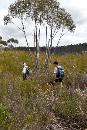
Daniels Ridge
Has its southern end at Galah Trig Station and Galah Mountain. This ridge trends in a north, north east direction for 6km to a cliff line above Rocky Creek. It is here that Daniels Pass gives access to Rocky Creek.
Dante Slot
1.3 km south south west of Nobles Canyon car park. The cliff face has fractured and hence created two major parallel slots with a cross fracture, in plan view it looks like a lower case "h". Over 250 m in length and at least 30 m deep. Named by Michael Keats, Brian Fox and Yuri Bolotin on a Bush Club walk, 19th May 2014.
Dargan *
Is a suburb of Lithgow and was assigned as such by the Geographical Names Board on 11th July 1997.
Dargans Arch
Is a natural sandstone arch, it has a length of 14m, a width of 8m and a height of 9.3m. Located 900m north, north east of the intersection of Bells Line of Road and Valley View Road, Dargan. Access is via Sandham Road, Bell.
Dargans Creek *
Is a watercourse about 6.5km long. It rises 3km south west of Bald Trig Station and flows generally east then south into the River Lett. Wollangambe, Lithgow and Hartley Topo Maps,headwaters GR 445 918. Dargans Creek is recorded in the Sydney Morning Herald 15th January 1846, p. 3 in reference to a stock route through to the Mudgee Road at Jews Creek. Also shown on the Survey Plan C346.1507 dated 1866. Thomas Dargin (note various spellings), born in the Hawkesbury area in c1801, married John Howe's step daughter, Eliza Kennedy, in 1821 and later Howe's daughter Mary. He also owned three hotels in Windsor. In1819, Thomas was a member of John Howe's successful expedition to the Hunter region. Ref: Macqueen, Andy. Somewhat Perilous, 2004, p. 111. Dargan was a pioneer drover in the district. Ref: Morgan, MacLeod. A short history of the Wolgan Valley, 1959. RAHS Journal, Vol. 45, Pt. 2, p.90. "Thomas Dargon (sic), John Howe's son-in-law and fellow explorer, who had charge of its herd of cattle." Ref:Rolls, Eric. A Million Wild Acres, 1981, p. 77. This was in 1821. The Map of the Village of Newnes shows one of the unformed roads named Dargan Street. Thomas Dargan purchased 640ac, Portion 1, Parish of Hearne, 1836 and Portion 3, 640ac, 1839. Ref: Survey Plan B.305.691 and B.583.691. Note, one Survey Plan has both the spelling of Dargan and Dargin.
Daves Pass
Is a natural pass linking the top of the cliff line to Newnes, 700m west of the old Newnes Hotel. Described and named by Michael Keats on a Bush Club walk, 9th April 2008."Dave (David) Dash found one that looked possible. It resolved into one of the most beautiful canyon descents I have experienced anywhere. It was richly endowed with Tree Ferns and Epiphytes." Named after David (Dave) Macdonald Dash (1943-2021)
Daves Slot
Dawson Cave
Is located 420m north north east of Mount Dawson on the Capertee / Wolgan divide. It is a more of sheltered location between the rocks as an ideal place to camp. Also known by the name Mount Dawson Caves by bushwalkers from early 2000.
Dead Dog Swamp
Headwaters of Carne Creek, near the junction of Beecroft Firetrail and Sunnyside Ridge Road. Ref: Correspondence with Danny Whitty, 3rd July 2010. Local usage name c1960s.
Dead Sea Scroll
Is an ironstone tube 2m in length and 50cm in diameter. When viewed from the right angle, it appears as a scroll of pastry or paper. In keeping with the heavenly themed features in this area, Michael Keats named this rock sculpture the Dead Sea Scroll on a Bush Club walk, 7th June 2012. Located above the northern side of Bungleboori Creek, 2.9km south, south east of the road intersection of Two Trees Road and Waratah Ridge Road.
Deanes Amphitheatre
Deanes Creek *
Is a perennial stream rising on the north east side of the junction of Glowworm Tunnel Road and Galah Mountain Road. It flows generally north and north east for about 18km into Rocky Creek, about 10km south, south east of Glen Davis. Named after Henry Deane.
Henry Deane (1847-1924), Engineer-in-Chief of NSW Railways, and consulting railway engineer to the Commonwealth Oil Corporation. He was also as a keen photographer and botanist. Eucalypt deanei, located in the Blue Mountains, is named after him, as well as Boronia deanei, which is found on the Newnes Plateau.
Deanes Creek Caverns
Refer to six unique caverns, hollowed deeply into the eastern side of the cliff walls above Deanes Creek. Each has a centrally disposed waterfall which is recessed into the top overhang giving a keyhole or horseshoe effect when viewed from below. Dimensionally five of the caverns are incomplete hollowed out spheres, of the order of 35m to 50m in diameter. Named by Michael Keats and Brian Fox on a Bush Club walk, 13th February 2015.
Deanes Creek Falls
Located 1.35km west north west of the locked gate on Deanes Creek Trail via Galah Mountain Road. These falls drop more than 40m through a twisting slot from a deep and complex "C" shaped canyon up on the plateau above. Named by Michael Keats and Brian Fox on a Bush Club walk, 13th February 2015.
Deanes Galleries
Is a series of very large overhangs on the eastern side of Deanes Creek and 500m north east of Rock Island. It also includes an amazing collapsed and tilted rock which has formed a walk through tunnel. It is some 20m long and has a fine, level, washed sandy floor. Named by Brian Fox on a Bush Club walk, 19th December 2013.
Deanes Lookout
Is possibly named by David Warren Noble. David also had heard it called The End of the World by local Lithgow people who had previously taken 4WD vehicles into the area. Ref: Correspondence with David Warren Noble, 14th October 2009. Ref: Yah Hut Log Book, 27th July 1981.
Deanes Plateau
Central to this plateau is Deanes CreekTrail. Murrays Mount is also located on this plateau. The western side is bounded by Deanes Creek and the eastern side by Rocky Creek. The north eastern point is known as Deanes Lookout or The End of the World.
Deanes Siding *
Is now a locality about 4km north of the junction of Glowworm Tunnel Road and Galah Mountain Road. When the Wolgan Valley Railway was operating, Deanes Siding was an important stop for adding additional locomotive power to enable trains to haul products out of Newnes. Deanes Siding was named after Henry Deane, consulting railway engineer to the Commonwealth Oil Corporation, by Donald Alexander Sutherland, Consulting Engineer and General Manager of The Commonwealth Oil Corporation Ltd, in 1906. Ref: Deane, Henry. The Wolgan Valley Railway - Its Construction, 1910, reproduced by the Australian Railway Historical Society, 1979. It was at Deanes Siding that the Wolgan Valley Railway gradient dropped as it neared the Wolgan Valley. Henry Deane (1847-1924), Engineer-in-Chief of NSW Railways, was a keen photographer and botanist. Eucalypt deanei, located in the Blue Mountains, is named after him, as well as Boronia deanei, which is found on the Newnes Plateau.
Death Trap Canyon
Death Trap Canyon is accessed via Galah Mountain Road. Ref: Jamieson, Rick. Canyons Near Sydney, 5th edition, 2012, p. 50.
See Death Trap Cave, Death Trap Rock
Death Trap Cave
Is located about 100m on the eastern side of Rocky Creek and 900m west of Mount Budgary. The cave measures 47m across the mouth, 19.2m deep and 23m high. It has a sloping floor, which does detract from its otherwise impressive dimensions.
Death Trap Falls
Is a double tier waterfall, a simply beautiful, perfectly symmetrical waterdrop. The name Death Trap Rock Falls is consistent with other names as part of Death Trap Canyon but does not reflect the displayed elegance. Accessed via Galah Mountain Road. Ref: Jamieson, Rick. Canyons Near Sydney, 5th edition, 2012, p. 50.
Death Trap Rock
Can be viewed from a ledge at GR 463 109, where this spectacular formation can be photographed. This very large rock within Rocky Creek has cleaved away from the western cliff line, tilted and fractured in the process, but somehow managed to maintain overall integrity.
December Creek
Has its headwaters on the northern side of the road junctions, Chifley Road and Bells Line of Road, Bell. It flows in a north and easterly direction for 6km to join the Wollangambe River at 510 914. Named by Ian Thorpe 17-18th December 2005. .
Deception Canyon
Deception Point
Named after the nearby Deception Canyon. Deception Point is a small but spectacular promontory on the eastern cliff edge of the Wolgan River with commanding views of the Wolgan Valley, Donkey Mountain and the Wolgan - Capertee Divide. Located 900m west of the Glowworm Tunnel car park. Named by Michael Keats and Brian Fox on a Bush Club walk, 15th November 2014.
Deep Pass *
Is a saddle, about 300m west of Mount Norris on the western end of Railmotor Ridge. Access is via Glowworm Tunnel Road, Eastern Boundary Road and Deep Pass Trail. Deep Pass is shown on the map Parish of Rock Hill, 1st edition, 1882. Deep Pass was assigned as a Rural Place by the Geographical Names Board on 11th July 1997.
Deep Pass Camping Area
Road access via Glowworm Tunnel Road, Eastern Boundary Road and Mount Cameron Trail. From the barrier a walking track mostly down hill for 900m leads to the open flat area. NPWS has provided toilet.
Deep Pass Canyon
Is a descriptive name, being "deep" in terms of the surrounding area and also being a narrow gorge dividing two creek systems. Two brothers, Alan and Russell May, and John Norris built a hut at Deep Pass in the late 1940s. The hut has since been destroyed. The chimney foundations can still be identified. The trio may have had some sort of lease in the area. Ref: Correspondence with David Warren Noble, 14th October 2009. See also Mount Norris. Oral history from Ken Poppett, 24th February 2012, as he recalls, "One hut was built / owned by Morris Reginald Hayden (1929-1997), a timber cutter. Later,"bikies"reportedly extended the hut and added a large structure they called a hall. Later again, the whole thing was removed by the NPWS."
Deep Pass Creek
Has its headwaters on the southern side of Deep Pass saddle, between the Blue Mountains National Park barrier and Mount Norris. This small creek of 2.1km flows in a southerly direction to its junction with Dingo Creek. This name is derived from the natural and locality name, Deep Pass.
Deep Pass Trail
Is about 5km in length from its junction with Eastern Boundary Road, to the road barrier. The remaining 250m walk leads down the hill to the level flat camping area, Deep Pass Camping Ground.
Delusional Pass
Refers to the access to below the cliff line above the eastern side of Carne Creek 1.3km east, south east of the Carne Creek and Wolgan River junctions via Delusional Slot. So named by Brian Fox on a Bush Club walk, 19th May 2014.
Delusional Slot
Is not obvious until you are up close to the starting point. A fold in the slot itself gives the appearance of a short natural adit. When you are up close then the full wonder is revealed. It is very narrow, 50cms for most of the 50m length and it comes complete with an internal graded ramp that leads down some 30m to the base of the top cliff line.There was some banter about the slot going all the way through the cliffs to the talus slope and provide a back entry to the Wolgan Valley Resort and the absurd possibility of ordering coffees all round. No way was this going to happen and so because of this, this huge slot has been called Delusional Slot by Michael Keats on a Bush Club walk 10th January 2014. Delusional Pass refers to the access to below the cliff line via Delusional Slot so named by Brian Fox on a Bush Club walk, 19th May 2014. Base of pass 401 175.
Derailment Hill *
Was named by Wilf Julius Hilder, former employee of the Department of Lands. Wilf named features in this area based on a steam railway theme; this was due to the existence of the former Wolgan Valley Railway Line. The name was originally rejected by GNB in 1975 and much later assigned by GNB. Ref: Government Gazette, 29th September 2006. Derailment Hill is located 1.4km near due south of Mount Norris and has a height of 994m. This hill is on top of a small spur, which in turn is on the southern side of Railmotor Ridge.
Desperado Walls
Refers to the cliff line on the south western side of Mystery Mountain. Name recorded with map in Taylor, Pete. The Wolgan Valley A Rockclimber's Guide, 1st ed; 1974, p. 17. The first climbers in this area were Roland Pauligk and Tony Nemec in January 1975.
Devils Pinch *
Is a steep section of land close to and on the south bank of the Wolgan River, located 4.6km downstream from Newnes and 5.6km upstream from the Wolgan River and Rocky Creek junction. This point also marks the eastern end point of the Wolgan Valley. Devils Pinch was a descriptive name for the notorious narrowing of the valley which made travelling through the area difficult. It refers to the narrow tight squeeze for the bridle track between the river and high ground. The Parish Map of Barton, County of Cook, 1st edition, 1884 shows a bridle track along the Wolgan River from present day Newnes to the junction of Annie Rowan Creek and Wolgan River. Midway along this track, the Parish Map shows the name, The Devils Pinch. Shown on Mount Morgan Topo Map, GR 470 265, but correct location is GR 463 262.
Devils Pinch Canyon
Devils Throat
So named as the water rushing down Camp Creek enters a circular, 2 to 4m diameter shaft of about 15m in height and pours out at the base via horizontal slot hole in the rock, before cascading down another 15m drop. It is as if the devil's head is upside down and water pours down its throat and out of its mouth. Named by Michael Keats on a Bush Club walk, 22nd March 2007. Devils Throat is also the bottom part of Alcatraz Canyon.
Devils Throat Pass
Gives an easy access in a cliff lined area from the western end of Fire Trail No. 1 via Glowworm Tunnel Road and Carne Creek. So named by Brian Fox and Michael Keats on a Bush Club walk, 10th April 2015 as it gives the easiest and quickest access to Devils Throat within Camp Creek.
Diagonal Caves
Are located above Adrenalin Creek. They were named by Yuri Bolotin during a Bush Club walk in this area, 8th April 2013. These caves are on two distinct levels and are slightly offset from one another. It is not possible without some significant risk to climb from the upper to the lower cave. Both caves have a single curved overhang which is over 100m.
Diamond Cavern
Is located on the western side of Adrenalin Creek and 500m east of Fire Trail No. 6 off Sunnyside Ridge Road. Named by Chris Sterling and described on Michael Keats walk report on the 27th November 2012 as,"we entered a huge and cavernous eroded area. Slot is not quite the right word. A cavern is best description. The mouth was tapered from both the top and bottom giving a rough pinched diamond shape to the aperture. The cavern widens inside and the floor rises rapidly towards the back, some 40m in from the opening."
Diamond Ramp
Is located within the Eldorado Slots above Eldorado Walls, 1.6km due south of the old Newnes Hotel. This ramp led to the top of an extremely eroded pagoda, with three evenly spaced ravine/slots of great dimensions stretched out below at 90 degree angles to each other. Jointly named by Yuri Bolotin, Michael Keats and Brian Fox on a Bush Club walk, 10th October 2016 in keeping with the Eldorado theme, plus a Diamond Python was photographed at the base of the ramp.
Dicksonia Forest Ravine
Is one of the oldest and finest Dicksonia antarctica Tree Fern forests a person is ever likely to come across. Located within a northern tributary of Dingo Creek, 1.4km south west of Deep Pass. This name was coinedby David Dash and Michael Keats on a Bush Club walk, 16th November 2012.
Dingo Creek *
Rises on Waratah Ridge, north east side of Glowworm Tunnel Road and Waratah Ridge Road. It is about 17km in length and flows north and east into Bungleboori Creek. Name assigned by GNB, Government Gazette, 29th September 2006. Originally, Dingo Creek only referred to the first 4km of the creek from its headwaters; the eastern section of this creek was known as the North Branch Bungleboori Creek.
Dingo Creek Falls
Located on Dingo Creek, 940m south east of Cockatoo Hill. These falls have a drop of about 10m into a small rocky pool with a depth of 1.5m. Named by Brian Fox 28th November 2014 on a Bush Club walk.
Dingo Defile
Is located 800m south east of Eastern Boundary Road and Deep Pass Trail. This narrow defile between two large gullies gives access from a northern tributary cliff line towards Dingo Creek. Named by Brian Fox on a Bush Club walk, 28th November 2014. The vertical difference is 65m. A squeeze midway via a tunnel opens into a narrow, fern filled defile.
Dingos Lair
Is located 800m south east of Eastern Boundary Road and Deep Pass Trail. Named by Michael Keats on a Bush Club walk, 28th November 2014. "U" shaped over hang in which the western wall is more than 105m in length. The back wall about 50m and the eastern wall 50m. In the centre at the northern end a finely divided waterfall some 15m high cascades onto a rocky platform. It appears to be a permanent water source.
Dinner Gully *
Is a water courserising about 7km west, south west of Rock Hill. It flows for about 2km generally north, north east into Budgary Creek. Mount Cameron Trail passes midway along Dinner Gully. Name gazetted on 30th May 1975 as Dinner Gully. Previous name Dinner Creek. Lt. Col. Hugh Powell Gough Clews, known as "The Major" (1890-1980), Australian Survey Corps, named Dinner Creek after the place where they had lunch (dinner). Ref: Kameruka Magazine, Vol: 16; No. 2, July 1978. Note: Clews chapter, The Bad Bit across the River, records,"Lunch at the appropriately named Dinner Creek." The bridle track to Mount Cameron was in use from 1903 and Clews (in the 1930s) most likely was just referring to the already local name.
Dinosaur Slot
During a walk on 18 July 2020, after spending some time at the lookout on the edge of the Valley of the Dinosaurs, we did not return to the road but walked south, following the rim of the valley. At GR 2529 3201, 996 m, we located a stunning slot, 50 m long and only about half a metre wide, that ends up on the valley floor, at GR 2536 3203, 980 m. Yuri Bolotin named this dramatic alternative entry to the valley, Dinosaur Slot.
Discontiguous Fern Slot
Is located 900m north east of Invincible Trig Station. Named by Michael Keats on a Bush Club walk, 30th August 2103. This most unusual slot and waterfall combination has two breaks and morphs into a contorted, sculptured canyon like form. It then reverts to a fern backed waterfall before again becoming a sculptured form, terminating in a flat and usually dry quartz gravel terrace.
Divine Descent
Is an access point from the top to the base of the cliff line on the eastern side of Carne Creek and on the southern side of Nobles Canyon. It cannot legitimately be called a "pass" as only a few could ever do it without a tape or rope, and a "pass" should be negotiable in both directions without aids. Named by Michael Keats on a Bush Club walk, 19th May 2014.
Dobbs Drift
Originally referred to the State Mine entry but now locally refers to the steep section of road on State Mine Gully Road, 1.8km north of the railway workshops. The gully in which the State Mine was located was locally known by a number of names - Steak Knife Gully, Permafrost Gully, Dobbs Drift and The Drift. Dobbs Drift is located 1.5km north of State Mine Museum referred to in the entry under the State Mine. A drift is an incline access into a mine, i.e. not vertical or horizontal. The mine entrance, built in 1948, was named after John Phillip (Jack) Dobbs who was the State Mine Miners Federation Lodge Secretary. Ref: Lithgow Mercury, 12th June 2001, 3rd January 2002 and Stephen Imrie's correspondence, 5th January 2010.
Dobbs Drift Lookout
Is located off State Mine Gully Road, 2.1km north of the railway museum, State Mine Gully, Lithgow. This unfenced lookout gives easy accessible views back towards Lithgow and the surrounding rock pagodas.
Doctors Gap *
Is a suburb on the eastern side of Lithgow. The original track cut by Thomas Brown in 1834 came via Bells Line of Road and southern end of the old landing strip off Scenic Hill. (midway along the old track). Most likely named after Dr Walter Fawkes Mackenzie, (died 1886). He owned land covering 400ha between Lithgow and Hartley Valley. He was a medical doctor, Ref: SMH 9th August 1872, p. 1. He and his brother John held coal leases in this region. Ref: Carne, J F. The Kerosene Shale Deposits of NSW, 1903, p. 244.
Dogs Rug
Is located 200m below Dingo Defile and eastern side of a small tributary. A scramble up a slot leads to a rumpled platform below a higher cliff line. Named by Michael Keats on a Bush Club walk, 28th November 2014 in keeping with the Dingo theme of the area.
Dog Trap Creek *
Is a non perennial stream rising about 4km south by west of Genowlan Mountain. It flows generally east for about 6km into Coco Creek. All of Dog Trap Creek tributaries are on the northern side of Glen Davis Road. Most likely, the name would have originated from the use of traps to catch Dingos in this area.
Dome Cave
Named so because its domed ceiling is naturally decorated by a series of almost perfect concentric circles, as successive layers of ironstone banded sandstone have been uniformly removed in a circular manner. The floor is loose sand and is at an angle of almost 45 degrees. The dimensions are grand, 18m across the front, 16m from the drip line to the back wall and 12m high, also measured at the drip line. Named by Yuri Bolotin on a Bush Club walk, 16th May 2013.
Dome of St Peters
Is an unusual pagoda 2.4km due south of the junction of Two Trees Road and Waratah Ridge Road. It contains an arch of fine proportions with the sunlight reflecting on a small, centrally disposed natural plinth within, like a flaming votive symbol, and secondly, when you enter the arch, it opens out as a great internal dome. Michael Keats and Brian Fox on a Bush Club walk, 21st May 2012, named this the Dome of St Peters, continuating the heavenly theme of features within this locality. The dimensions are: height 4m, width 6m and arch width 3m. The dome interior is larger, nearly 5m in diameter, as it extends beyond the arch.

Donkey Mountain *
Is a dissected mesa 8km south, south west of Newnes. This large, isolated mountain, 950m in height, is 350m above Wolgan Road. The mesa has at its southern end Mount Wolgan. Extensive views over the greater part of the Wolgan Valley can be seen from the top of this mountain. A note in Surveyor Robert Hoddle's diary, dated 12th November 1825, "Mr Walker J.P. and party in that quarter (Capertee area) A she ass foaled: being the first bred in theColony."Ref: Colville, Berres Hoddle. Robert Hoddle Pioneer Surveyor 1794-1881, 2004, p. 92. Annabella Boswell's Journal, 1839, records, that James Walker (who owned the outstation Wolgan) had quite a few donkeys. The mountain was first shown (but with no name) on the Survey Plan B4.691r, dated 3rd January 1831 Originally spelt on the early parish maps as The Donkey Mountain, for example, Parish of Wolgan, 1884. It was not until the recent parish maps of the early 1960s that the word "The" was dropped. Locals referred to the mesa as Big Donkey and Little Donkey (Little Donkey is Mount Wolgan). Ref: Joe Bird, oral history to Brian Fox, 15th June 2009. Joe also spoke to me about a path cut into the Wolgan Valley, called the Donkey Steps. Joe's great, great grandfather, Edward (Ned) Murray (1791-1862), was one of the earliest farmers in the Wolgan (he worked for the property owner, James Walker from 1824) and he had a donkey that he called Neddy. Thomas Archer records in his diary on the 17th June 1866, "Mule arrived last night from Wolgan." Ref: Morgan, MacLeod. A short history of the Wolgan Valley, 1959. RAHS Journal, Vol. 45, Pt. 2, p. 88. Geoff Fox, a bushwalker with The Bush Club, has explored, mapped and named many of the individual features within Donkey Mountain.
North East Maze section: Grand Entrance, The Freeway, Kents Crevasse, Two Storey Cave, The Green Room, Fairy Cave, Eagle Rock, Eagle Nest, The Grand Hall, Fig Trees Green Room Portal, Jenny Craig, QANTAS Drop, Fire Ramp, Wide Ramp, Scrubby Ramp, Lighthouse, Arrow, Gum Tree Room, Treeway, Cowpasture, Donkey Canyon, High Cave, Low Cave, Mossy Rocks, Long Passage, Too Tight Crevasse, Wolgan Window.
Middle Donkey Mountain section: Window,Titanic Canyon, Fern Gully, Eastern Lookout, Tayan View, Kents Ascent, Sticky Ramp, Port Canyon and Terrace Canyon.
The South West End: Sun Ledge, The Columns, Python Point, Top Slot, Fence, and The Stile.
Note: Donkey Mountain is a very fragile environment. Please help protect it by refraining from camping on the mountain and by only using fuel stoves; no lighting of wood fires.Donkey Steps
This pathway was on the eastern side of the present day Wolgan Road near Wolgan Gap; it was locally named the Donkey Steps. This area is currently used as access for the telephone line into the Wolgan Valley. The road down this steep section was surveyed on 3rd March 1866, but the present road down Wolgan Gap was found to be a better alternative. Ref: Road Plan R587.1603r. Referred to as the original access into the Wolgan, it was here that the first cattle were brought into the valley. Ref: Joe Bird, whose great, great grandfather lived and worked in the Wolgan Valley, oral account to Brian Fox, 17th June 2009. Also; Ref: Morgan, MacLeod. A short history of the Wolgan Valley, 1959. RAHS Journal, Vol. 45, Pt. 2,p. 93. Anything too large was lowered directly over the cliffs on rope. It was not until 1897 that the present Wolgan Road was constructed. Ref: Wolgan Valley Homestead Complex - Conservation Management Plan, prepared by Conybeare Morrison International, 2006. The Survey Plan C2323-1507 shows "permanent spring" near the top of the Donkey Steps.
Donkey View Pass
Is a natural pass giving access through the cliffs to the top of a long, thin peninsula located at the northern extremity of Firetrail No. 7 off Sunnyside Ridge Road. Named by Michael Keats on his Bush Club walk, 28th October 2009.The choice of name was derived from the dominant view across the Wolgan Valley to Donkey Mountain.
Doom Caves
Double Decker Cave
Is located underneath the Wolgan Valley’s top cliff line, 2.3km north east of the propertyKoopartoo. This two storey overhang has dimensions of about 60m in length by 5m high by 10m wide. Named by Yuri Bolotin and Craig Flynn on a bushwalk on 30 September 2017.
Double Decker Gully
Is a useful way of route up some 190m from the Wolgan Valley that terminates at the spectacular Double Decker Cave. Named by Yuri Bolotin and Craig Flynn on a bushwalk, 30 September 2017.
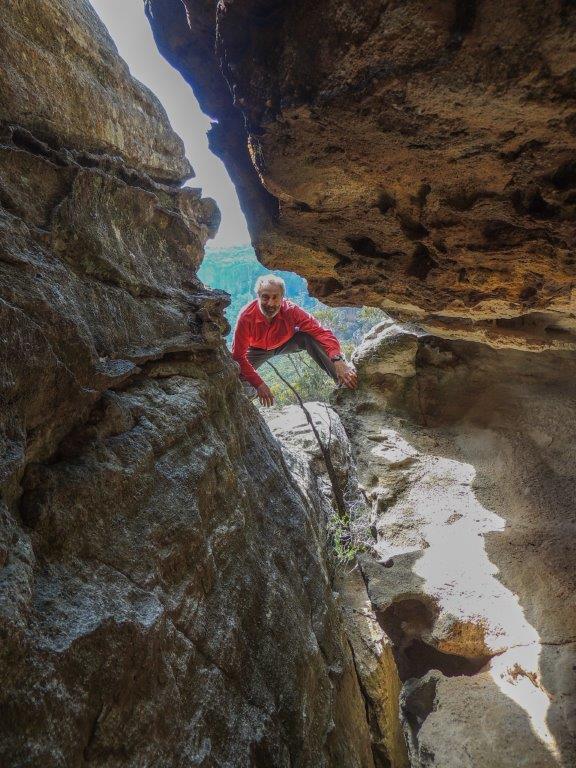
Double Decker Slot
Is located high above the western side of Genowlan Creek, 1.1km south, south east of Point Hatteras. This very narrow 50cm wide and 5m high slot extends for about 30m. Because of many chockstones, this slot also has a second storey passage that can be walked to the top of the slot, hence the name. Named by Brian Fox and Yuri Bolotin on a bushwalk of 2 August 2019.
Dragons Lair
Is a promising cluster of pagodas, photogenic and waiting to be explored, 400m south of Point Hatteras. Named by David Blackwell, November 1984. Ref: Correspondence with David Blackwell, 2nd May 2010.
Drum Rock
Is located on the edge of an overhang, on a northern side creek off Rocky Creek,1.5km north east of Mount Budgary. Named by Michael Keats on his Bush Club walk, 25th March 2009. This unusual rock, about 1m cube in size,reverberates when struck, producing a rhythmic, drum like sound.
Drury Cave
Is so named as this large overhang has the name, R Drury 1938, written in it on the back wall. In a visitor's book in an Aboriginal cave in this vicinity, there is an entry which reads, 'site was discovered in 1928 by Nelson Mason and Robert Drury'. Nelson's grandson related that they discovered this area while fox hunting, which they did regularly during those days, to sell the fox skins.
Duiwan
See Coxs River
This aboriginal name according to Helen Riley, Wiradjuri Elder and Sharon Riley, Wiradjuri representative means, Emu. Ref: Oral history 3rd May 2016.
Dulhuntys Creek *
Has its headwaters on the eastern side of the township of Portland. It flows in a generally northerly direction for over 16km to join Williwa Creek at GR 771172, which in turns flows into Jews Creek and the Turon River. The first land grant of Cullen Bullen, (2000ac), was taken up by Robert Venour Dulhunty. His brother, Lawrence Vance Dulhunty, also took a large grant of land nearby. For more information on the Dulhuntys, see Cullen Bullen entry.
Dulhuntys Hole
Now known as (see) Rowans Hole. This was the shortest route into and out of Capertee Valley. Note: Shown on the map Parish of Ben Bullen, 1885, as Dulhuntys Hole and the latter maps as Rowans Hole. See Cullen Bullen entry re the Dulhuntys.
Dumbano Creek *
Also see Suboir Canyon. A watercourse, about 14km long. It rises about 3.5km east of Bald Trig Station and generally flows north east into Bungleboori Creek. One of the first bush walking clubs to explore Dumbano Canyon was the Sydney University Bush Walkers. Early walkers from the SUBW were John Paynter and others, who on 24th - 26th December 1961 went as least as far as the upper and middle constrictions. Ref: www.subw.org.au/archives. The three Aboriginal named creeks in this area, Dumbano, Bungleboori and Yarramun, were most likely named by Major Clews when he surved this area in 1932 for the Wallerawang one inch to the mile Army Topo Map.
Dung Cave
Is a large sandstone overhang located at the junction of Camp Creek and a tributary that flows into Carne Creek. Named by Michael Keats on his Bush Club walk, 7th March 2007, because the old and odd shaped animal dung was found in this overhang.
Dwarf Casuarina Forest
Is located on the western slopes of Genowlan Mountain, 1.5km south of Genowlan Point. Ref: Correspondence with David Blackwell, 2nd May 2010, who records , "this is really just a default name, it being a most distinctive and beautiful pin cushion forest, waist high. The area is completely covered with Allocasuarina nana, with occasional, taller protruding Xanthorrhorea." Named c1984.
Eaglet Rock
Is located within the Mugii Murum-ban State Conservation Area on the western side of Mount Airly and below the feature known as Torbane Balcony. Named by Yuri Bolotin and Peter Medbury on a bushwalk 14 June 2021. Yuri recorded, "a giant rock sculpture that looked like an Eagle chick".
East Creek
Is a tributary of Carne Creek and has its headwaters between North Ridge Road and Camp Road, 2.7km north east of Bungleboori Camping Ground. It flows in a generally southerly direction for 5.7km to its junction with Carne Creek. 700m before this junction, Camp Creek flows into it from the east. Name recorded in the Proposed Birds Rock Colliery, Environmental Impact Assessment, December 1981, figure 3.
East Creek Falls
Located within the southern end of East Creek. The creek watershed is between North Ridge Road and Glowworm Tunnel Road, Newnes Plateau. The top bridal veil fall is over 30m, the lower fall about 20m. Connecting the two falls is a twisted hollow tubular section of about 4m. The bottom waterfall discharges into a glorious shallow pool. Named by Brian Fox and Michael Keats 30th March 2015.
East Creek Galleries
East Wolgan Swamp
Is located at the headwaters of the Wolgan River on the northern side of the road junctions, Blackfellows Hand Trail and Beecroft Firetrail. This swamp extends for 2km. The southern part was originally known as see Lightning Swamp.
Easy Glade Pass
Gives an easy grade access between the valleys of Little Capertee Creek and Canobla Creek. Named by Yuri Bolotin on a Bush Club walk, 20th April 2017. Yuri recorded,“Thinking about both coming up from Canobla Creek side and especially walking down into the Little Capertee Creek, this was one of the easiest and most pleasant passes in memory, so I called itEasy Glade Pass (if it sounds a little bit like ‘easy grade pass’, then I meant it this way).”
Echo Lookout
Is located 200m above and overlooking the Wolgan River, access 3km from Little Capertee Creek Camping Ground via the Pipeline Track. Named by Thomas Ebersoll, owner of the old Newnes Hotel and shown on his hand drawn map, The Newnes Area, 2005.
Edmund Cavern
Edmund Cavern is 100m further south of Edmund Falls within Edmund Gully. This cavern is a gaping fern filled cave inaccessible to walkers halfway up the cliff face. So named by Michael Keats and Brian Fox on a bush club walk, 25th May 2015. Joseph Edmund Carne (1855-1922) State Government Geologist for whom Carne Creek is named.
Edmund Falls
Located within Edmund Gully a cliff lined tributary of Carne Creek, which is on the southern side of Fire Trail No. 3, off Glowworm Tunnel Road, is a 30 plus metre waterfall, So named by Michael Keats and Brian Fox on a bush club walk, 25th May 2015. Joseph Edmund Carne (1855 -1922) State Government Geologist for whom Carne Creek is named.
Edmund Gully
Is a cliff lined tributary of Carne Creek, located on the southern side of Fire Trail No. 3, off Glowworm Tunnel Road. Within this gully is a 30 plus metre waterfall, Edmund Falls. Edmund Cavern is 100m further south, a gaping fern filled cave inaccessible to walkers halfway up the cliff face. So named by Michael Keats and Brian Fox on a bushclub walk, 25th May 2015. Joseph Edmund Carne (1855-1922) State Government Geologist for whom Carne Creek is named.
Edwins Bath
Is located above the cliff line 1.6km north, north west of the intersection of the Wolgan Road and the road to the Emirates resort. Edwin Barton (1833-1876) had married Georgina Lyon Wolgan Walker (1843-1906) in 1865. Their family were the earliest property owners in the Wolgan Valley. Edwins Bath is just one of many tributaries which runs into Barton Creek. The use of the word, ‘Bath’ describes a glorious one metre deep crystal clear pool enclosed in an ornate chamber of natural architectural splendour. Named by Michael Keats, Brian Fox and Yuri Bolotin on a Bush Club walk 30th August 2016.
Edwin Slot
Is located above the cliff line 1.5km north north west of the Wolgan Road and Emirates intersection. So named as it is the first name of Edwin Barton in keeping with the nearby Barton Slot and Barton Glen. Named on a Bush Club walk, 28th August 2015 by Brian Fox, Yuri Bolotin and Michael Keats. This slot is about 40m long, up to 30m high and varies in width from a very tight 30cm to 1m.
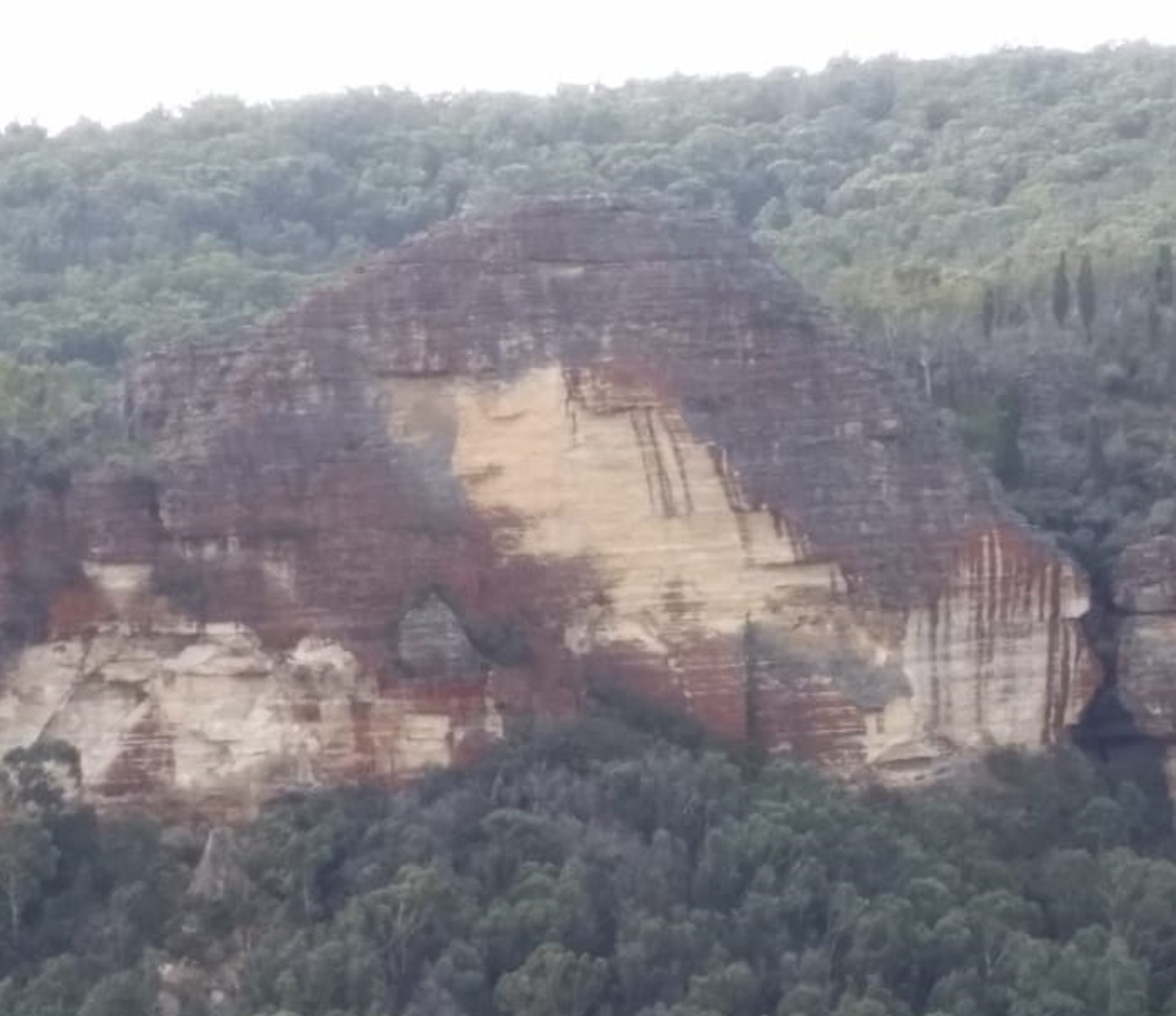
Egyptian Rock
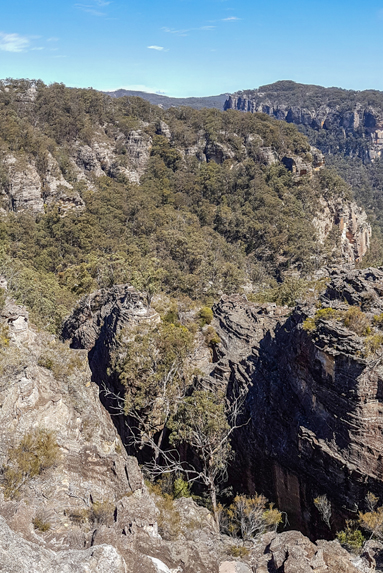
Eldorado Slots
Is the accumulative name to over 20 slots which dissect the Eldorado Walls. Located in a 400m wide semicircular gully above the first major cliff line 1.5km due south of the old Newnes Hotel. Jointly named by Yuri Bolotin, Michael Keats and Brian Fox on a Bush Club walk, 10th October 2016 in keeping with the Eldorado theme. Silver Slot and Diamond Ramp are two named slots in this complex.
Eldorado Traverse
Eldorado Walls
Refers to the bluff as seen to the south of the old Newnes Hotel. This high, cliff faced hill is above the junction of the Wolgan River and the Capertee Creek. Fabled El Dorado is associated with gold, and the sun shining on the walls gives this golden hue. Name recorded in Taylor, Pete. A Rockclimbers Guide to the Wolgan Valley, 1st ed; 1974, p. 137. Climbed from January 1975.
Elysium
Elysium is located within Wollemi National Park above the cliff line and about 1 km due west of the Zobels Gully and Wolgan River junction. This is a flat, almost square space, about 50 m by 50 m enclosed on three sides by very high walls formed by giant curved blocks of bare grey and black coloured sandstone. Enormous Tree Ferns, more than ten metres high, fill this space. Named by Yuri Bolotin on 20 November 2020. He described it as,“The light, the colours, the textures, the sounds were all divine and made it such a perfect, special place to wander in. Wow! I have called this exceptional corner of the Wollemi, Elysium, Paradise in Greek mythology, in keeping with the theme of this area.” This area is accessed via Elysium Slot.
Elysium Slot
Elysium Slot is located within Wollemi National Park above the cliff line and about 1 km due west of the Zobels Gully and Wolgan River junction. At the top it is only about 50 centimetres wide, with parallel walls over 10 metres high. It goes down at a sharp gradient, widening gradually to about three metres across, and finishes with a negotiable drop into a wider gully and a ledge in the left-hand wall. Named by Yuri Bolotin on 20 November 2020. He described it as,“It is a very impressive slot, measuring about 50 m in length and dropping 20 m below the cliff line.” This slot leads to Elysium.
Emirates One & Only Wolgan Valley Resort
Construction of the resort commenced 21st November 2007. The complex is an investment of more than $125 million plus which included major upgrades to fencing, power, roads and electricity infrastructure. The resort is the largest capital investment in the Wolgan Valley since the Newnes Industrial Complex was built a century earlier.
Endorphin Channel
Is a slot on the eastern side of Endorphin Gully, having a length of 60m and width varying from 50cm to 1m. It descends like a staircase through about 30m of vertical height. Named by Michael Keats on a Bush Club walk, 6th May 2013.
Endorphin Gully
Is located between Sunnyside Ridge, (Firetrail No. 7) and Adrenalin Head, (Firetrail No. 6). It rises on the spine of Sunnyside Ridge and flows north to join Carne Creek. Named by Michael Keats on a Bush Club walk, 6th May 2013.
Endorphin Point
Is a high viewing location with expansive views over the Wolgan Valley, including Donkey Mountain. So named by Michael Keats on a Bush Club walk, 20th June 2013, after the gully below, Endorphin Gully. Endorphin Point is shown as a spot height of 1006m.
Endorphin Slot
Is located 1.1km south, south west of the Wolgan Pinnacle on the western side of Endorphin Gully. This very narrow slot is just 30 to 40cm wide. Its smooth vertical walls are 20m in height, and it has a length of 30m which includes a right angled bend. Named by Brian Fox on a Bush Club walk, 20th June 2013.
Eskbank Track
Is a walking track between the southern end of Eskbank Street in Lithgow and Braceys Lookout in the Hassans Walls Reserve. The name "Eskbank" comes fromEskbank House , Lithgow. The track was reconstructed in 1998.
Ethereal Canyon
Is located 2km near due east of the intersection of Waratah Ridge Road and Two Trees Road, within Newnes State Forest. "Ethereal" means light, airy, heavenly or celestial. So named by Michael Keats on a Bush Club walk, 24th September 2012, after Rodney Nelson, a fellow bushwalker, captured on camera shafts of light entering this beautiful canyon.
Ethereal Falls
Exploded Pagoda
Plain of Shards is an area of rock formations located 400m north, north west of Mount Jamison and 700m south west of Wolgan Trig Station. Named by Rodney Falconer, who was one of the major players in the creation of the Gardens of Stone National Park, November 1984. Rodney named it after a sweeping expanse of bare rock, covered by the scattered remains of ironstone bands as if broken pottery was scattered across it. Other names recorded areThe Exploded Pagoda. Ref: Tom Brennan’s photo gallery, October 2010.Exploded Pagoda. Ref: David Noble’s blog, 9th July 2013. Ben Bullen Topo Map, GR 310 197.
Exploding Galaxies
Refers to the cliff line above the Wolgan River, opposite the Pipeline Track. Name recorded in Owens, George. New Rock climbs in the Blue Mountains, 1972.
Faberge Caves *
Faberge Gully
Faberge Gully is located below Faberge Caves which on the southern side of Mount Tricky, 1km above Little Capertee Creek Camping Ground, Newnes. Named by Yuri Bolotin, 2nd October 2015 the gully is an access down towards Cathedral Canyon above the Little Capertee Creek Camping Ground.
Fantasia Room
Is within the feature known as Mothers Arms on the eastern side of Genowlan Mountain, 1.2km south of Genowlan Point. This ‘room’ is accessed via beautiful dry overhang, 50m long and 3-4m high, with a flat floor covered with white powdery sand, which in turn leads to the bottom of a giant slot. This slot is likened to a room which continues for about 40m and terminates at a wall of ferns, pierced by a very narrow slot on the left hand side. Named by Yuri Bolotin and Brian Fox on a Bush Club walk on 22 December 2017 as the room is located next to Fantasia Traverse.
Fantasia Traverse
Is a mix of slots, canyons and cross junctions located on the eastern side of Genowlan Mountain, 1.3km south of Genowlan Point. It is part of Mothers Arms Pagodas. Named by Michael Keats on a Bush Club walk, 9th - 11th November 2010. So named due to the variety, beauty and challenging components of this section.
Farmers Creek *
Is a perennial stream rising 4.5km north of Clarence Railway Station. It flows generally south west for about 17.6km through city of Lithgow into Lake Lyell and the Coxs River. Surveyor General Thomas Mitchell recorded in his diary on the 2nd April 1835. Ref: Mitchell, Major Thomas. Expedition to the River Darling, 1835.
Fernbrook Creek
Has its headwaters at the southern junction of Fernbrook Ridge and Marrangaroo Ridge. It is non perennial and flows generally south for 2.7km to join Marrangaroo Creek. Named by Brian Fox, 29th March 2016. Fernbrook Fire Trail follows part of this creek system.
Fernbrook Fire Trail
Links Reserve Road, Marrangaroo to the Beecroft Firetrail. Named after Fernbrook Creek in which it follows.
Fernbrook Ridge
Trends generally south from Marrangaroo Ridge for 4km to above Marrangaroo Creek. Lithgow Topo Map. Named after Fernbrook Firetrail, which generally parallels this ridge in the gully to the west. Name recorded on Michael Keats bush walk, 30th April 2010.
Fern Cave
Is located on the eastern side of East Creek, and 150m south of East Creek Falls. This cave is approximately 30m wide, 15m deep and has a height of 20m. The cave has a section of flat and sloped floor. In one corner there is a large natural window through which the water of a creek falls. But the most striking feature of the cave is that all of its walls are thickly covered in luxuriant green ferns, Named by Yuri Bolotin, on a Bush Club walk, 25th January 2016.
Finger Pinnacle
So named as this 30m high and 1m wide slab of detached rock face has broken away like a finger of a hand. Located below the first cliff line 300m north of the western end of Nobles Canyon. Named by Brian Fox on a Bush Club walk, 19th May 2014.
Finnigans Lookout
Is recorded in the Lithgow Mercury, 26th August 1935, p. 6 as one of the pretty spots to be seen along the top of Hassans Walls, Lithgow. Possibly the large rock at the end of Finnigans Point, which can be seen from the Great Western Highway at the top of River Lett Hill.
Finnigans Point
At Hassans Walls, Lithgow is described in the Lithgow Mercury, 14th May 1915, p. 4 as “a bold high promontory jutting out into the Hartley Valley.” Hartley Topo Map, GR 369 887.Finnigans Creek* GR 363 879 to 370 848 is a partly perennial creek that flows south into River Lett, 1.5km north east of Hartley and that was recorded in the Singleton Argus, 30th January 1926, p. 5. Finnigans Point can be viewed from the boardwalk at Padleys Pedestal Trig. Named after the Finigan family (note correct spelling) who lived in Hartley between the years 1840s to 1870s.
Finnigans Spur
Extends from Hartley Trig, off Hassans Walls Road in a generally southerly direction for 700m to Finnigans Point. The last 100m contains a dissected rocky outcrop. So named by Brian Fox and Keith Painter on the 6th September 2016 while investigating historical features in this area of Hassans Walls.
Firebird Rocks
Is a rocky ridge and cluster of incredible formations, stylised sculptures of birds as well as mythological creatures. Located on the western most pagoda above and on the eastern side of Baal Bone Gap, and 800m west, south west of Mount McLean. Named by Michael Keats on a Bush Club walk, 29th July 2013, as it reminded him of the fiery, phantasmagorical sounds and imagery of Russian composer Igor Stravinsky's Firebird Suite.
Firebox Ridge
Extends from Girdwood Ridge at the barrier between Newnes State Forest and Blue Mountains National Park in a generally north east direction for about 6km. Name coined by Wilf Hilder in 1972 to reflect the historical usage of the Wolgan Valley Railway.
Firecat Walls
Refers to the cliff line on the south western side of Sunnyside Ridge Road. This cliff line was named by Joe Friend and climbed from early 1972. Ref: Taylor, Pete. A Rockclimbers Guide to the Wolgan Valley, 1st ed; 1974, p. 13.
Firefly Canyon
This canyon was found by David Noble and Tom Williams in 1977 on a Springwood Bushwalking trip, they had noticed fireflies when they camped above the canyon. This canyon contains four or five short abseils. Reference: Jamieson, Rick. Canyons near Sydney, 1993, p. 40.
Firefly Creek
Firefly Creek has its headwaters on the western side of Island Mountain, 2.8km south east of Newnes. It flows in a generally north east direction for 2.9km to its junction with the Wolgan River. Within Firefly Creek is the canyon known as Firefly Canyon. This canyon was found by David Noble and Tom Williams in 1977 on a Springwood Bushwalking trip; they had noticed fireflies when they camped above the canyon. This canyon contains four or five short abseils. Reference: Jamieson, Rick. Canyons near Sydney, 1993, p. 40.
Firefly Point
Firefly Point overlooks the Wolgan River and Firefly Creek and Canyon which is 300m below. This point of land is on a the eastern end of a small plateau which has on the north side the cliff line known as the Exploding Galaxies above the Wolgan River. The southern side of the plateau is Firefly Creek and Firefly Canyon. Extensive views of the Wolgan Valley below. Named by Yuri Bolotin on a Bush Club walk 1st July 2016.
First Lookout
Is located at Hassans Walls, Lithgow above the eastern side of Rutherford Glen. So named as it was the first lookout when coming via the original track from Lithgow. Old graffiti engraved below this lookout records the name, H Watkins 1936. Ref: Lithgow Mercury, 25th March 1912, p. 2.
Flat Bottom Creek
Has its headwaters between Fire Trails No. 7 and 8 off Sunnyside Ridge Road.This creek flows generally north for 7km to its junction with the Wolgan River.Named by Michael Keats on a Bush Club walk, 18th July 2007. A motor bike trail crosses the headwaters of this creek at GR 360 118.
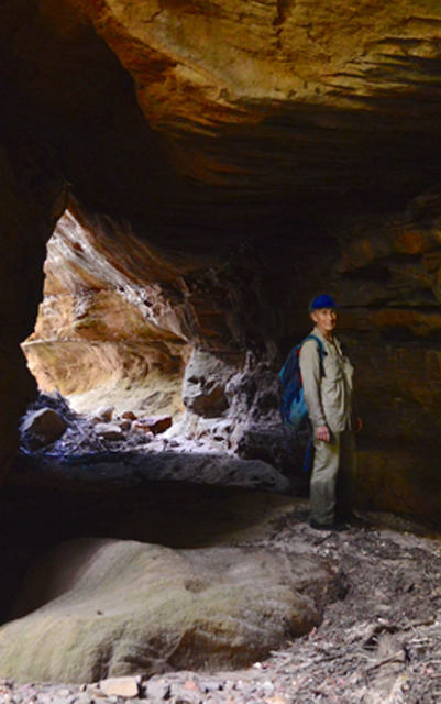
Flat Bottom Creek Tunnels
Are located on Flat Bottom Creek just before this creek plunges over the cliff line. Named by Michael Keats on a Bush Club walk, 22nd November 2013.
Flat Top
Is as the name suggests. Located on the ridge north of Dumbano Tunnels. This is a flat scrubby area of about half a square kilometre above 1020m. Named by Peter Fox, National Parks Association bushwalker, 1995-1998.
Flying Carpet
As that was what it felt like when we stood there. A flat projecting rock platform midway (about 60m) up the eastern cliff face of Carne Creek, between the features known as, The Gurgler and Long Zig Zag Pass. Named by Yuri Bolotin on a Bush Club walk, 9th May 2014. Yuri recods, "Stood on the top and looked down. 50m below between the tight, almost vertical narrow walls, the Tree Fern crowns looked miniscule."
Forge Point
Is located 1km north, north west of the Glowworm Tunnel on the cliff line, where the old Wolgan Valley Railway Line at the base of this cliff line changed direction from north west to north east. Ref: Eardley, G H. and Stephens, EM. The Shale Railways of NSW, 1974, p. 139. This name relates to a forge used to fabricate the railway lines.Herbert Sidney Rosewarne records,"Forge Point was also called Cable Point. Cable was the employed railway construction ganger."Ref: Stephens, Eric. Wolgan Railway Notebook, 1934-1937.
Fort Ridge
Trends in a generally north west and northerly direction from above Airly Creek in the south, having the Hut Trail along its spine from the Glen Davis Road. Its northern extent traverses what is known as The Fort (from which the ridge derives its name) to the south western side of Mount Airly. The southern section is within the Gardens of Stone National Park, whereas the northern section is in Mugii Murum-ban State Conservation Area. Named by Yuri Bolotin and Peter Medbury on a bushwalk 14 June 2021.
Fossil Ridge
Trends in a generally north south direction for 2.2km from the Great Dividing Range at the intersection of Moffitts Trail and Murdocks Creek Trail. Named by Brian Fox on a Bush Club walk, 21st January 2013 due to the abundance of plant fossils in the rocks along this ridge.
Four Level Cave
Is so named as four distinct sandstone overhangs are located one above the other. The top two are impossible to access, the lower two can be walked. Located 1.9km north east of Invincible Trig Station. Named by Yuri Bolotin on a Bush Club walk, 2nd August 2013.
Foxs Wedge
Is a 50cm wide crest to the ultimate high point on a wedge shaped rock jutting out and overlooking the Wolgan Valley. Located 1.2km south east of Cape Pinnacle. Named after Brian Fox, who walked out to the tip of this seemingly impossibly narrow promontory, by Michael Keats on a Bush Club walk, 27th June 2011.
Frenulum Pass
Is a bush walking pass 1.5km north, north east of Mount Budgary which leads into Budgary Creek. Named by Michael Keats, 5th August 2009. This pass together with Lanceolate, Ocellus, Pheromone and Spiracle Passes, all near Mount Budgary, is named after an anatomical part of a moth. Michael had encountered large numbers of moths during his walks on Mount Budgary Plateau.
Freshwater Creek *
Is a non perennial stream that, rises about 4km south east of Glen Davis. It flows generally north east for about 4km into the Capertee River. Freshwater Creek name was approved by the GNB on 30th October 1970. The name does not appear on any parish maps and was first used on the 1st edition topographical map of Mount Morgan.
Friday Canyon
Is a ‘wet’ canyon, about 150 meters in length, a tributary that flows into Wollangambe River. Located 1.5km near due south of Goochs Crater. Namedby Freda Moxom, Nick Collins and Paul Ma during a bushwalk, Friday 11 March 2016.
Galadriel Gorge
Is just one of the many side canyons located on the northern side of the junction of the Great Dividing Range and the Ben Bullen Range. At the head of this gorge there is an exquisite chamber, called the Hall of Galadriel. Galadriel is a key character in the Lord of the Rings. She was the beautiful Elven Queen and the mother of Celebrian. Played in the film by Cate Blanchett. Named by Yuri Bolotin on a Bush Club walk, 26th July 2013. Yuri named it so in keeping with the theme of Lord of the Rings that inspired him to name other features in this area.
Galah Mountain *
Is an insignificant hill on Daniels Ridge located between Deanes Creek and Rocky Creek. 1040m in height.
Galah Mountain Trig Station *
Is now known as Galah Trig Station. Elevation 1042.30m. Located on a small basalt hill, on the southern side of Galah Mountain. Accessed via GlowwormTunnel Road and Galah Mountain Road. Established by the Royal Australian Survey Corps, 1930. Ref: Trig Summary Cards, Department of Lands, Bathurst. Two trig stations in this area are named after the local birdlife; the other one is Cockatoo Hill Trig Station.
Galaxies Gully
Galaxies Gully is located on the southern side of the Wolgan River and the eastern side of the Newnes industrial site. This gully has remains of the buildings and a cave house which were in use during the period when Newnes was in operation as an oil shale town (1907-1920). This gully has its headwaters on the far western side of Island Mountain and is a double pronged gully which flows south for 1.5km to join the Wolgan River. The eastern branch gives access to Galaxies Traverse. Named by Yuri Bolotin and Brian Fox on a Bush Club walk, 1st July 2016.
Galaxies Gully East Pass
Is accessed via the Wolgan River Trail, Newnes. It is a useful way of route to the top of the ridge, leading to Firefly Point, as well as Looking Glass Canyon. This pass was shown to Yuri Bolotin by Tom Brennan on 19 February 2017. Named by Yuri in keeping with the name of the gully where the pass is located on a walk of 8 September 2017.
Galaxies Traverse
Galaxies Traverse is a ledge between two cliff lines above the Wolgan River. Located 2km from the locked gate on the ruins side of the Wolgan River at Newnes. The ledge runs for over two kilometres and is accessed via a gully on its western side. The name was coined by Brian Fox and Yuri Bolotin on a Bush Club walk, 1st July 2016 after the name of the main cliff line known by the rock climbing fraternity as Exploding Galaxies.
Gandalf Slot
Is a beautiful dead end slot. Gandalf is a good wizard in the Lord of the Rings and you probably need to be a wizard to be able to climb this slot all the way to the top. Named by Yuri Bolotin on a Bush Club walk, 15th August 2013, in keeping with his Lord of the Rings themed names in this area. Located 1.3km north east of Invincible Trig Station.
Gang Gang Canyon
Is about 500m long, its width varies between 5m to 25m. The cliffs on either side vary from 20 to 40m. The creek and canyon were named by Michael Keats on a Bush Club walk, 12th November 2012.
Gang Gang Caves
Are located within Gang Gang Canyon, part of Gang Gang Creek so named for a number of hemispherical chambers in this section of the creek. One cave in particular had a steep sloping floor and measured 30m wide, 35m from the back wall to the drip line and an estimated height of 60m. It also features an inaccessible second storey. Named by Yuri Bolotin and Brian Fox on a Bush Club walk, 16th January 2016.
Gang Gang Creek
Has its headwaters on the eastern side of Carne Creek and western side of Gang Gang Road. This road was named by Eric Lane, former Newnes State Forest foreman in the early 1980s, due to the large flocks of Gang Gang Cockatoos,Callocephalon fimbriatum, in this locality. Gang Gang Creek flows in a generally north east and northerly direction for 4.9km to its junction with Carne Creek.
Gang Gang Falls
Are located within the eastern tributary of Gang Gang Creek, 380m upstream from Gang Gang Tunnels. About 40m in height the water flows over the rock face like a bridal grown. Named by Brian Fox, Michael Keats and Yuri Bolotin after the creek in which they are located, 24th July 2015.
Gang Gang Minor
Refers to a rising side canyon on the eastern side of Gang Gang Canyon. This side canyon contains a huge hemispherical chamber with a steep sloping floor. This chamber is 20m high, 20m deep and the opening about 20m across, an almost perfect sphere. Named by Michael Keats on Bush Club walk, 12th November 2012.
Gang Gang Playground
Is an area encompassed by the mid section of Gang Gang Creek. Named by Michael Keats on a Bush Club walk, 27th April 2012 after the road and creek with this name and the playground of the pagoda bedecked cliff line and views.
Gang Gang Swamp
Is located on the creek tributaries within the radius of Gang Gang Road. 2km north north east of Bungleboori Camping Ground.
Gang Gang Tunnels
Are located within Gang Gang Creek, access via North Ridge Road via Bungleboori. It would appear that at least two very large creek side sculptured pagodas had partly collapsed across the creek, falling in such a way as to provide caverns and slots. Named by Brian Fox, Michael Keats and Yuri Bolotin after the creek in which they are located, 24th July 2015.
Gannon Cave
Is located at Hassans Walls, Lithgow and is the first rock overhang on the lower track (Undercliff Track) on the right hand (western) side of Hassans Glen. Named after Samuel Hodge Gannon (1834-1913), who was a very active member of the Lithgow community. Within this overhang is the seats and table like an old school desk placed there in 1915. Ref: Lithgow Mercury, 14th May 1915, p. 4.
Gap Creek *
Is a non perennial stream rising on the eastern slopes of Mount Airly. It flows generally north, north east for about 4km into Genowlan Creek. The name is descriptive for this creek that flows between Mount Airly and the cliff line of Point Hatteras. This creek also flowed through the former Town of Airly.
Garage Cave
Is located halfway up the steep section of a 4WD track between Genowlan Creek and the south west end of Genowlan Mountain. Named by Colin (Col) Maxwell Ribaux, former local land owner, in the l990s.
Garden of Eden
Is a feature within Coach Wood Forest. At its entry, it is almost totally filled with the Soft Tree Fern, Dicksonia antarctica. Within this enchanted forest, there is a mature Anchor Vine,Palmeria scandens, that has a girth of 20cm and has wrapped itself around a tree very tightly so it formed a spiral ribbed tube nearly one metre high, before it climbed 20m plus into the tree canopy above. This amazing natural sculpture has been dubbed The Serpent. Both features named by Michael Keats and Brian Fox on a Bush Club walk, 20th August 2012. This ravine is located 500m south east of Galah Trig, access via Galah Mountain Road.
Gardens of Stone National Park *
Covers 15,080ha. The irregular boundaries roughly extend in the north to the Glen Davis Road, eastern boundary with the Wollemi National Park, western side to Castlereagh Highway at Ben Bullen and southern side, Sunnyside Ridge Road. The majority of the park is located on the Ben BullenTopo Map. Described by the NPWS as, "Pagoda rock formations cluster near sandstone escarpments, where erosion has sculpted bee hive shaped domes and other forms. Banksia, dwarf casuarinas and other wind pruned heathland plants give the area its garden like appearance. This park forms an important part of the Greater Blue Mountains World Heritage Area." Stage one of the Gardens of Stone National Park was created on the 29th November 1994. Stage two was proposed by the Colong Foundation in 2005 and is yet to be approved. It will cover an additional area of nearly 40,000ha. Credit is given to Rodney Falconer for coining the name, Gardens of Stone, November 1984. Ref: Correspondence with Rodney Falconer and David Blackwell, March 2010."I gave it the name Gardens of Stone, which stuck, following an October trip during which the place became a flowery garden studded with rock statues (mint bushes and banksias were particularly prolific that season and the scent of massed flowering Calytrix tetragona shrubs was so overwhelming that you were walking through honey coated air for hours on end. As Haydn Washington was in South America at the time, David Blackwell was frantically busy with work and I was in the process of moving to Canberra, we passed it onto the Colong Foundation (of which both Haydn and I were or had been Directors at the time) who did the longer term leg work and saw it into fruition, particularly thanks to Keith Muir with Peter Prineas and Alex Colley giving great support as well." Ref: Correspondence to Michael Keats from Rodney Falconer, 15th March 2010.
Gardiners Gap *
Is a break in the Great Dividing Range about 3km north west of Wolgan Gap and about 5km due east of the town of Cullen Bullen. Gardiners Gap is shown on the map Parish of Ben Bullen, 1885. William Wolf Gardiner (c1809-1887) took out a Conditional Purchase for 40ac in this area on the 28th February 1867. Later his grandsons, Thomas William Gardiner (1866-1940) and Charles Livingstone Gardiner (1886-1952), purchased land in 1883 and 1913 respectively. Ref: Survey Plans 719, 1411, 1502, 1832, 1870 and 3753- 1496. NSW BDMs. Gardiners Gap was the quickest way for drovers to move cattle and sheep from Ben Bullen to Bell, simultaneously avoiding the toll at Blackmans Flat from 1876. Ref: Brown, Jim.Bent Backs, 1989, pp. 275-276. Wilson, Alex. Map showing the various attempts to find the best route from Mount Victoria to the Western Country NSW, 1914. This map shows a dotted line from Gardiners Gap to Newnes Junction (connects to Bells Line of Road). Text reads,"Route suggested by delegates of Richmond Committee for road Mudgee to Wellington Valley." Also text, "stock route Cullen Bullen to Bells Line opened by Thomas Maddox. "
Gardiners Hill *
Is a hill about 4.2km south east of Ben Bullen that has Jews Creek on its western and southern side. Platform Rock is on the southern end of Gardiners Hill.
Gardiners Point
Is a point of land off a narrow spur, having the last 200m consisting of a rocky bluff which overlooks Jews Creek and Baal Bone Colliery. Named by Michael Keats after Gardiners Hill which is 600m to the west, on a Bush Club walk, 14th March 2016.
Gaudis Sentinel, Gaudis Stairs.
This isolated sandstone pinnacle on the southern side of Gaudis Wall and a nearby negotiable natural staircase were also named after Antoni Gaudi. Access via Ben Bullen, Moffitts Trail.
Gaudis Wall
Is a 300m long three dimensionally sculptured cliff face. It was given this name by Graham Conden on a Bush Club walk, 21st January 2013. Graham likened it to the work of Spanish architect, Antoni Gaudi. Located 2.6km north north east of Ben Bullen Railway Station. Access via Hutchinson Road and Moffitts Trail.
Gemini Cave
Also see Michelangelo Cave. This large twin overhang was named by Bob Whiting in December 2009. Ref: The journal of The Sydney Speleological Society, 2011, 55 (3): 64. Not being aware of this former name, Michael Keats named this cave Michelangelo Cave on a Bush Club walk, 16th January 2012.
Genowlan Canyon
Is located 2.4km north east of Genowlan Trig and 2.5km south east of Point Hatteras. It is about 50m deep, 200m long. Genowlan Canyon was named by Brian Fox and Michael Keats on a Bush Club walk, 27th October 2010. Described by Michael as follows,"Stood on the top and looked down. 50m below between the tight, almost vertical narrow walls, the Tree Fern crowns looked miniscule."
Genowlan Castle
Is located 700m north east of Genowlan Trig. It is a massive grouping of pagodas likened to a wall of battlements immediately below a top turret. Named by Michael Keats on Bush Club walk, 1st June 2015.
Genowlan Creek *
Is a non perennial stream rising at Genowlan Trig Station. It flows generally north, east and north east for about 12km into the Capertee River. Genowlan Mountain and Genowlan Creek are shown on the Parish of Morundurey 1894 Map. Survey Plan R1164.1496, dated 1873, shows it as Genowlan Peak. Genowlan Mountain was also known as Morandurey Range. Ref: Eardley, G H. and Stephens, E M. The Shale Railways of NSW, 1974, p. 88. The name Genowlan has similar syntax with the word Jenolan, which in turn was an Aboriginal name meaning "high place". Ref: Cook, Samuel. The Jenolan Caves, 1889, pp. 14-15.
Genowlan Guardian
Is located on the eastern side of Genowlan Mountain, 1.9km south of Genowlan Point. Named by Yuri Bolotin and Brian Fox on a Bush Club walk 22 December 2017 because of the prominence of this giant pagoda jutting out over the top cliff line and the profile of a human head on top; it is clearly visible from all directions.
Genowlan Mountain *
Is located on the northern side of a large mesa between the Capertee River and Coco Creek, 3.5km north east of Airly. Genowlan Mountain and Genowlan Creek are shown on the Parish of Morundurey 1894 Map. Survey Plan R1164.1496, dated 1873, shows it as Genowlan Peak. Genowlan Mountain was also known as Morandurey Range. Ref: Eardley, G H. and Stephens, E M. The Shale Railways of NSW, 1974, p. 88. The name Genowlan has similar syntax with the word Jenolan, which in turn was an Aboriginal name meaning "high place". Ref: Cook, Samuel. The Jenolan Caves,1889, pp. 14-15.
Genowlan Oculus
A pagoda rests precariously on the cliff edge above the norther side of the area known as The Hammer. That is nothing unusual. What is unusual is the huge horizontal, cylindrical perforation, large enough to crawl through. The views looking east are unique. Named by Michael Keats on a Bush Club walk, 21st March 2016.
Genowlan Pinch
Is a narrow defile is only 300mm wide and 10m long. Located 340m due west of the communication tower at Airly and 30m south of Airly Frustum. Named by Michael Keats on a Bush Club walk, 16th November 2015.
Genowlan Plateau
Signage erected by NPWS on the track to Genowlan Mountain, 2km south of Genowlan Point reads,“You are now standing on the top of Genowlan plateau in Mugii Murum-ban SCA, over 1000m above sea level, surrounded by sandstone cliffs up to 300m high.”
Genowlan Trig Station *
Is a trigonometrical station on same mesa, elevation 1040m, and is 3.8km south, south west of Genowlan Mountain. Established by the Department of Lands, 1912. Ref: Trig Summary Cards, Department of Lands, Bathurst.
Georgina Canyon
is located 2 km south east of Mount Dawson. On its eastern end, it appears as a thin black line from aerial photographs. In one place, it is so small, you can step over it as it is less than 50 cm wide. Some four metres below that point, the canyon bellows out into a Fern-filled cavernous void complete with limpid pools that looked very cold. This canyon is in two distinct sections. The first of about 200 m is tight, mysterious and flanked by pagodas, the second section is much broader, extends for maybe a further 300 m and discharges over the cliff edge. Named by Brian Fox, Michael Keats and Yuri Bolotin on a Bush Club walk 30th August 2016. Georgina Lyon Wolgan Walker (1843-1906) had married Edwin Barton in 1865. Edwin and Georgina’s father were the earliest property owners in the Wolgan Valley.
Gindantherie Pinnacle
Is an imposing isolated sandstone pinnacle, about 70m high. Located on the escarpment 4km due west of Newnes and midway between Point Nicholson and Mount Dawson. Gindantherie Pinnacle was named by Michael Keats and submission sent to the GNB on 9th October 2006. It is highly likely that the name is of Aboriginal origin. Lithgow Council Minutes, 6th August 2007, raised no objections to this name. Other recorded names are Lost Sister (Tom Brennan, October 2010) and the Fourth Sister. The Parish of Gindantherie is a land administrative district within the County of Cook.
Girdwood Ridge
Trends east west and divides the watersheds of upper Dumbano Creek and Wollangambe River. Clarence Firetrail runs along this ridge. Named by Peter Fox, National Parks Association bushwalker, between the years 1995-1998, after Kathleen (Kate) Olive Girdwood, a bushwalker and member of the Upper Blue Mountains Bushwalking Club.
Glen Alice *
Is a small village on Umbiella Creek about 11km north west of Glen Davis and about 37km from Capertee. Dr James Innes (1796-1846) married Jane Alicia McLeod in 1828. James was granted 1760ac in July 1825, but it was not officially gazetted until October 1831 at 14 pound per annum. He named his cattle station, "Glen Alice". Jane Alicia was born c1800 and died on 2nd December 1881. James's brother George (1802-1839) took over the property a few years later, and when he died, his wife Georgianna Lorn Moorshead sold the property. It was the property name that became the name of the settlement of Glen Alice. Glen Alice was notified as a village on the 22ndJuly 1878 and gazetted as a village on the 14th September 1901. Ref: Sydney Gazette, 28th May 1831, p. 2 and 12th January1832, p. 3, Survey Plan 89.691, dated 23rd October 1833 and Annabella Boswell's Journal (Annabella was the daughter of George and Georgianna Innes). .
Glen Davis *
Is a village about 38km east of Capertee on the Capertee River. Situated on Portions 1 and 2 and on part of Portion 3, Parish of Gindantherie, County of Cook. Land District of Lithgow. An area of 198ac (80ha) was resumed for the Town of Glen Davis and about 294ac (119ha) was also resumed for town extension purposes under the Glen Davis Act No. 38, 1939, which came into force via proclamation in the Government Gazette, dated 15th December 1939. Acquisition of land, Government Gazette 32 of 23rd February 1940. Named after Sir George Francis Davis (1883-1947). The Federal Government's Senator A J McLachlan persuaded George and Chris Davis to form a subsidiary of Davis Gelatine - National Oil Pty Ltd in 1937. George gave up most of his other business activities to lead this new enterprise.The new industrial complex in the Capertee Valley was named Glen Davis after him. Ref: Australian Dictionary of Biography - Online Edition.
Note: Originally this location was known as Newnes North (Newnes South was at the present location of Newnes). Plan of Portion ML 12, dated 30th May 1908 shows Newnes North with significant buildings and tunnels into the shale mines. Lithgow Mercury 1st March 1907, p. 8, records the bridle path linking Newnes North to Newnes South.
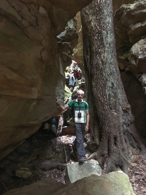
Glen Day Defile
is located on one of the western tributaries of Glen Day Gully 2 km south, south west of Newnes. Midway along the gully, when descending, you enter a shallow constriction, which quickly becomes deeper and deeper. In a few more minutes, after carefully negotiating a 2.5 m drop, you enter a small, very dry canyon, with deeply eroded walls, only about half a metre apart, covered in green moss. A couple of metres later, the walls, now over 20 m high, open up to a magnificent overhang on the right-hand side, some 30 m long and 6-7m deep. Here, the ‘room’ is sufficient to accommodate several Coachwood and Sassafras trees. The canyon continues until the second overhang of equal size to the first one, is reached. The constriction is about 250 m long. Named by Yuri Bolotin and Brian Fox on a bushwalk of 27 September 2019.
Glen Day Gully
Is a three pronged gully system, 1.7km in length, on the southern side of Little Capertee Creek directly above the inlier of Glen Day's property. Named by Michael Keats on a Bush Club walk, 1st November 2013.
Glen Trig
Is the highest point on the Wolgan - Capertee Divide, 2.1km due south of Glen Davis Camping Ground. A rocky, smooth outcrop has a round brass survey marker, embedded in concrete, with the inscription,"Royal Australian Survey Corps, Survey Mark, Glen Davis." Elevation 938m.
Glory Box
Is a 250m long cliff lined ravine and a tributary of Carne Creek. It is filled with tree ferns, felt ferns, numerous fungi species in season and boxed in by 90m cliffs. Walking access can be gained to this ravine with one difficult spot, where rope assist is handy. Named by Brian Fox on a Bush Club walk, 2nd April 2013.
Glowworm Tunnel
Is located at the northern end of Glowworm Tunnel Road, accessed via Clarence or State Mine Gully, Lithgow. It was here that the old Wolgan Valley Railway line wound around the base of the cliffs, then through a tunnel approximately 400m long. The creek near this tunnel is called Tunnel Creek and has also been referred to as Penrose Creek. This was the second tunnel constructed in 1907 for the railway to Newnes from Newnes Junction, off the Main Western Line. The first tunnel is now vehicular access to the Glowworm Tunnel and about 3km closer towards Lithgow. The Glow Worms are a larval stage of a harmless, luminous species of fungus gnat, family Arachnocampa. Spelling has varied on different maps, such as Gloworm Tunnel; Ben Bullen Topo, first edition, Glowworm Tunnel Road; Cullen BullenTopo, second edition, as well as Glow Worm Tunnel and Glow-worm Tunnel, websites.
Glowworm Tunnel Road
Glowworm Tunnel Road starts at the junction ofthe Old Bells Line of Road and the State Mine Gully Road and generally heads north to the end point which is the car park and start of the Glowworm Tunnel Track to the Glowworm Tunnel. All unsealed. Part of the way the road follows the alignment of the old Wolgan Valley Railway and two tunnels.
Golden Bowl
Is a sunlit almost spherical overhang on one of the upper tributaries of Dingo Creek, 900m north east of Mount Norris. Named by Rodney Nelson on a Bush Club walk, 28th November 2007.
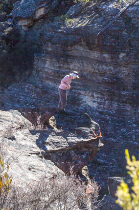
Gollum Canyon
Is a narrow, twisting, treacherous, slimy canyon. Within the story of Lord of the Rings, Gollum is a small, slimy creature that lived in the caves underground and he was very treacherous. Named by Yuri Bolotin on a Bush Club walk, 15th August 2013, in keeping with his Lord of the Rings themed names in this area. Located 1.4km north east of Invincible Trig Station.
Gonzo Rock
Within Hecates Cauldron a rock face was so named because of its likeness to Gozo the Muppet, by Jafar Calley on a Bush Club walk, 29th August 2015.
Goochs Crater *
Is a natural amphitheatre located on a tributary of Wollangambe River 7.5km north east of ClarenceTrig Station and 6km north west of Wollangambe Crater in the locality of Newnes Plateau. It is a unique, crater like swamp feature, ringed by deeply under cut pagodas, roughly oval in shape, approximately 105m long by 65m wide at the northern end, narrowing to approximately 35m at the southern end. The northern end slopes steeply and evenly to the ridge top above the crater. The sides are formed by the vertical walls of deeply under cut pagodas varying from 20 to 30m high. The southern end is formed by what appears to be the remains of a collapsed pagoda. The swamp itself has typical sedge vegetation and associated plant communities. Named in memory of Nicholas Andrew Gooch (28.3.1947 -18.7.2003), who originally discovered this feature in 1978. The name has become widely known by the bushwalking fraternity Australia wide. Ref: Rae Gooch and Springwood Bushwalking Club members.
Originally named by Nicholas Andrew Gooch as Cave Swamp Crater 31 December 1978.Goollooinboin *
Is the name of a land administrative district, Parish of Goollooinboin, within the County of Cook.
Gordian Knot
Is a mass of contorted ironstone. Named by Haydn Washington, one of the triumvirate who explored and named the Gardens of Stone National Park. The knot is also a platform to view the Wolgan Valley. Located 25m east of the walking track between Mount Horne Trail and Mount McLean. Ref: Correspondence with Haydn Washington, 30th May 2010.
Grand Balcony
Is one of the most remarkable locations in the Wollemi National Park. It is a ledge of gargantuan proportions, approximately 400 metres long. What makes it particularly amazing are the cliffs above and below. Below, the drop is 35 m+; above, the cliffs are at least 50 m high. Adding to the splendour, is the array of colours - shades of pink, through to apricot, orange to deep purple. Located on the eastern side of a cliff-lined, V shaped gully, a southern tributary of Capertee Creek on the western end of the property Red Cliffs, Newnes. Named by Michael Keats, Brian Fox and Yuri Bolotin on a bushwalk, 6 May 2016.
Great Dividing Range *
Extends the entire length of the east coast of Australia, generally in a north south direction. This range was also referred to as The Dividing Range and Main Range. In the scope of this work, the range extends from near Capertee, Ben Bullen, Moffitts Trail, The Bicentennial National Trail and Gardiners Gap to the Castlereagh Highway 4km south of Cullen Bullen. Great Diving Range was shown on Survey Plan by Robert Dixon, September 1830. Ref: Surveyor General, select list of Maps and Plans, 2517. Early references to Great Dividing Range appeared in the SMH in 1835 as part o fadvertisements for land and stock, and the words " Dividing Range" - in the SMH on 10th July 1823, p. 2.
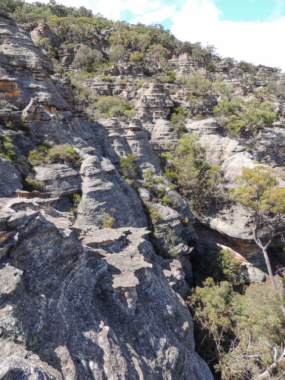
Great Wall of China
Refers to the north south line of rocky pagodas on the western side of Mount Airly. This wall of pagodas is bisected by many deep slots otherwise walking along them is relatively easy. Named by Dr Haydn Washington c1984.
Great Wall of China
Refers to a small rocky ridge line and part of the road leading up to Genowlan Trig Station. Named by Colin (Col) Maxwell Ribaux,former landowner of Airly. Named in the 1970s.
Green Gully *
Is a non perennial stream rising 4.5km south, south west of Glen Davis. It flows generally north for about 5km into the Capertee River.The descriptive name of this north south facing gully refers to the dense green ferns at its headwaters. Within this gully, is the Pipeline Track that connects the villages of Newnes and Glen Davis. Numerous examples of old infrastructure of the former pipeline still exist in the gully. Shown as Green Gully on on the Plan of Portion ML 8; Survey Plan, M10825, dated 27th July 1895. The Survey Plan M13826, dated 9th May 1908, records on the eastern side of Green Gully, "Horse Track to Glen Alice".
Green Room
Is a descriptive name for this fern enclosed gully on the northern side of Nayook Creek and eastern side of Mini Standley Chasm, Deep Pass. This name was known and in use by National Parks Association member, Max Reinel, in the year 2000.
Greens Camp
Is located about 200m east of the track intersection of Pagoda Track and the main track to the Glowworm Tunnel, and about 38km from Clarence. Initials F R and a date 7/1/1907 are carved into a rock face rediscovered by Mark Langdon, September 2013. On 1st May 1907, a post office was set up at Greens Camp with Mr E. Sheared as postmaster. Ref: Taylor, Greg. J. Newnes, History of a Blue Mountains Oil-Shale town, undated, p. 34. Greens Camp was the name of a railway construction camp for the Wolgan Valley Railway. During construction, this camp housed up to 600 people. Ref: Letter from Henry Martin, storekeeper, The Gorge via Clarence, dated April 1907.
Greens Spur
Is 1.3 km in length. It trends in a southerly direction off Sunnyside Ridge Road near Fire Trail No. 8 and has at its southern end Point Green. This narrow southern end contains pagodas which overlook both the eastern and the western side the Wolgan River. This spectacular spur and point above the Wolgan Falls, with 360-degree views, was one of the last major areas which Richard Green photographed late June 2015 for the Gardens of Stone: In Focus photographic competition. Named by Yuri Bolotin in honour of his achievements on a bushwalk, 20 November 2015. Richard Green, a renowned Australian landscape and nature photographer, tragically died in a helicopter crash in November 2015.
Grevillea Ridge
Extends from Dominic Dellalibera's property, Ngamperi, which is located below and on the north eastern side of Pantoneys Crown, to the talus slope of Pantoneys Crown. The middle section of this ridge is covered with Xanthorrhoeas, but Dominic gave it the name Grevillea Ridge owing to the rare Grevillea obtusiflora subsp. fecunda which also grows there.
Grottos
Also called The Grottos. Located in side creek 800m west, south west of Rock Hill. There are various entries of this name in the Yah Hut Log Book, late 1970s.
Grove Firetrail
Is now known as Beecroft Firetrail. The section of this firetrail which joined the Wolgan Road to Kangaroos Creek Road was also known and signposted as Grove Firetrail after the Thomas Henry (1883-1952) and Nellie Adelaide Grove (1889-1967) who lived in this vicinity prior to the 1930s. Ref: Correspondence Danny Whitty local resident and historian, 3rd June 2014. Nellie Adelaide Grove held a Special Lease in 1922 over the portion of land in which the current Beecroft Firetrail intersects with Masons Lane, Lidsdale. Ref: Parish of Cox, County of Cook 7th edition, 1930.
Gundangaroo Trig Station *
Has an elevation of 845m, located between Mount Gundangaroo and Mount Canobla. The trig is named for its location on Mount Gundangaroo and was established in December 1984 by Patrick Potts, a piling overseer employed by the then Central Mapping Authority of Bathurst. A piling overseer is the person who does all the hard work for the surveyor when erecting and clearing for a trig station.
Guzzlers Gulch
Extends1.5km from the saddle known as Natural Bridge in a south east direction to the junction of Nayook Creek. So named after Guzzlers Hut, now in ruins, that lies within this gully. Name recorded in the Yah Hut Log Book entry, 18th November 1972. Within this gully, at GR 499 090, is a natural arch. This unique geomorphologic feature is about 5m high, 5m wide and about 4m thick. Named Guzzlers Gulch Arch on a Bush Club walk, 28th January 2013 by Brian Fox and Michael Keats.
Guzzlers Gulch Arch
Guzzlers Gulch extends 1.5km from the saddle known as Natural Bridge in a south east direction to the junction of Nayook Creek. So named after Guzzlers Hut, now in ruins, that lies within this gully. Within this gully, at GR 499 090, is a natural arch. This unique geomorphologic feature is about 5m high, 5m wide and about 4m thick. Named Guzzlers Gulch Arch on a Bush Club walk, 28th January 2013 by Brian Fox and Michael Keats.
Hades Ridge
Is a north south trending ridge on the eastern side of Moffitts Trail and the eastern side of Poseidon Arena. There is an Upper Hades Ridge and a Lower Hades Ridge. Named by Michael Keats and Brian Fox on a Bush Club Walk, 16th April 2010, after the Greek god Hades. Two other nearby ridges, trending north south, were given the names of Poseidon and Zeus, the brothers of Hades.
Hagar Castle
Is a 300m high rocky outcrop on the eastern side of Rocky Creek, 1.6km south of the junction of Rocky Creek and Deanes Creek. This massive bluff was named by IanThorpe, a member of The Bush Club, on 1st October 2008, as he likened it to Hagar, The Horrible's Castle.
Hailstorm Retreat
Is a 300m long negotiable slot varying in width from half a metre to five metres and cutting through 140m of vertical cliff line. Access is via the barrier at the eastern end of Waratah Ridge Road. Recorded in Jamieson, Rick. Canyons Near Sydney, 4th edition, 2001, p. 55. A pagoda at the northern end defining the entry/ exit to this slot is at GR 510 012.
Hair of the Dog Ravine
Is a 700m dramatic knife like cleft surrounded by 50m cliffs. It is located 1.5km south west of Derailment Hill. Access via the end of Waratah Ridge Road. So named by Yuri Bolotin, 8th April 2011, as this ravine joins Dingo Creek.This ravine can be negotiated from both the top and the bottom. It is a pass.
Halfway Hollow *
is a non perennial stream rising 2.6km north of MountHarvey. It flows generally north, north west for about 4.6km into Crown Creek. So named as it is halfwaybetween Capertee and Glen Alice. Name recorded in NSW Government Gazette, 26thFebruary 1875 as Half-way Hollow. Shown on Carne, Joseph. Geological Map of theCapertee and Wolgan Valleys, 1901.
Hall of Celebrian
Is located 3.1km east, south east of Cullen Bullen, below and on the northern side of the junction of the Great Dividing Range and Ben Bullen Range. Described as, "A cavern of great dimensions, estimated to be 30m across, 15m high and the same depth. Rounding a natural, web like rock partition, there is a second cave of similar dimensions, the two forming a huge conjoined overhang cavern complex." Named by Yuri Bolotin on a Bush Club walk, 28th June 2012. an is a fictional character and wife of Elrond created by J.R.R. Tolkien in the book The Lord of the Rings.
Hall of Elrond
Is located on the Ben Bullen Range, 2.7km east, south east of Cullen Bullen. Named by Yuri Bolotin, following his walk on 16th December 2011. Yuri recorded,"starting as a mere crack in the sandstone, it plunges down to the bottom of the valley, 30m below, whilst opening up first to 2-3m and then to a 15-20m wide, 60m long mini canyon, with side branches and a balcony level above the Fern studied floor. As I made my way down, I felt as though I was descending from the high bastions and lookouts of the fantasy city above, to the majestic palace chamber of the city's king. I called this place the Hall of Elrond (the Lord of Rivendell)." Yuri used visual references provided by J.R.R. Tolkien's Lord of the Rings.
Hammer Pass
Gives access via a natural slot in the cliff line to, The Hammer, which is the narrow peninsula of land surrounded by cliff lines on the eastern extremity of Genowlan Mountain. Named by Brian Fox on a Bush Club walk, 21st March 2016.
Happy Valley Springs *
Is a locality about 1km north west of Bald Trig Station and about 4km north of Clarence. This valley name applies to the headwaters of Farmers Creek. Originally, the name applied to the small swamp and associated natural springs that gave rise to the area being reserved for a travelling stock route. This area at present is owned by, "The Lower Mountains Motorcycle Club", which built a complex on the site, 1973-1974. Originally this area was surveyed in 1877 for a 123ac (50ha) lot and used as a Travelling Stock Route, (TSR No. 59). The track to and from this TSR was known as Maddox's Line. Ref: Survey Plan C734.1507. Thomas Maddox had purchased 30ac on the Coxs River at Lidsdale in 1853. Ref: Survey Plan C38-1507. Maddox Lane in Lidsdale carries the family name. The name Happy Valley Springs appears on the 1890 edition of the Parish Map of Marangaroo.
